
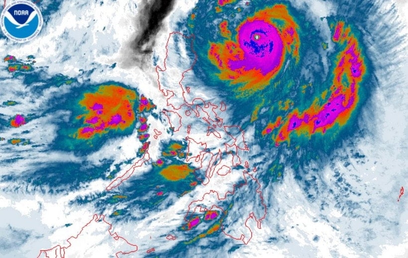
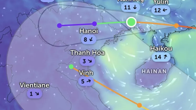
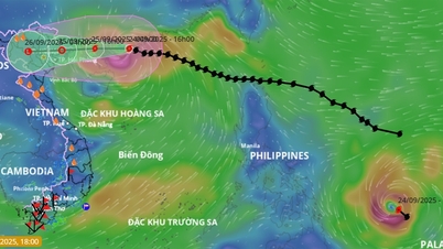
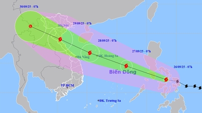
According to the Hai Phong City Hydrometeorological Station, at 1:00 p.m. on September 21, the center of storm Ragasa was at about 18.5 degrees North latitude; 126.2 degrees East longitude, about 430km east of Luzon Island (Philippines). The strongest wind near the center of the storm was level 14-15 (150-183km/hour), gusting to level 17, moving west-northwest at a speed of about 15-20km/hour.
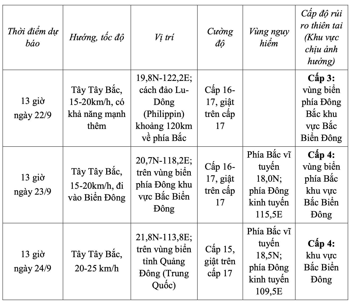
From the next 72-120 hours, each hour traveling about 20 km, the storm intensity gradually weakened.
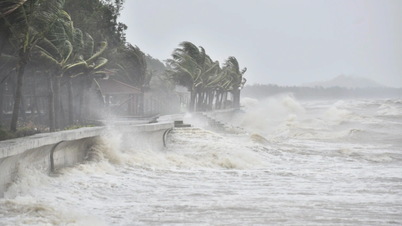
Due to the impact of the storm, from September 22, the sea in the northeast of the East Sea will gradually increase to level 8 - 9, then increase to level 10-14, the area near the storm's center will be level 15-17, gusting above level 17, waves over 10m high, and the sea will be very rough.
Vessels operating in the above mentioned dangerous areas are susceptible to the impact of storms, whirlwinds, strong winds and large waves.
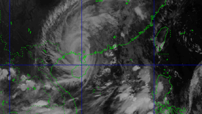
According to the Philippine Meteorological and Hydrological Administration, on the morning of September 21, tropical storm Ragasa strengthened into a super typhoon, with wind speeds of 185 km/h and gusts of up to 230 km/h.
According to the announcement at 11:00 local time (10:00 Vietnam time), storm Ragasa was located 555km east of Tuguegarao city, Cagayan and was moving west at a speed of 15km/h.
The storm is forecast to approach or make landfall in Batanes province or Babuyan archipelago on September 22.
The agency warned that storm Ragasa has the potential to bring heavy rain, strong winds and form the strongest tropical cyclone.
Residents are also advised to be alert to the risk of rising sea levels with peak tides exceeding 3 meters in the next 48 hours in low-lying or uninhabited coastal villages in the areas of Batanes, Cagayan, Ilocos Norte and Ilocos Sur.
PV (synthesis)Source: https://baohaiphong.vn/bao-ragasa-dat-cap-sieu-bao-do-bo-vao-philippines-truoc-khi-di-vao-bien-dong-521401.html


![[Photo] Prime Minister Pham Minh Chinh receives Secretary of Shandong Provincial Party Committee (China) Lin Yu](https://vphoto.vietnam.vn/thumb/1200x675/vietnam/resource/IMAGE/2025/9/26/821396f0570549d39f33cb93b2e1eaee)


Comment (0)