
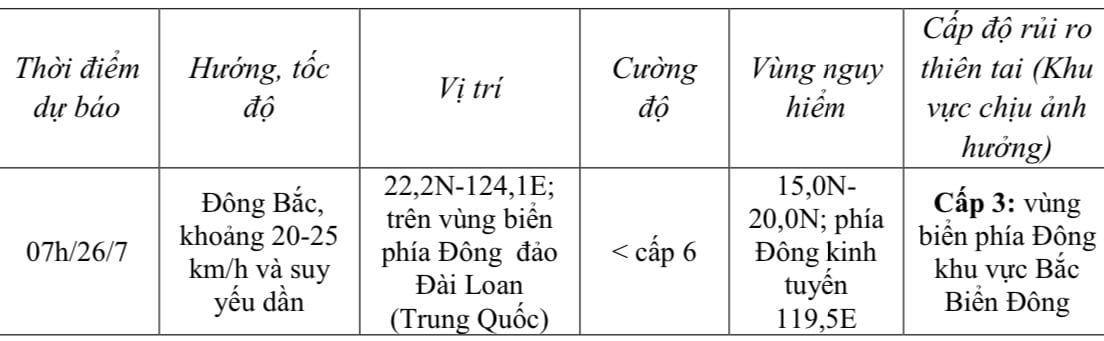
At 7:00 AM on July 25th, the typhoon's center was located at approximately 17.7 degrees North latitude and 120.5 degrees East longitude, over the western part of Luzon Island (Philippines). The strongest winds near the center of the typhoon were at level 9 (75-88 km/h), with gusts up to level 11; it was moving northeast at a speed of about 10 km/h.
 |
| Forecast of storm developments over the next 24 hours. |
Due to the influence of the storm, the eastern part of the North East Sea region is experiencing strong winds of force 7-8, with winds near the storm's center reaching force 9, gusting to force 11; sea waves are 3-5 meters high. The sea is very rough, and vessels operating in the aforementioned dangerous areas are likely to be affected by thunderstorms, tornadoes, strong winds, and large waves.
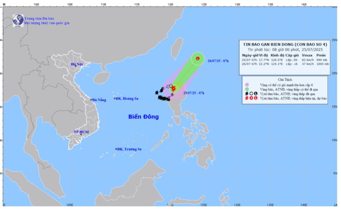 |
| The trajectory and path of Typhoon No. 4 |
Typhoon No. 4 did not directly affect the weather in Dong Nai province.
The weather in the province will be cloudy with scattered showers and thunderstorms in the afternoon and evening, with moderate rain in some areas and heavy rain in localized areas. During thunderstorms, be wary of tornadoes, lightning, and strong gusts of wind.
Kim Lieu
Source: https://baodongnai.com.vn/xa-hoi/202507/bao-so-4-dang-suy-yeu-dan-b3e01a6/
![[Image] Nearly 125,000 Hanoi students completed the Literature exam for the 10th grade entrance exam.](https://vphoto.vietnam.vn/thumb/1200x675/vietnam/resource/IMAGE/2026/05/30/1780117233041_ndo_br_thiet-ke-chua-co-ten-2-png.webp)


Comment (0)