
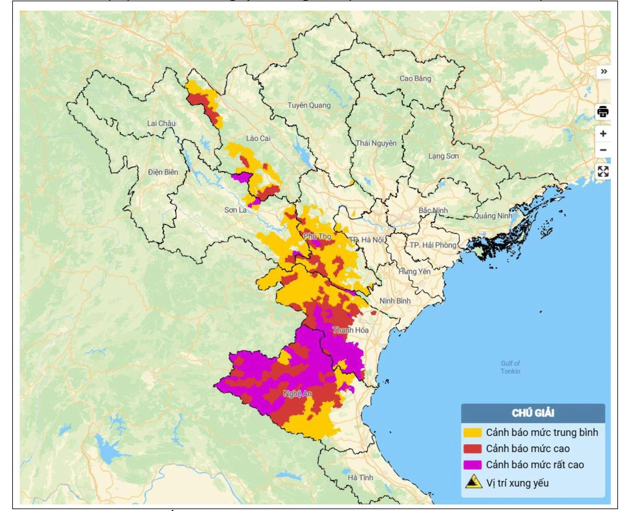
Map of flash flood and landslide risk in the areas.
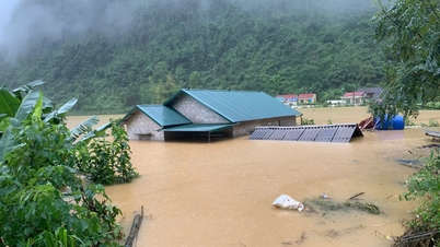
Accordingly, within 24 hours (from 4:00 a.m. on July 22 to 4:00 a.m. on July 23), the provinces of Son La, Phu Tho, Lao Cai , Thanh Hoa and Nghe An had moderate rain, heavy rain, and very heavy rain in some places such as: Nhu Thanh 350mm (Thanh Hoa); Chau Nga 334.6mm (Nghe An); Pu Danh 197.4mm (Son La); Doan Ket 184.8mm (Phu Tho); Tram Tau 133mm (Lao Cai);...
Soil moisture models show that some areas in the above provinces are close to saturation (over 85%) or have reached saturation.
Warning: In the next 3-6 hours, Thanh Hoa and Nghe An provinces will continue to have rain with accumulated rainfall ranging from 10-30mm, in some places over 60mm; Phu Tho, Son La and Lao Cai provinces will have rain ranging from 20-40mm, in some places over 80mm.
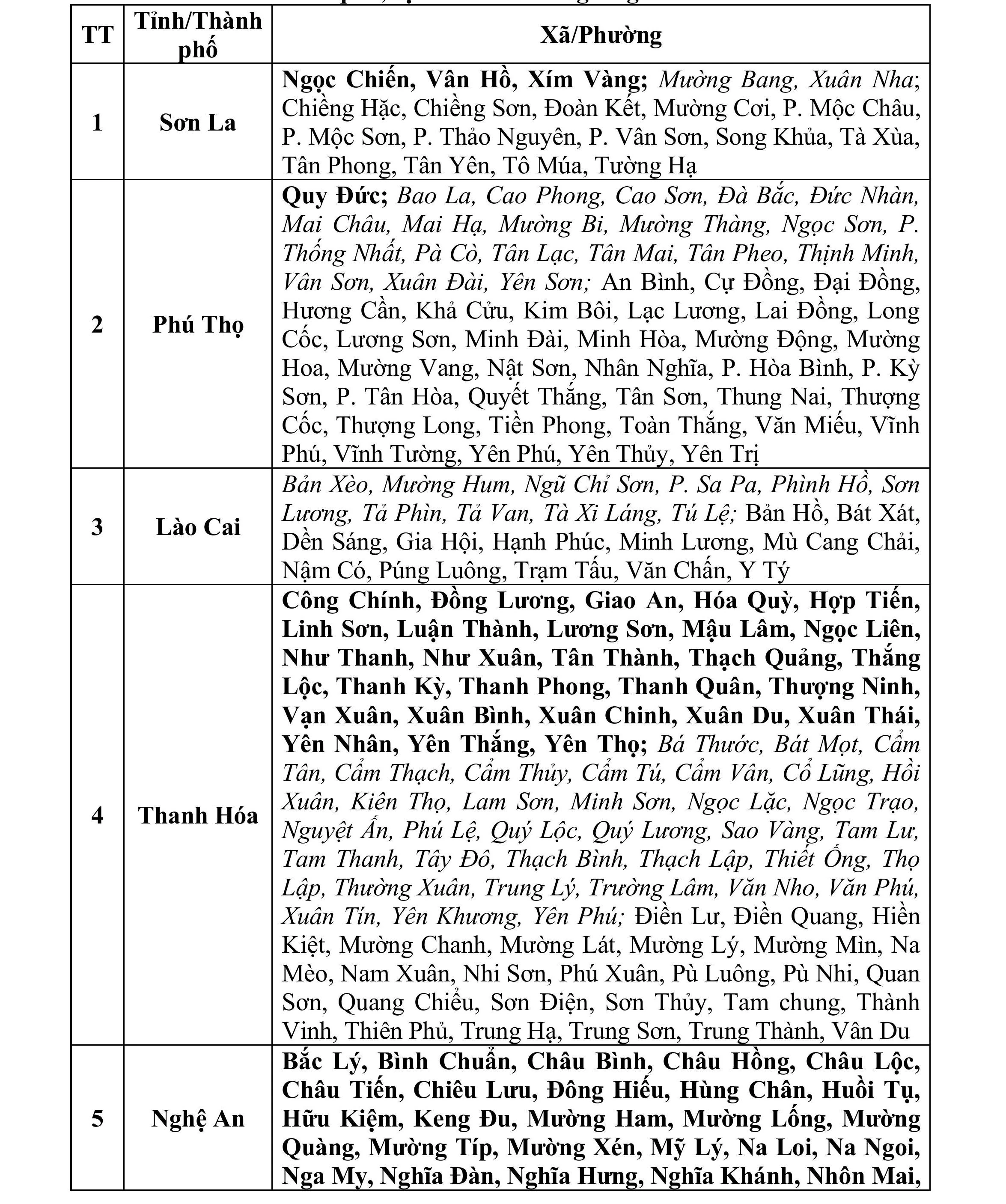
List of areas at risk of flash floods and landslides in the next 6 hours from 4:30 a.m. on July 23.
In the next 6 hours, there is a risk of flash floods on small rivers and streams, and landslides on steep slopes in many communes and wards.
Warning level of natural disaster risk due to flash floods, landslides, land subsidence due to heavy rain or water flow: Level 1, Nghe An only: Level 2.
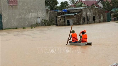
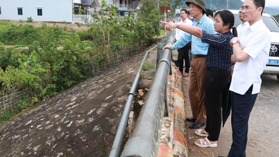
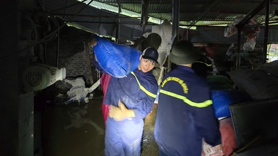
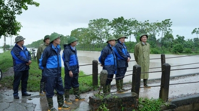
Flash floods and landslides can have a very negative impact on the environment, threaten people's lives; cause local traffic congestion, affect the movement of vehicles; destroy civil and economic works, causing damage to production and socio-economic activities. The National Center for Hydro-Meteorological Forecasting recommends that local authorities pay attention to reviewing bottlenecks and vulnerable locations in the area to take preventive and response measures.
NDS
Source: https://baothanhhoa.vn/cac-khu-vuc-canh-bao-lu-quet-sat-lo-dat-trong-6-gio-toi-255778.htm
![[Photo] General Secretary To Lam, Secretary of the Central Military Commission attends the 12th Party Congress of the Army](https://vphoto.vietnam.vn/thumb/1200x675/vietnam/resource/IMAGE/2025/9/30/9b63aaa37ddb472ead84e3870a8ae825)
![[Photo] Solemn opening of the 12th Military Party Congress for the 2025-2030 term](https://vphoto.vietnam.vn/thumb/1200x675/vietnam/resource/IMAGE/2025/9/30/2cd383b3130d41a1a4b5ace0d5eb989d)
![[Photo] Panorama of the cable-stayed bridge, the final bottleneck of the Ben Luc-Long Thanh expressway](https://vphoto.vietnam.vn/thumb/1200x675/vietnam/resource/IMAGE/2025/9/30/391fdf21025541d6b2f092e49a17243f)

![[Photo] President Luong Cuong receives President of the Cuban National Assembly Esteban Lazo Hernandez](https://vphoto.vietnam.vn/thumb/1200x675/vietnam/resource/IMAGE/2025/9/30/4d38932911c24f6ea1936252bd5427fa)
![[Photo] The 1st Congress of Phu Tho Provincial Party Committee, term 2025-2030](https://vphoto.vietnam.vn/thumb/1200x675/vietnam/resource/IMAGE/2025/9/30/1507da06216649bba8a1ce6251816820)


Comment (0)