

After officially becoming a centrally-governed city, Dong Nai entered a new phase of development with a modern, multi-centered urban landscape. With an area of 12,700 km², a population of nearly 5 million people, and 95 commune-level administrative units, Dong Nai has identified two strategic development axes: the Dong Nai Riverfront and Long Thanh International Airport.
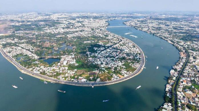
A panoramic view of the Dong Nai River as it flows through the city of Bien Hoa, seen from above. The river meanders through green islets and densely populated residential areas — the 'backbone' of the landscape, planned as a strategic development axis, harmonizing modern urban development with nature preservation.
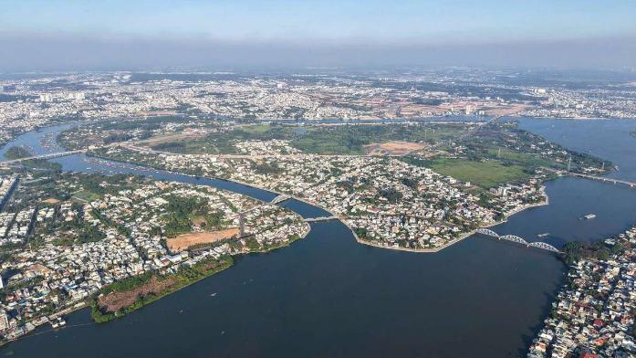
Cu Lao Pho, once the most bustling trading port in the Southern region of Vietnam, is now being planned as a modern, model urban area spanning nearly 300 hectares. A 5.6 km riverside road, completed at the end of 2025, adds a green corridor to the urban area.
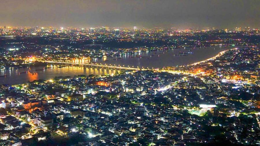
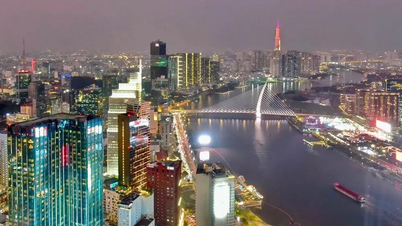
Bien Hoa city center at night — a newly established centrally-governed city with nearly 5 million inhabitants — shines brightly along both banks of the Dong Nai River. The illuminated bridges and riverside roads reflect on the water's surface, creating a modern and vibrant urban landscape.
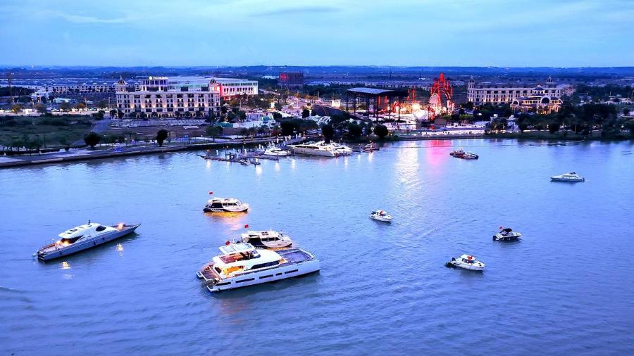
Aqua City is a large-scale urban area located along the Dong Nai River, featuring a marina and integrated infrastructure. Possessing all the characteristics of a high-end ecological urban area, Aqua City attracts residents and promotes socio -economic development for Dong Nai City.
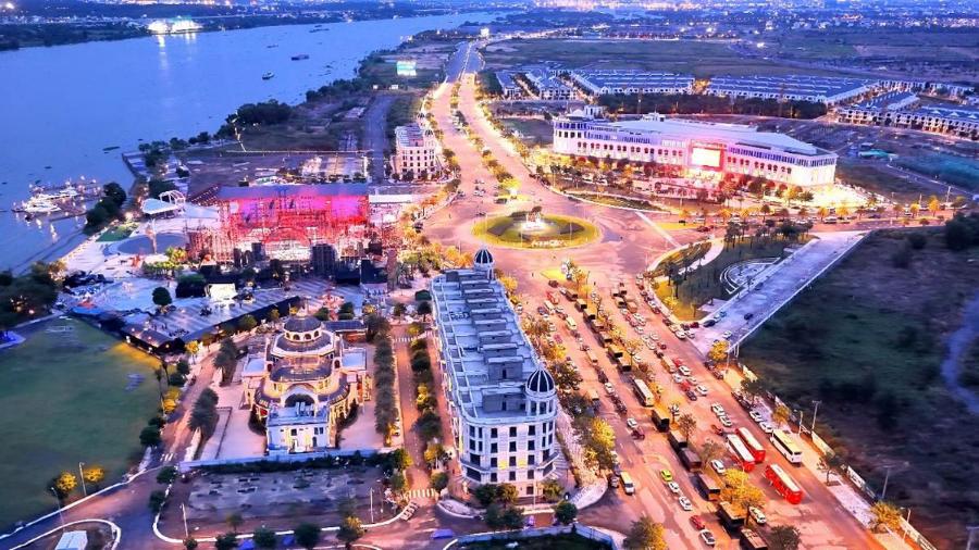
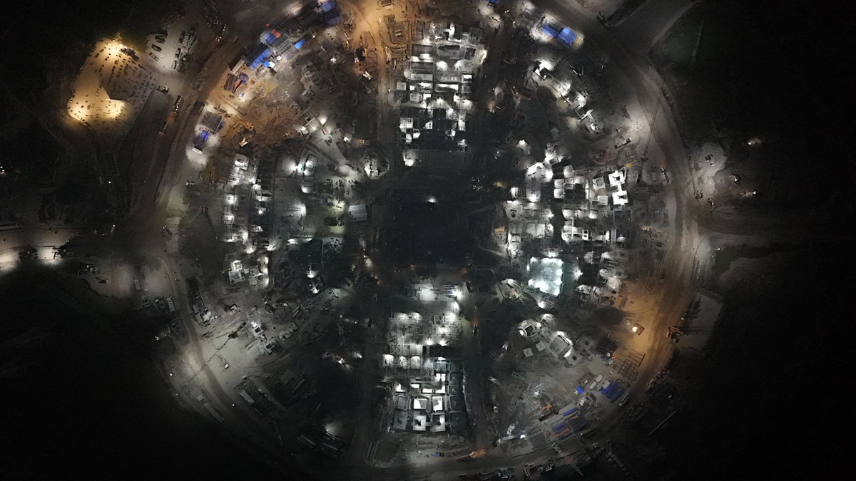
Aqua City 'illuminates' the urban strip along the Dong Nai River. Viewed from above, the urban area emerges with a well-planned system of internal roads, marinas, and public spaces — a model for the eco-urban development trend of Dong Nai City.
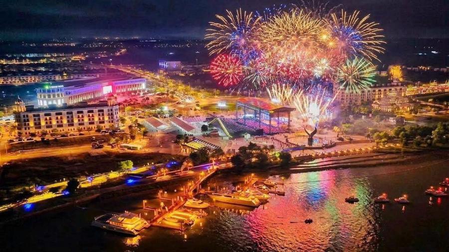
Spectacular fireworks illuminated Aqua City on the night of the ceremony announcing the establishment of Dong Nai City on May 18, 2025. Chosen as the venue for this historic event, Aqua City became a symbol of the new development phase of the Bien Hoa - Dong Nai region.
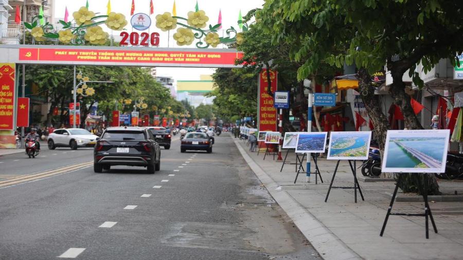
Streets in Tran Bien ward during the early days of Dong Nai becoming a centrally-governed city. Signs celebrating the event and photo exhibitions showcasing the city's appearance lined the sidewalks. Tran Bien is one of the wards with the highest population in the country, with over 125,000 people.
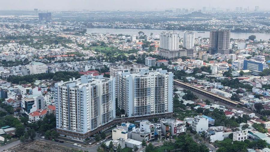
A series of high-rise buildings and apartment complexes have sprung up amidst existing residential areas, reflecting the rapid urbanization of Dong Nai. In the distance is the Dong Nai River — evidence of the urban development orientation linked to the riverine landscape axis.
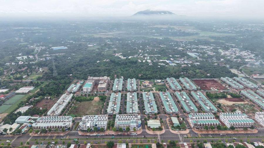
The Long Khánh center, with its new urban area taking shape at the foot of Mount Chứa Chan, is one of the key investment areas for the development of spiritual and ecological tourism —a testament to Đồng Nai City's multi-center development strategy.
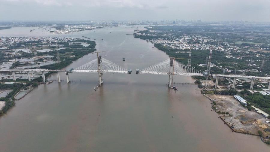
The Phuoc Khanh Bridge — one of the largest cable-stayed bridges in the region — is currently in the final stages of construction on the Ben Luc - Long Thanh expressway, expected to be completed in June 2025, directly connecting Dong Nai with Ho Chi Minh City via the Southern corridor.
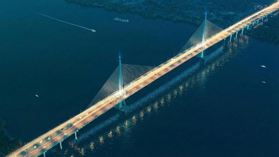
The Long Hung Bridge – scheduled for completion in 2028 – will be a strategic link connecting Ho Chi Minh City and Dong Nai City. Along with the Phuoc Khanh Bridge, it is a key transportation project shaping the future inter-regional urban development of the Southeast region.
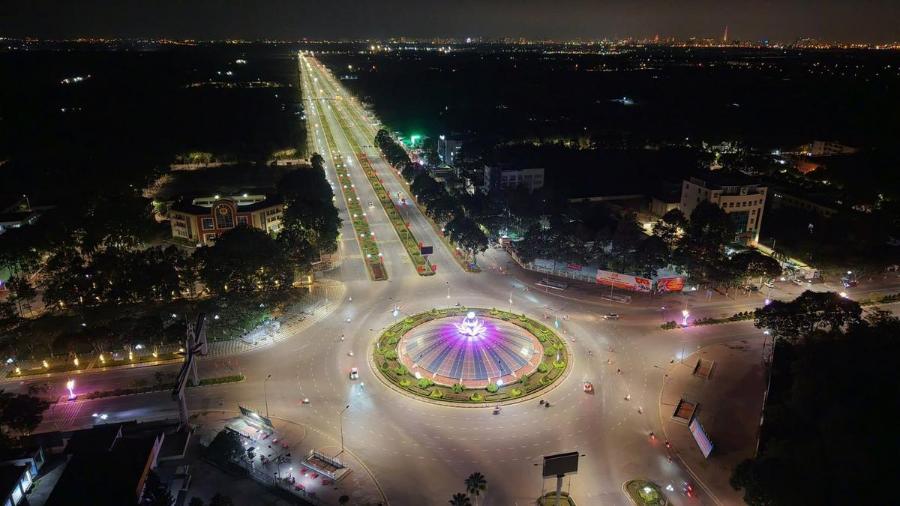
The Nhon Trach urban center at night features a lotus-shaped roundabout and a straight boulevard connecting Long Thanh Airport with Ho Chi Minh City's Ring Road 3. Nhon Trach, envisioned as a future airport satellite city, is rapidly transforming thanks to its inter-regional infrastructure system.
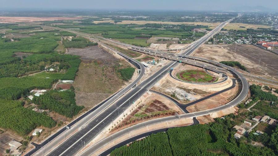
The Bien Hoa - Vung Tau expressway interchange, connecting to the access road to Long Thanh airport, is preparing for opening. The interwoven expressway and ring road system is the backbone infrastructure, expanding development space and shortening the distance between Dong Nai and major economic centers.
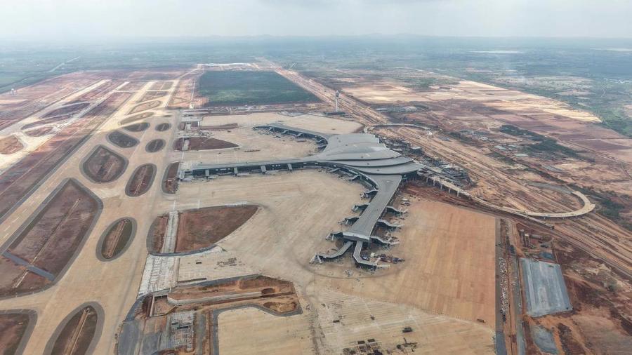
Long Thanh International Airport, with its uniquely designed lotus-shaped terminal, has a total investment of nearly $16 billion. The project is expected to be operational by the end of 2026, representing the biggest boost to economic growth in Dong Nai province and the entire Southeast region in the next decade.
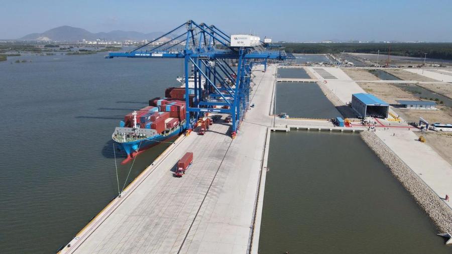
The Phước An seaport, scheduled to become operational in 2025, combined with Long Thành airport, will create a closed-loop logistics system—maritime and air—laying the foundation for Đồng Nai to become an important cargo transshipment center in the Southern economic region.
Source: https://baochinhphu.vn/dien-mao-dong-nai-sau-ngay-len-thanh-pho-102260521235641929.htm

![[Image] Close-up view of the interchange connecting the two expressways and Long Thanh Airport.](https://vphoto.vietnam.vn/thumb/1200x675/vietnam/resource/IMAGE/2026/05/25/1779703378210_ndo_br_z7863716673926-224453a31600126cce10622af6290afd-4549-jpg.webp)
![[Image] Hanoi's urban life under the challenge of a "scorching hot" environment](https://vphoto.vietnam.vn/thumb/1200x675/vietnam/resource/IMAGE/2026/05/25/1779706979265_nang-nong-t5-2026-minh-duy-7-4636-jpg.webp)



































































Comment (0)