
 |
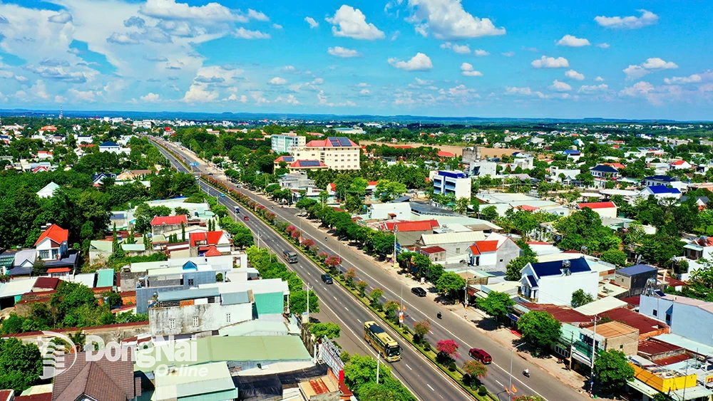
| An aerial view of Dong Xoai ward. Photo: Phu Quy |
The road from Bien Hoa to Dong Xoai is about 90km long. Then, several tens of kilometers further up to Phuoc Long, Bu Gia Map, down to Bu Dang… I encountered almost all the familiar scenery of Dong Nai . Endless rubber forests, rice paddies preparing for the summer-autumn harvest… just like on both sides of National Highway 1 and National Highway 20 in Dong Nai; durian farms like in Long Khanh and Long Thanh; Ba Ra Mountain reminding me of Chua Chan Mountain; Thac Mo hydroelectric power plant reminding me of Tri An hydroelectric power plant; offices, houses, and streets in Dong Xoai that are all familiar… But in the end, the impression of “familiar yet strange” remains with me from my short trip.
Japanese squirrels on the border
A "sóc" is a clustered settlement of the S'tiêng ethnic group, certainly not as large or densely populated as a (former) district. I think that's why calling a district a "sóc" is less appropriate than calling it a "bù" in the local dialect. And "sóc Jamap" became the place name Bù Gia Mập for the large area with many small "sóc"s; similarly, Bù Đốp district on the left and Bù Đăng district on the right extend all the way to Đồng Nai.
Sitting and drinking tea, listening to stories about the land of Bu Gia Map, hearing about the S'tieng people in the highlands and lowlands, known by different names, looking towards the distant border with three provinces of Cambodia, more than 20km away, it's a pity the sun is setting. I'll have to postpone my visit to that faraway place to another time, or to Bu Dop with the Hoang Dieu National Border Gate, the Tan Tien Sub-border Gate, or the Hoa Lu International Border Gate, or the Loc Thinh Border Gate in Loc Ninh.
From what I've heard and read beforehand, I learned that the S'tieng, an indigenous ethnic group in the Southern Central Highlands, numbers over 100,000 people throughout Vietnam, with the largest concentration in Binh Phuoc province. The S'tieng can be broadly divided into two main groups: the Bu Deh group in the lowlands, who have long practiced wet rice cultivation and used buffaloes and oxen for plowing; and the Bu Lo group in the highlands, who primarily practice slash-and-burn agriculture. S'tieng houses vary between regions. The Bu Lo live in longhouses with extended families under a patriarchal system; the Bu Deh live in extended families under a matriarchal system. Besides stilt houses, there are also rudimentary earthen houses resembling huts, with roofs extending almost to the ground. The entrances are very low, located at both gable ends, and a single door at the front of the house; the eaves above the doors are either trimmed or curved upwards, similar to those on traditional houses.
The Ma people.
Notable figures from the S'tieng ethnic group's wartime history include the People's Armed Forces hero and anti-American fighter Dieu Ong, and now, female National Assembly representative Dieu Huynh Sang, who served in two terms (13th and 14th).
***
I hope that one day, after Dong Nai and Binh Phuoc are united, I will have the opportunity to visit a longhouse and chat with my S'tieng friends, just as I did with my dear Chơro friends in Dong Nai.
The story of Bo Nam Bra mountain
In a S'tieng folk tale, long ago, there was a giant father with three daughters. He wanted to give each daughter a piece of land so they could share the responsibility of governing the village. He worked hard to build hills (Bờ Nâm) for his daughters to live on. To distinguish their roles, he created mountains of different heights. For the eldest daughter, he used a Lung (the largest type of basket used by the S'tieng people) to fill a Lung of earth, creating Gia Lao Mountain (Xuan Loc, Dong Nai) today. For the younger daughter, he used a Xa (a smaller type of basket than the Lung) to fill a Xa of earth, creating Bờ Nâm Woen (or Veng) - which is Ba Den Mountain in Tay Ninh today. For the youngest daughter, he used a Khiêu (the smallest type of basket used by the S'tieng people) to build a hill by the Dak Lung River (the upper reaches of the Be River today) to create Bờ Nâm Brá - which is Ba Ra Mountain. Therefore, today Mount Ba Ra is the lowest of the three mountains in the Southeast region of Vietnam.
Another legend says that the giant had only two daughters, the elder sister living in the Ba Den mountain region, and the younger sister in the Ba Ra mountain region.
***
According to the S'tieng people, in the past, the S'tieng, Khmer, and Chơro communities mainly lived in the Bà Đen mountain region. Later, due to disagreements, a group of S'tieng people led by Mrs. Giêng moved eastward to find a new place to settle. Along the way, the group stopped twice. Once at Sóc Bưng (present-day Thanh Phú commune, Bình Long district), they rested. Because the group was large and they rested for so long, the ground where they sat sank, creating a place called Bờ Nâm Cầm Beng, which is the Thanh Phú circular earthen rampart site. Later, when they reached the Sóc Bưng area (Lộc Quang commune, Lộc Ninh district), about 30km from the first stop, they rested again, creating a similar-shaped site in Sóc Bưng hamlet - which is the Lộc Quang 2 circular earthen rampart site today. Finally, the group arrived at the Bờ Nâm Brá area - Bà Rá mountain. Recognizing that the area has high mountains, large rivers, and many streams flowing through it, along with beautiful scenery suitable for farming and long-term residence, the S'tieng people chose this place as their home and have remained so to this day.
***
Today, Ba Ra Mountain is an interesting tourist destination. From Dong Xoai, travel north for about 50km to Phuoc Long, where you will find Ba Ra Mountain.
From the foot of the mountain, our vehicle took us up to Bang Lang Hill, located about one-fifth the height of the summit. The road was paved, but we had to stop because the next section was under repair. On Bang Lang Hill, there is a memorial monument dedicated to the heroic martyrs. Ba Ra was originally a revolutionary base and a battlefield during the war against the US. Ba Ra Mountain was recognized as a national historical and cultural relic by the Ministry of Culture and Information in 1995. I heard that Ba Ra Mountain had a cable car system built to serve tourists and pilgrims from the foot of the mountain to the summit (currently out of operation). From Bang Lang Hill, you have to climb 1,767 stone steps to reach the summit (previously just earthen steps). A friend here boasted: "Standing on the summit of Ba Ra, you can see the entire plain of Binh Phuoc, and you can see Thac Mo town and the Thac Mo hydroelectric power plant quite clearly."
Durian in Phu Tin
The biggest surprise of my trip was visiting Phu Tin and Phu Nghia in Phuoc Long, where I saw a 30-hectare durian farm owned by a farmer and businessman of the same age as me. At 76, born in the year of the Tiger, he still rode his motorbike, moved quickly and nimbly, spoke eloquently, and was especially sharp and meticulous when talking about durian. His name is Truong Van Dao, originally from Cu Chi, who moved to Binh Phuoc to start his business over 30 years ago. My friend, from Long Khanh, Dong Nai, confided that he had always been proud of his hometown as the "durian capital" with its vast farms growing this fruit, exporting large quantities everywhere each season. But here, Ba Dao Company surprised him with its entire factory processing durian into dozens of export products, including whole frozen durians exported to China.
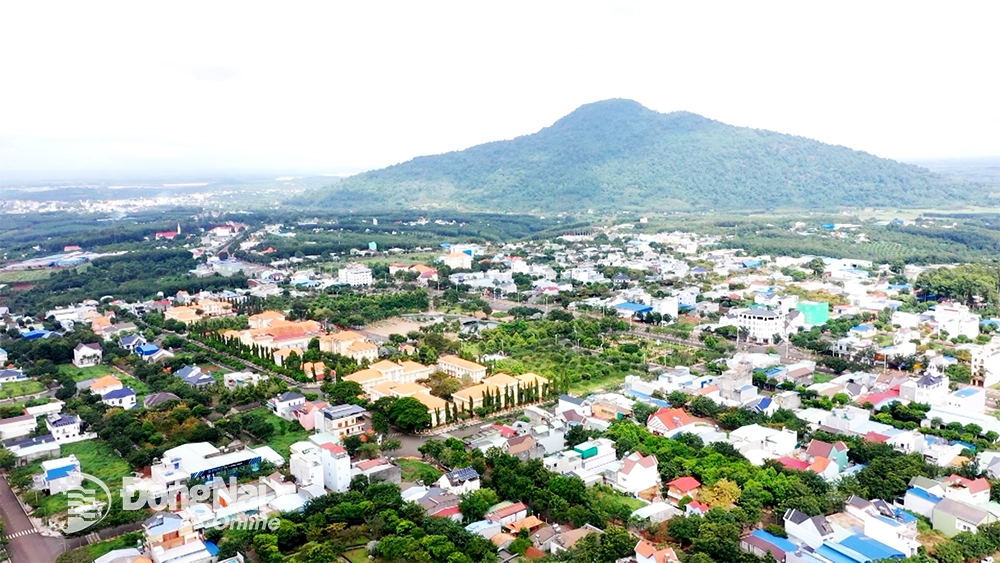 |
| Phuoc Long ward viewed from above. Photo: Phu Quy |
The durian orchard of the farm owner has a very unassuming appearance, consisting entirely of low-growing trees, quite different from the familiar image I have of durian trees reaching 20 meters in height in Long Thanh and Long Khanh. Mr. Ba explained: "I treated the trees to encourage the growth of many branches from a lower level, making harvesting easier."
It wasn't harvest season, so the factory was quiet as we were given a tour. To have the modern production lines for sorting fruit, packaging durian segments, and freezing whole fruits using liquid nitrogen, Mr. Ba Dao had to overcome many difficulties regarding permits, capital, technology, and management to get to where he is today. He used many words that were both professional and colloquial, which caught my attention, prompting me to ask for detailed explanations. It was a pleasure to listen to him and enriched my own vocabulary of colloquial terms. He talked about artificial pollination for durian, explaining that he has to hire seasonal workers and wait for the right time for the stamens to "release the male flowers." This involves workers using specialized tools to rub the male stamens, causing pollen to fall onto the female pistils, increasing the rate of fruit set.
I thought to myself, "Why can't a durian farming model like Mr. Ba Dao's be developed in Dong Nai when the two provinces are one?"
The sound of the pestle clicking
Soc Bom Bo is a must-see destination on any trip. Located in the former Bu Dang district, it's a small village. The Soc Bom Bo Museum is well-maintained and features many artifacts and images depicting the people of Bom Bo pounding rice to provide food for the soldiers. It houses both an original set of stone xylophones and a smaller set. The tour guide, a S'tieng woman, even performed the song "The Sound of the Pestle in Soc Bom Bo" by composer Xuan Hong, accompanied by music on this smaller set of stone xylophones.
I heard that during the recently held Bom Bo Festival, a large number of people from all over and locals came to attend. "For the first time in Binh Phuoc, there was a traffic jam lasting for hours around Bom Bo!" - my friend from Binh Phuoc recounted proudly.
June 2025.
A new Dong Nai
It was a short two-day trip. We took advantage of the time to visit as many places as possible, so the car was practically on the move.
On Tuesday morning, sitting at a sidewalk cafe, I pondered many things. Why does Binh Phuoc have so many similarities to Dong Nai? The hydroelectric dams on the Be and Dong Nai rivers, the vast rubber and cashew plantations, the two "sister" mountains of Chua Chan and Ba Ra, the two indigenous ethnic minority groups of the two regions…
The owner of the restaurant, having overheard our conversation, realized we were from Dong Nai. He quickly struck up a conversation about the provincial merger. He said, "It would be wonderful if the new Dong Nai province included Xuyen Moc district from Ba Ria - Vung Tau. The new province would stretch from the border to the sea, encompassing mountains, forests, plains, and the ocean." It turns out that even ordinary people in Binh Phuoc are quite interested in and keeping up with the merger; they're not indifferent at all.
I then thought of the S'tieng and Choro ethnic groups of the newly established Dong Nai province. So, Dong Nai now has two large indigenous ethnic groups of the Southeast region. Even more interesting is that the majority of both the S'tieng and Choro people share the surname Dieu.
The new Dong Nai now has both wings of a bird!
Notes by writer Khoi Vu
Phuoc Long ward viewed from above.
Source: https://baodongnai.com.vn/dong-nai-cuoi-tuan/202507/mot-mai-nha-chung-801147a/

![[Video] Sunset at Lap An Lagoon – Where the sun sets over the fishing nets](https://vphoto.vietnam.vn/thumb/1200x675/vietnam/resource/IMAGE/2026/05/31/1780192137701_beach-landscape-sea-water-nature-grass-745871-pxhere-com.jpeg)


![[E-Magazine]: And tomorrow, the sun will rise.](https://vphoto.vietnam.vn/thumb/402x226/vietnam/resource/IMAGE/2026/02/27/1772199533891_e-magazine-roi-w1200t0-di2608d199d5160636t11920l1-mtg-013.webp)


![[Video] Sunset at Lap An Lagoon – Where the sun sets over the fishing nets](https://vphoto.vietnam.vn/thumb/340x192/vietnam/resource/IMAGE/2026/05/31/1780192137701_beach-landscape-sea-water-nature-grass-745871-pxhere-com.jpeg)


Comment (0)