

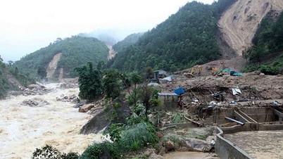
According to a preliminary report from the Quang Ninh Provincial Irrigation Department, due to the impact of prolonged heavy rain, flooding occurred on May 18th on rivers in the eastern part of the province; local authorities deployed personnel to guard at culverts and spillways.
Video : The water level of the Ka Long River in the Mong Cai area continues to rise and flow rapidly on May 18th.
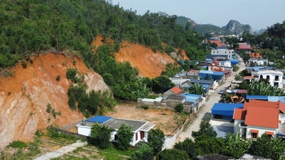
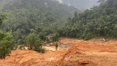
Heavy rains and floods caused localized landslides at two points on National Highway 18C (in the former Binh Lieu district) with a volume of approximately 400 m3; cleanup efforts have been organized.
Provincial Road 326 suffered damage to approximately 30 meters of asphalt, and repairs have been carried out to allow traffic to pass. Preliminary statistics show that 127.5 hectares of rice and 8 hectares of vegetable crops were flooded and flattened; several power poles were broken and property was damaged. There were no casualties.
The reservoirs remain safe, and some have begun releasing water, such as Chuc Bai Son reservoir (releasing 13.68 m3/s) and Trang Vinh reservoir (releasing 307.23 m3/s). Local authorities have relocated some households at risk of landslides to safe areas.
According to information from the Quang Ninh Provincial Meteorological and Hydrological Station, in the next 3-6 hours, moderate to heavy rain will continue in the area, with total accumulated rainfall generally ranging from 50-70 mm, and even higher in some localized areas.
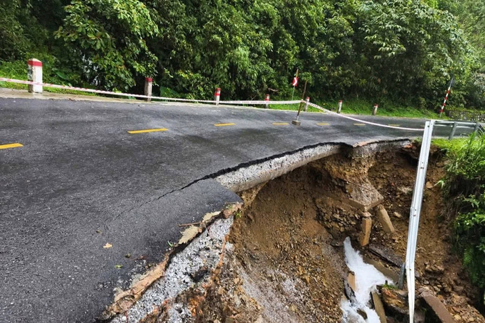
A landslide has occurred at Km74+600 on National Highway 18C leading to Binh Lieu.
This rainfall is likely to continue causing localized flooding in many streets, roads, rice paddies, and low-lying areas along rivers and coastlines in the province, with flood depths ranging from 30 to 50 cm. Flooding may occur from morning to noon and throughout the afternoon of May 18th. A level 1 flood risk warning has been issued.
Moderate to heavy rain, with very heavy rain in some areas, has the potential to cause floods, flash floods, and landslides in high-risk areas, especially around road construction sites, tunnels, coal mines, and hillside areas; localized flooding in some low-lying roads and residential areas; flooding of culverts across small rivers and streams; and during thunderstorms, there is a possibility of tornadoes, lightning, and strong gusts of wind that can uproot trees, damage houses, transportation infrastructure, and endanger ships operating at sea and human lives.
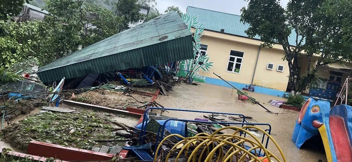
The roof of the playground at the kindergarten in Duong Hoa commune was blown down by a storm.
Therefore, authorities advise people to absolutely avoid going into forests, streams, ravines, and low-lying areas. Children should not be allowed to play near rivers, streams, hillsides, or embankments. People living on slopes and mountainside areas should prepare evacuation plans in case of prolonged heavy rain. Avoid crossing flooded areas and roads at risk of landslides. Closely monitor announcements from local authorities.
Over the past 24 hours, Quang Ninh province has experienced moderate to heavy rainfall, with some areas receiving very heavy rain. Rainfall measurements recorded included: 180.4 mm in Hoang Que ward; 215.4 mm in Quang Duc commune; 170.6 mm in Ba Che commune; 159.2 mm in Dien Xa commune; 297.8 mm in Ha Long ward; and 201.4 mm in Viet Hung ward. This rainfall has caused localized flooding on many streets, roads, and rice paddies, with water depths ranging from 0.4 to 0.6 meters in several wards and communes in the province.
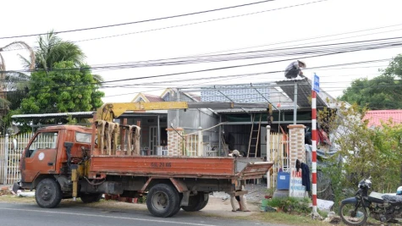
According to information from the People's Committee of Dam Ha commune, Quang Ninh province, in the early morning of May 18th, a storm swept away the corrugated iron roof of a house, causing it to fall onto the road and become entangled in power lines, resulting in a localized power outage. Authorities are currently working to resolve the issue.
On the same day, the corrugated iron roof of the playground at a kindergarten in Duong Hoa commune, Quang Ninh province, was also blown down by a storm, causing damage. Fortunately, no students had arrived at school at that time.
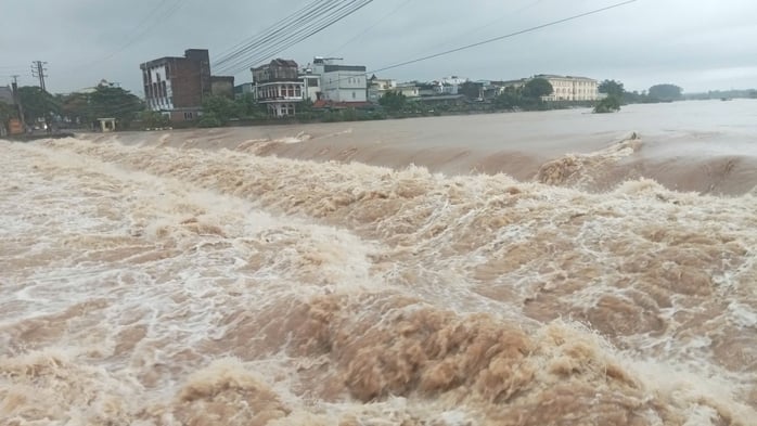
The water level of the Ha Coi River rose after heavy rain.
In Quang Ha commune, high tides combined with strong upstream water flow are causing the water level in the Ha Coi River to continue rising, posing a risk of flooding in low-lying areas of the commune.
According to the leaders of Quang Ha commune, the local authorities are proactively monitoring the situation to inform owners of vehicles and boats to increase vigilance and avoid operating in dangerous areas when water levels rise.
The People's Committee of the commune also requested that the villages urgently disseminate information widely to the people so that they can proactively elevate their property, ensure the safety of people and livestock, and prepare plans to prevent flooding, not being complacent about the heavy rain and rising tides in the coming days.
Source: https://nld.com.vn/mua-lu-gay-sat-lo-ngap-ung-nhieu-noi-196260518145842544.htm
![[Image] Close-up view of the interchange connecting the two expressways and Long Thanh Airport.](https://vphoto.vietnam.vn/thumb/1200x675/vietnam/resource/IMAGE/2026/05/25/1779703378210_ndo_br_z7863716673926-224453a31600126cce10622af6290afd-4549-jpg.webp)



![[Image] Hanoi's urban life under the challenge of a "scorching hot" environment](https://vphoto.vietnam.vn/thumb/1200x675/vietnam/resource/IMAGE/2026/05/25/1779706979265_nang-nong-t5-2026-minh-duy-7-4636-jpg.webp)





























































































Comment (0)