
The application of remote sensing technology and artificial intelligence to collect data in a number of fields has become popular and focused. In particular, the development of the socio- economy has led to an increasing demand for data from remote sensing as well as the use of artificial intelligence.
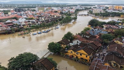
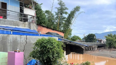
Vietnam has a coastline of more than 3,260km, with marine ecosystems playing an important role in the development of a sustainable blue ocean economy due to their rich biodiversity and socio-economic benefits to people, but are under increasing threat from marine pollutants.
This requires regular monitoring and assessment of water quality, primarily in coastal waters.
Application of technology to monitor seawater quality in coastal areas
Recently, the research team of the Vietnam Space Center (under the Vietnam Academy of Science and Technology) has coordinated with the Polish Institute of Geophysics (under the Polish Academy of Sciences) to successfully conduct a research project on applying AI and remote sensing in monitoring seawater quality in the waters of Ha Long Bay and Cua Luc (Quang Ninh province).
This is the first project in Vietnam to simultaneously use Sentinel-2 satellite data, advanced machine learning algorithms and the GEE platform (Google's cloud computing platform) to model and monitor water quality parameters such as surface temperature, suspended solids, chlorophyll-a and chemical oxygen demand.
The novelty of the research lies in the synthesis and creative application of remote sensing, artificial intelligence and cloud computing technologies to solve the problem of seawater quality monitoring, while also providing feasible solutions to overcome the challenge of data shortage and providing in-depth analysis of practical value.
In addition, the study also opens up a new approach in applying remote sensing technology combined with machine learning to monitor water quality, thereby effectively supporting water resource management in key coastal areas, and gradually expanding to all sea areas.
According to the Research Group on Remote Sensing in Monitoring Water Quality Indicators of the Vietnam Space Center, to deploy widely in our country's seas, it is necessary to have necessary conditions such as: high-quality human resources; quality and synchronous in-situ data. This is the prerequisite and also the biggest challenge.
")
For AI models to be able to produce accurate results for each sea area, a network of monitoring stations or periodic sampling campaigns at local levels is needed.
Master Ngo Duc Anh, researcher, member of the research group on Remote Sensing in monitoring water quality indicators, Vietnam Space Center shared the advantages of implementation, namely, available technology and low cost. In particular, the data source from the Sentinel-2 satellite is completely free.
The Google Earth Engine (GEE) cloud computing platform also provides powerful processing without requiring investments in expensive supercomputers.
The pilot study in Ha Long Bay has developed a proven method that can be adapted and applied to other marine areas, saving the time and effort of starting research from scratch.
The research team of the Vietnam Space Center also raised challenges, which are the specific characteristics of each sea area. Each sea area of Vietnam (North, Central, South) has different oceanographic characteristics, pollution sources and optical composition of water.
A model trained for Ha Long Bay cannot be automatically applied to the Ca Mau sea area. Therefore, each locality needs its own model calibration process, which requires field data at that location.
The lack of a network of automatic, continuous and synchronized monitoring stations across Vietnam's seas is a major barrier to large-scale model calibration and verification.
For the system to operate effectively nationwide, there needs to be a close and smooth coordination mechanism between central research units, relevant ministries (Agriculture and Environment, Science and Technology) and the authorities of coastal provinces and cities.
Opening up new space for the development of space science and technology in Vietnam
Sharing about the significance of the project, Dr. Vu Anh Tuan, Deputy General Director of the Vietnam Space Center, said that the research has opened up a new approach in applying remote sensing technology combined with machine learning to monitor water quality, thereby effectively supporting water resource management in key coastal areas.
")
Despite the limited field data, the Random Forest model still gives good forecast results for indicators such as "suspended solids" (TSS).
The integration of water quality distribution maps on the Google Earth Engine platform has created an intuitive tool, allowing monitoring of marine environmental fluctuations over space and time, serving practically the management and planning of sustainable development of the research area.
According to Dr. Vu Anh Tuan, one of the conditions for widespread implementation of the above project is technology infrastructure and centralized database; initial financial investment as well as maintaining operations, training human resources...
In particular, the success of large-scale deployment depends largely on the proactive and active role of local authorities with sea. Resolution No. 57-NQ/TW dated December 22, 2024 of the Politburo on breakthroughs in science, technology, innovation and national digital transformation has identified the importance of "space", while emphasizing the goal of autonomy, gradually mastering core technologies, to serve socio-economic development and ensure national defense and security.
"This can be said to open a new space for the development of space science and technology in Vietnam and this is also a factor that encourages coastal localities to participate in the Remote Sensing Project in monitoring water quality indicators," Dr. Vu Anh Tuan emphasized.
With Resolution No. 57, the major strategies of the Vietnam Space Center such as mastering technology, manufacturing satellites with Vietnamese brand, building large databases and using artificial intelligence to apply space technology on a national scale in important fields such as monitoring resources, environment and natural disasters; territorial planning; developing marine economy; responding to non-traditional security challenges such as climate change, search and rescue; contributing to ensuring national defense, security and sovereignty... have great momentum and opportunities to be realized in the near future.
Dr. Vu Anh Tuan believes that the problem of applying remote sensing and artificial intelligence in large-scale water environment monitoring, Resolution No. 57 also creates great opportunities for worthy and focused investment.
At the same time, the results of this problem are also an important source of information for related sectors such as environment, aquaculture and fisheries, rapid and sustainable development of the marine economy with conditions for development in the spirit of Resolution No. 57.
It is hoped that Resolution No. 57 will soon come into practice, through amending regulations on investment, public procurement, finance... this has removed barriers, created a clear legal corridor and given autonomy to scientists./.
Source: https://www.vietnamplus.vn/nghi-quyet-57-mo-duong-so-hoa-du-lieu-giam-sat-nuoc-bien-bang-cong-nghe-ve-tinh-post1049565.vnp


![[Photo] Prime Minister Pham Minh Chinh receives President of Cuba's Latin American News Agency](/_next/image?url=https%3A%2F%2Fvphoto.vietnam.vn%2Fthumb%2F1200x675%2Fvietnam%2Fresource%2FIMAGE%2F2025%2F12%2F01%2F1764569497815_dsc-2890-jpg.webp&w=3840&q=75)


![[Photo] President Luong Cuong holds talks with Sultan of Brunei Darussalam Haji Hassanal Bolkiah](https://vphoto.vietnam.vn/thumb/402x226/vietnam/resource/IMAGE/2025/12/01/1764574719668_image.jpeg)


Comment (0)