
When will things be more spacious?
Hoi An plays a crucial role in promoting regional connectivity, especially in tourism development. This is due to its location within the northern growth cluster of the province and its position in the key coastal urban area of Central Vietnam. In recent years, external transportation links in Hoi An have been boosted, largely meeting development requirements in the new context.
The DT603 road (coastal route between Da Nang and Hoi An), upgraded about 20 years ago, was the first step in awakening a city once known as a "retirement town".
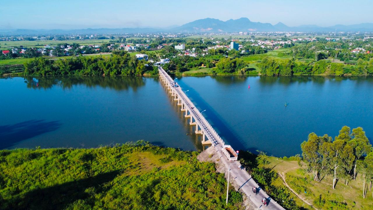
The construction of Cua Dai Bridge and Cam Kim Bridge has helped Hoi An "break" the transportation isolation from the south. Along with several provincial roads that have been upgraded in recent years, such as DT607 and DT608 (two routes connecting Hoi An - Dien Ban - My Son), tourists from all directions now have much easier access to this heritage city.
Although the roads are now less congested, they can't be called spacious. After about two decades of investment, the DT603 route is beginning to show signs of not keeping up with development. Currently, this route restricts large trucks to primarily serve the needs of local residents and tourists.
The two provincial roads connecting Dien Ban and Hoi An also face obstacles. The DT607 route to Hoi An is narrowed (two-way road) due to land acquisition difficulties, and some sections remain unfinished due to land acquisition issues.
Meanwhile, a short section of the DT608 road near the Lai Nghi intersection (the border area between Dien Ban and Hoi An) remains uncompleted, creating a "bottleneck" that significantly impacts traffic.
In particular, the opening of the new Cam Kim bridge has made the Duy Phuoc bridge (also known as the Ba Ngan bridge) even more outdated. The demand for traffic between Duy Xuyen and Hoi An via National Highway 14H is currently very high, but the Duy Phuoc bridge is only 3.5 meters wide, causing vehicles to queue up and wait for each other during peak hours.
Mr. Van Anh Tuan, Director of the Department of Transport, said that the department strongly supports the idea of upgrading Duy Phuoc Bridge on National Highway 14H. Previously, the authorities had considered including it in the list of climate change adaptation projects for Hoi An City, but faced funding difficulties. The department will propose this project to the Ministry of Transport ; if the Ministry does not invest, they will propose using the provincial budget for investment.
It is understood that the Duy Phuoc bridge and access road project is on the list of priority investments according to the approved Provincial Planning for the period 2021-2030, with a vision to 2050. Therefore, the Provincial People's Committee has requested the Department of Planning and Investment to research and advise the province on considering and allocating investment capital in the period 2026-2030.
Transportation for the future
According to the transportation planning orientation of Hoi An City from the city's general planning project to 2035, with a vision to 2050, green transportation associated with ecological urban development is an important content.
In particular, the Hoi An authorities have identified plans to organize multimodal gateways, improve the public transportation system, build upon the bicycle sharing project in Hoi An, and expand the green transportation network throughout the country.
But that's a story for the future. Recently, despite efforts to establish parking lots at some gateways to the city center, such as the Thanh Ha pottery village area and the intersection of Nguyen Tat Thanh and Hai Ba Trung streets, along with traffic management measures aimed at restricting large trucks from entering the city center, traffic on inner-city arteries remains chaotic during peak hours.
Architect Luong Ngoc Trung - a planning expert and representative of the consulting consortium for the revised master plan of Hoi An City, said: "We have advised on the establishment of two important green transportation routes for Hoi An to shape tourism and be compatible with the city's ecological urban development orientation."
Furthermore, the city's future bridge and terminal systems will also see breakthroughs to expand multimodal transportation through new corridors to alleviate pressure on the existing transportation network.”
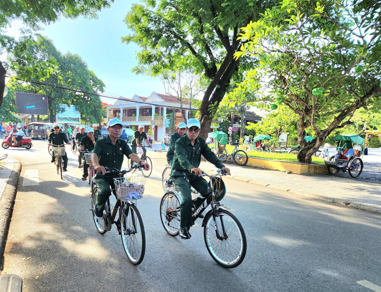
For many years, green transportation in Hoi An has been a focus. With funding from international organizations, hundreds of bicycles were introduced to create a public bike-sharing system for tourists and the community, which once created a sensation and even won the "Global Urban Transportation Award" from the German Ministry of Economic Cooperation and Development, but it is gradually fading into oblivion.
The project's goal of increasing the percentage of people using bicycles in Hoi An to 40% by 2025 is also quite far-fetched.
Much work remains to be done to ensure all roads leading to Hoi An are wide and to "green" the inner-city traffic of Hoi An as expected...
Source: https://baoquangnam.vn/nhung-neo-duong-ve-pho-hoi-3139356.html


Comment (0)