

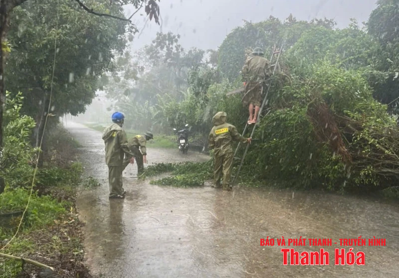
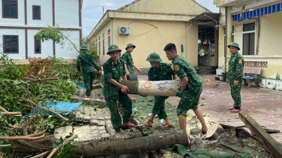
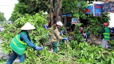
Trees fell in Nguyet Vien ward.
Particularly in Phu Tho, Hanoi and from Thanh Hoa to Nghe An, there will be heavy to very heavy rain. During thunderstorms, beware of flash floods and landslides at a high alert level.
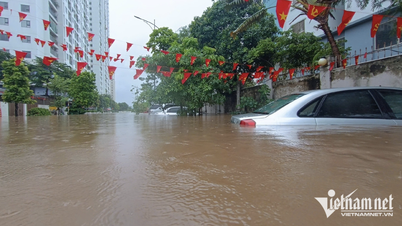
Last night and this morning (August 26), the midlands and deltas of the North, Son La, Lao Cai and from Thanh Hoa to Northern Quang Tri had moderate to heavy rain, with some places experiencing very heavy rain; Phu Tho, Hanoi and the area from Thanh Hoa to Nghe An had heavy to very heavy rain.
Rainfall from 7:00 p.m. on August 25 to 8:00 a.m. on August 26 was over 200mm in some places, such as: Ta Si Lang station (Lao Cai) 230mm, Van Mai station (Phu Tho) 270mm, Thach That station (Hanoi) 261.4mm, Van Xuan 1 station (Thanh Hoa) 220mm, Dong Van hydroelectric station (Nghe An) 272mm, Ho Xuan Hoa station ( Ha Tinh ) 242.4mm,...
From the morning of August 26 to the morning of August 27, the midlands and deltas of the North, Son La, Lao Cai, Thanh Hoa will have moderate rain, heavy rain and thunderstorms with common rainfall of 60-120mm, locally very heavy rain over 250mm.
From the night of August 26, heavy rain in the area from Thanh Hoa to Ha Tinh tends to decrease. From the afternoon of August 27, heavy rain in the North gradually decreases.
Warning level of natural disaster risk due to heavy rain, tornado, lightning, hail: level 1.
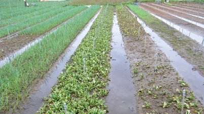
Heavy rains are likely to cause flooding in low-lying areas, urban and industrial areas; flash floods on small rivers and streams, landslides on steep slopes (real-time warning information on areas at risk of flash floods and landslides is provided online on the website of the Department of Hydrometeorology at: https://luquetsatlo.nchmf.gov.vn and in separate bulletins warning of flash floods and landslides). During thunderstorms, there is a possibility of tornadoes, lightning, hail and strong gusts of wind.
LP
Source: https://baothanhhoa.vn/thanh-hoa-tiep-tuc-mua-to-dien-rong-canh-bao-lu-quet-sat-lo-dat-cao-259545.htm
![[Photo] Prime Minister Pham Minh Chinh chairs meeting of National Steering Committee on International Integration](https://vphoto.vietnam.vn/thumb/1200x675/vietnam/resource/IMAGE/2025/8/26/9d34a506f9fb42ac90a48179fc89abb3)
![[Photo] Many people eagerly await the preliminary review despite heavy rain](https://vphoto.vietnam.vn/thumb/1200x675/vietnam/resource/IMAGE/2025/8/27/4dc782c65c1244b196890448bafa9b69)
![[Photo] Brilliant red of the exhibition 95 years of the Party Flag lighting the way before the opening](https://vphoto.vietnam.vn/thumb/1200x675/vietnam/resource/IMAGE/2025/8/27/e19d957d17f649648ca14ce6cc4d8dd4)


![[Photo] General Secretary To Lam attends Meeting with generations of National Assembly deputies](https://vphoto.vietnam.vn/thumb/402x226/vietnam/resource/IMAGE/2025/8/27/a79fc06e4aa744c9a4b7fa7dfef8a266)


Comment (0)