
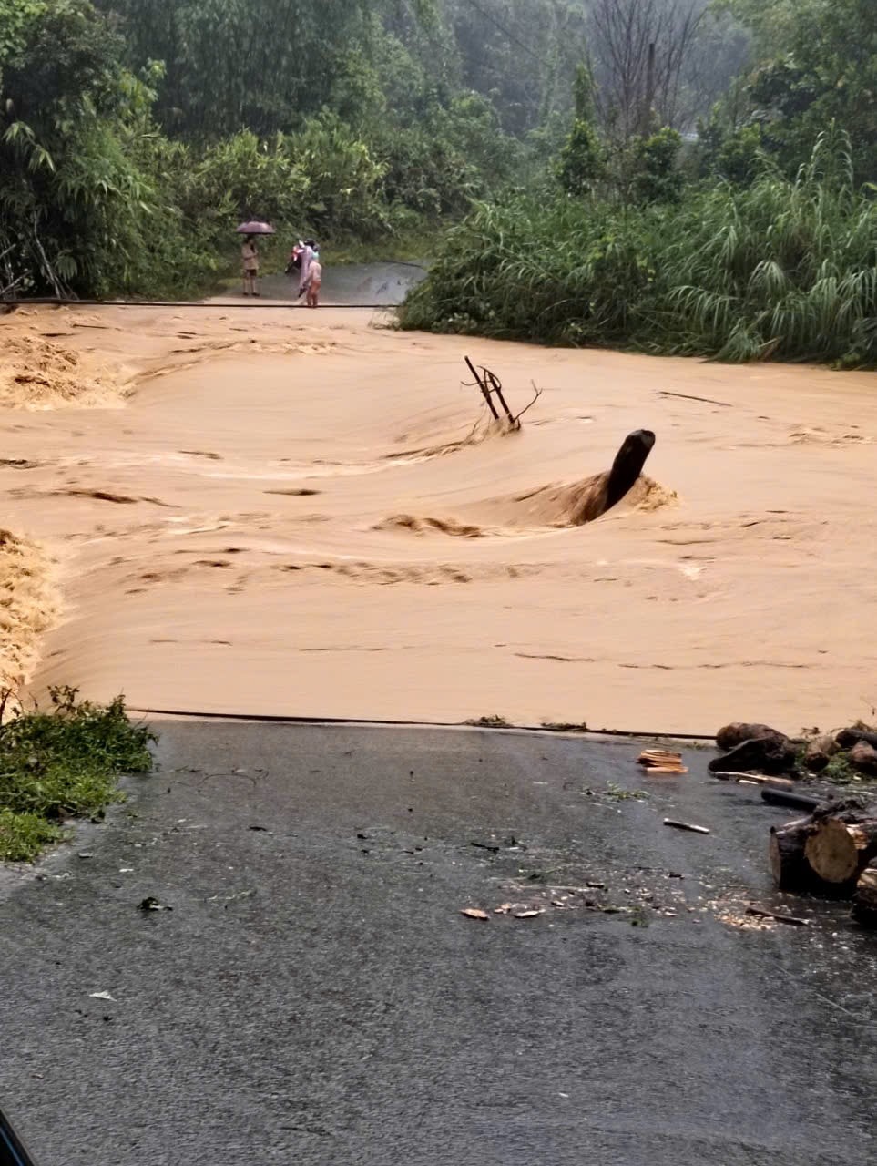
According to Mr. Alang Toi, Vice Chairman of the People's Committee of Tay Giang commune, heavy rain has continued in the commune since the evening of October 25th. Currently, water levels in the rivers are rising, causing some roads to be deeply flooded.
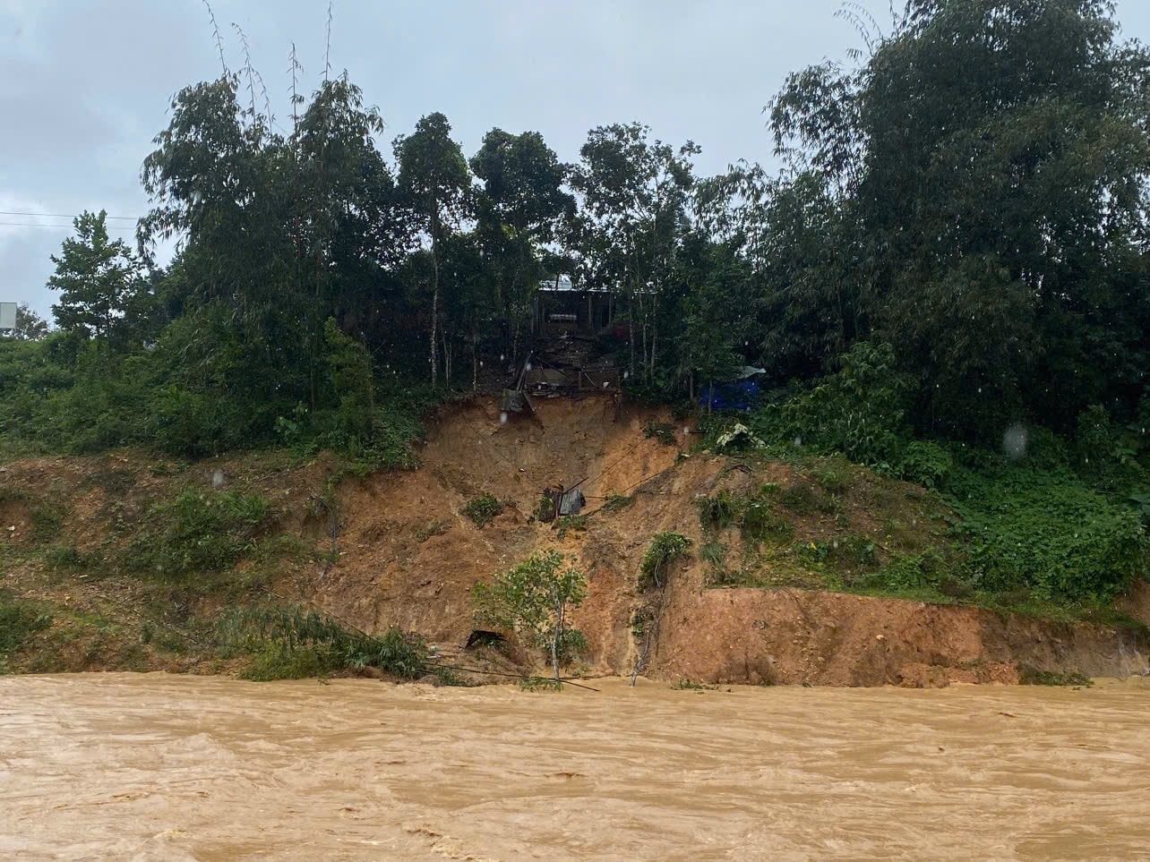
"Through on-site inspection, the main transportation routes in the commune have more than 42 landslide points of varying sizes, including 12 points where landslides have completely covered the road surface. The estimated volume of soil and rocks from the landslides is over 30,500 m³, burying 7,700 m of culverts and ditches," Mr. Toi said.
According to Mr. Toi, landslides on both the positive and negative slopes of the roads leading to the villages of Arui, Z'lao, Arớt, A Cấp, and Axòo have completely blocked the roads, isolating these villages. In addition, five bridges and culverts are experiencing subsidence of the approach roads and erosion of the bridge abutments. Authorities have set up checkpoints and posted warning signs.
“We have mobilized forces and equipment and are on standby. When the rain stops, we will temporarily reopen the road to ensure transportation for the people. The reassuring thing is that, after inspection, apart from the households subject to evacuation, the living conditions of the people in the commune are relatively stable,” Mr. Toi informed.
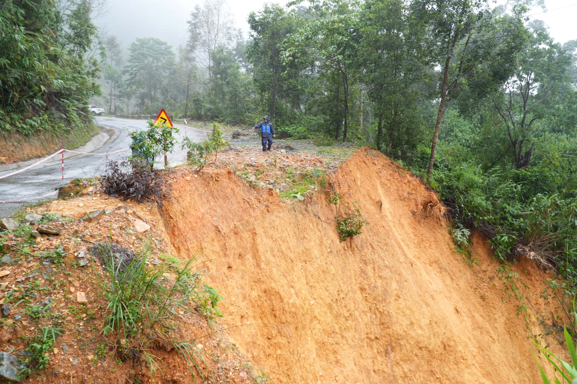
Additionally, on provincial road DT.606, at Km23+480, there is a risk of a section breaking, spanning 43 meters. At Km25 and Km26+200, the embankment has experienced minor landslides and soil erosion, with a high risk of further landslides. Local authorities have erected barriers, placed warning signs, and narrowed the road to approximately 3.5 meters for traffic.
To temporarily ensure traffic flow, the management unit has removed the traffic cones on the left side of the road, allowing vehicles to use the shoulder as well. If the landslide continues, provincial road DT.606 risks being cut off and blocked, causing traffic safety hazards in the area.
On the morning of October 28th, a landslide occurred on the land designated for residential development in Axòo village. The People's Committee of Tây Giang commune was forced to urgently relocate 3 households with 10 people to a safe place. At the same time, 6 households with 15 people at risk of landslides in the Cơ Tu Traditional Village residential area (Agrồng village) were evacuated to stay with relatives.
Source: https://baodanang.vn/xa-tay-giang-chu-dong-doi-dan-ung-pho-sat-lo-3308604.html


![[Photo] Prime Minister Pham Minh Chinh attends the Conference on the Implementation of Tasks for 2026 of the Industry and Trade Sector](/_next/image?url=https%3A%2F%2Fvphoto.vietnam.vn%2Fthumb%2F1200x675%2Fvietnam%2Fresource%2FIMAGE%2F2025%2F12%2F19%2F1766159500458_ndo_br_shared31-jpg.webp&w=3840&q=75)


Comment (0)