Project on Early Warning of Landslides and Flash Floods in Mountainous and Midland Areas of Vietnam.
The project will be implemented in mountainous and midland areas of 37 provinces and centrally-run cities from 2023 to 2030.
Focus on building an early warning information system for landslides and flash floods
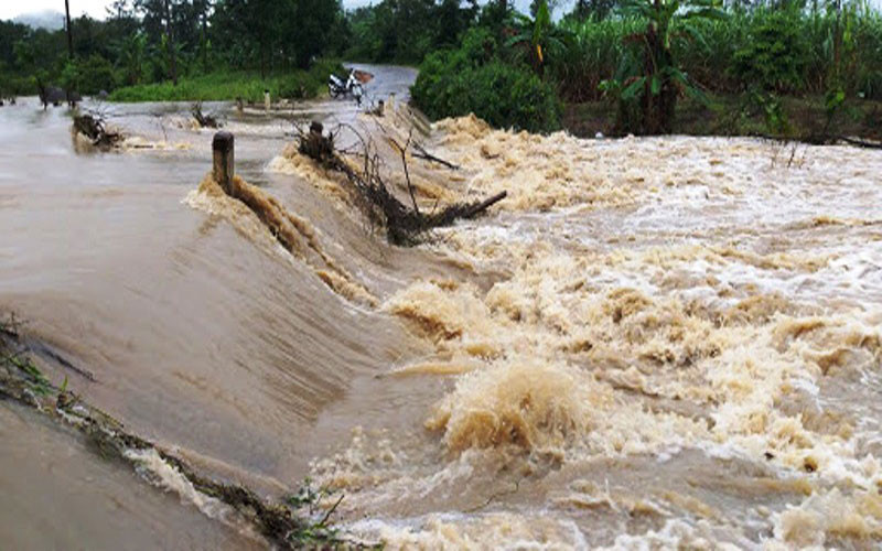
The general objective of the Project is to provide early warning of landslides and flash floods in mountainous and midland areas to serve natural disaster prevention and control, ensure the safety of people's lives and property, infrastructure, create conditions for socio -economic stability and development, and contribute to ensuring national defense and security.
Focus on building an early warning information system and a comprehensive, synchronous, and appropriate scale map system for zoning landslide and flash flood risks; providing and exchanging warning information with the community, enhancing the capacity to respond to landslides and flash floods.
The project aims to complete the system of legal documents serving the implementation of tasks related to zoning and early warning of landslides and flash floods such as: procedures, regulations, technical and economic norms for investigation, survey, forecasting - warning, etc. By 2025, complete a set of maps zoning risks due to landslides and flash floods at a scale of 1:50,000 displayed on a geographic information platform at a scale of 1:25,000 for 37 mountainous and midland provinces; at a scale of 1:10,000 and larger for 150 high-risk areas for landslides and flash floods.
By 2030, basically complete a set of maps zoning risks of landslides and large-scale flash floods for areas at very high risk; complete a comprehensive early warning information system connected with ministries, branches and localities, with two-way coordination between management agencies, warning and forecasting agencies and people in collecting, analyzing and processing data information, providing timely warning information on landslides and flash floods for mountainous and midland provinces of Vietnam.
Mapping of landslide and flash flood risk zones
The implementation contents of the Project include: Reviewing and perfecting the system of legal documents, procedures, and technical regulations to serve the implementation of tasks related to zoning and early warning of landslides and flash floods; investigating, building a data set, and mapping the current status to serve the mapping of risk zoning and risk zoning due to landslides and flash floods; mapping of risk zoning and risk zoning due to medium and large scale landslides and flash floods; establishing and maintaining the operation of the information system - early warning of landslides and flash floods; strengthening research, application of science and technology, and international cooperation in early warning of landslides and flash floods; improving community capacity in communication and use of early warning information.
In particular, the Project to upgrade and develop landslide and flash flood warning models for 37 midland and mountainous provinces of Vietnam; build a real-time landslide and flash flood early warning information system, with coordination between management agencies, warning and forecasting agencies and people in collecting, analyzing and processing data; update the database on landslides, flash floods, socio-economics, and damage to the early warning information system; test operation at the central level and 37 midland and mountainous provinces of Vietnam; invest in equipment and information technology infrastructure to serve the operation of the early warning system...
Source











![[Photo] National Assembly Chairman Tran Thanh Man receives Chairman of Morocco-Vietnam Friendship Association](https://vphoto.vietnam.vn/thumb/402x226/vietnam/resource/IMAGE/2025/7/26/b5fb486562044db9a5e95efb6dc6a263)





Comment (0)