

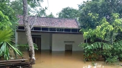
Specifically, according to preliminary information, in Ia Lop commune, flooding occurred in Chieng village, Doan village and Xuan Thien Solar Power Plant Cluster.
Ia Rve commune was flooded from village 11 to village 10, National Highway 14C from Ia Rve commune to Ia Lop commune.
Ea Rok Commune was also flooded in some low-lying areas. The locality has evacuated 4 households to higher ground to ensure safety.
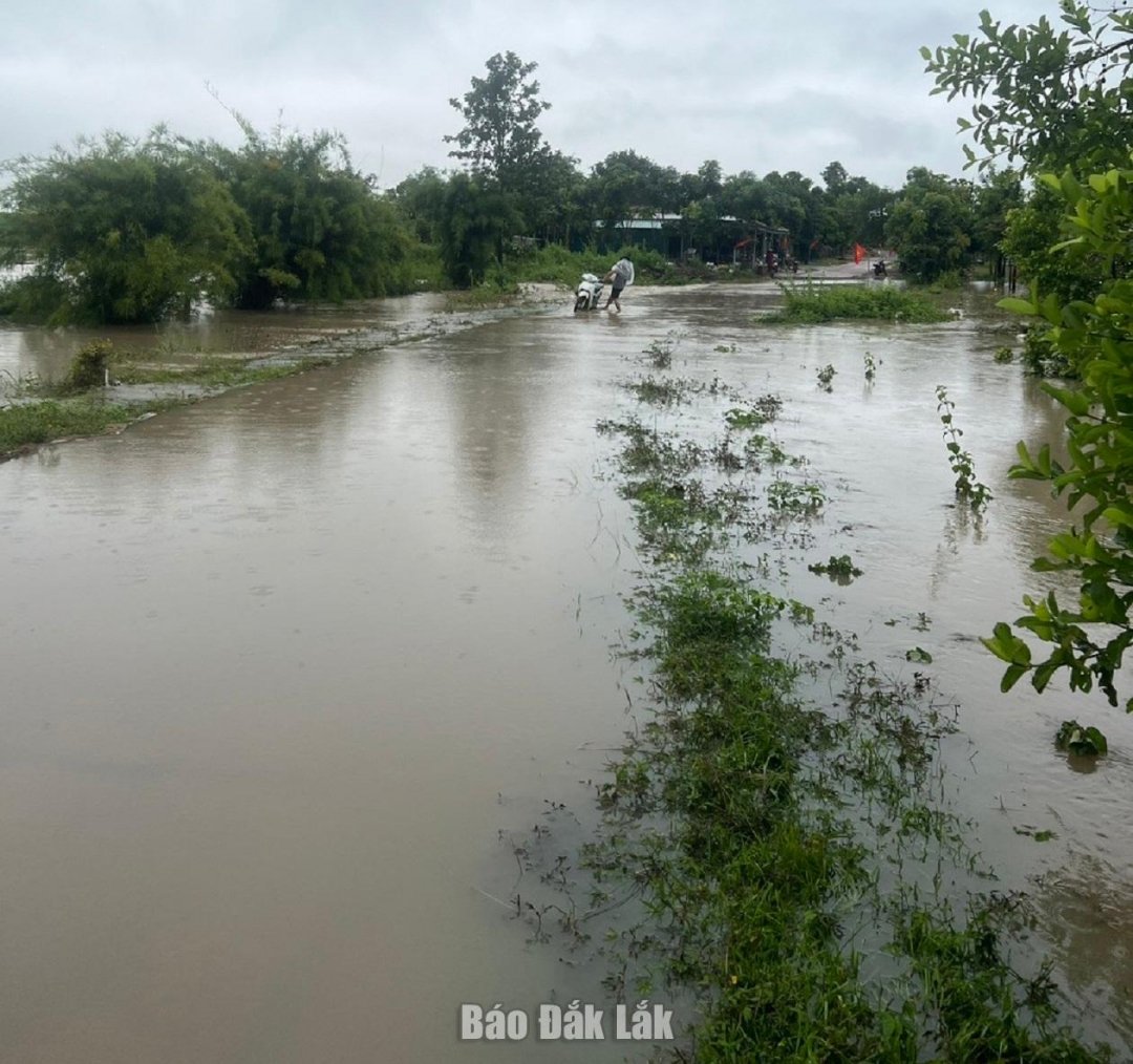 |
| A flooded spot in Ia Lop commune. |
The People's Committees of Ia Lop, Ia Rve, and Ea Rok communes have coordinated with functional forces to proactively deploy response work, support, and ensure safety for people.
Local authorities recommend that people limit movement through roads and areas with deep flooding and fast-flowing water; proactively evacuate people, property and livestock to high, safe places; absolutely do not collect firewood or fish when flood waters are rising; closely monitor announcements from local authorities and functional agencies to proactively respond.
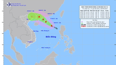
According to the National Center for Hydro-Meteorological Forecasting, at 7:00 a.m. on September 6, the center of the tropical depression was at about 17.7 degrees North latitude - 117.6 degrees East longitude, in the northeastern waters of the East Sea. The strongest wind was level 7 (50-61 km/h), gusting to level 9.
At 7:00 a.m. on September 7, the tropical depression moved northwest at a speed of 10-15 km/h, with the potential to strengthen into a storm, with winds reaching level 8 and gusts reaching level 10. The affected area is the northeastern part of the East Sea.
At 7:00 a.m. on September 8, the storm continued to move northwest at a speed of about 15 km/h and strengthened. The location is at 21.8 degrees North latitude - 112 degrees East longitude, on the coastal area of Guangdong province (China). Strong winds level 9, gusts level 11. The affected area is the northern part of the East Sea. Disaster risk level 3,
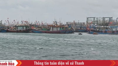
The Minister of Agriculture and Environment has just sent a telegram to the People's Committees of coastal provinces and cities from Quang Ninh to Dak Lak and related ministries and branches to proactively respond.
Source: https://baodaklak.vn/kinh-te/nong-lam-nghiep/202509/mot-so-xa-khu-vuc-phia-tay-dak-lak-bi-ngap-cuc-bo-ab5052b/
![[Photo] General Secretary To Lam attends the 80th Anniversary of the General Staff of the Vietnam People's Army](https://vphoto.vietnam.vn/thumb/1200x675/vietnam/resource/IMAGE/2025/9/6/126697ab3e904fd68a2a510323659767)
![[Photo] Prime Minister Pham Minh Chinh attends the 80th Anniversary of the Vietnam Posts and Telecommunications Group](https://vphoto.vietnam.vn/thumb/1200x675/vietnam/resource/IMAGE/2025/9/6/39a89e5461774c2ca64c006d227c6a4e)
![[Photo] 80th Anniversary of the General Staff of the Vietnam People's Army](https://vphoto.vietnam.vn/thumb/1200x675/vietnam/resource/IMAGE/2025/9/6/49153e2a2ffc43b7b5b5396399b0c471)


![[Photo] Rescuing people in flooded areas at the foot of Prenn Pass overnight](https://vphoto.vietnam.vn/thumb/1200x675/vietnam/resource/IMAGE/2025/9/6/19095b01eb844de98c406cc135b2f96c)


![[Photo] Many people directly experience beloved Uncle Ho and the General Secretaries](https://vphoto.vietnam.vn/thumb/1200x675/vietnam/resource/IMAGE/2025/9/6/2f4d9a1c1ef14be3933dbef3cd5403f6)


Comment (0)