

Quang Ninh province has successfully updated 264,453 residential land and housing plots onto the VNPT_iLIS system. Notably, the province has uploaded all 15,501 cadastral maps to the VNPT_iLIS spatial data system; and conducted population verification for 264,453 out of 274,925 land plots (achieving 96.2%). This demonstrates the initial positive results of Quang Ninh in standardizing land data, a complex field requiring simultaneous comparison between legal documents, digital data, cadastral maps, and actual land use.
In reality, over the years, land data in many localities within the province has suffered from a lack of scanned records, discrepancies in sheet and plot numbers, inconsistent information on land users, and untimely updates of land changes. After the merger of administrative units, the volume of data requiring standardization has increased even further, while many records have been created through various management stages. However, localities have adopted flexible approaches that suit their specific conditions.
A prime example is the Van Don Special Economic Zone (the largest commune-level locality in the country in terms of area). After the administrative reorganization, the area comprises all 12 communes and towns of the former Van Don district. However, land data from various periods is incomplete and inadequate, and the cadastral map surveyed in 2012 is no longer suitable for the current development reality.
In this context, Van Don chose a flexible approach by maximizing social resources and organizing work in a highly specialized manner, coordinating with Ha Long University to mobilize 30 students majoring in environmental resources to support the implementation. Specific tasks were assigned to the operational teams, including: the scanned data team, the land parcel spatial diagram data processing team , VNILIS data processing team, population verification team. Daily workload assignments, end-of-day progress review to immediately address any bottlenecks that arise.

The Van Don Special Economic Zone has also established a mechanism for regular online exchange between the local authorities, the Land Registration Office, VNPT , and specialized units. This approach has helped Van Don complete the cleaning of over 14,050 land parcels at level 1, ranking first in the province in the number of land parcels meeting the conditions for updating to the national land data. The local authorities have determined that data cleaning must go hand in hand with surveying, cadastral map correction, and the simultaneous issuance and renewal of land certificates. This is a fundamental approach, avoiding the situation of "cleaning today, discrepancies arising tomorrow."
Similarly, Dong Trieu ward also had to process a large volume of data with 250 cadastral maps. Over time, some areas have experienced significant changes in land use, but these have not been reviewed and updated in a timely manner, creating difficulties in the process of cross-checking, correcting, and synchronizing data. The ward has closely combined digital technology with practical management experience at the grassroots level, clearly identifying that technology can support data aggregation and synchronization, but the role of local officials and neighborhood leaders is particularly important in verifying the history of changes, land users, and plot numbers over multiple periods. With this approach, by May 19, 2026, the locality had cleaned and synchronized 10,667 out of 10,744 land plots, achieving 99.28%, completing 100% of the target assigned by the province.
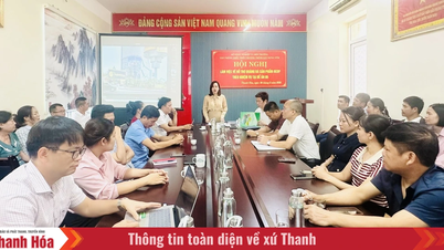
Not only in the two aforementioned localities, Quang Ninh province has identified the construction of a land database as a key task in its digital transformation, aiming to build a "foundation data" for modern state governance. A highlight of this campaign is the decisive and consistent direction from the provincial level down to the grassroots. In a short time, a series of directives, plans, working groups, and steering committees have been established and are operating synchronously. Beyond simply assigning tasks, the province has applied very specific principles: clear responsibilities, clear tasks, clear timelines, clear accountability, clear deliverables, and clear authority. From this directive mechanism, many localities have developed systematic, scientific, and practical approaches tailored to their specific areas.
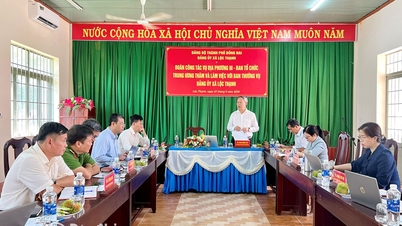
Comrade Nguyen Van Cong, Vice Chairman of the Provincial People's Committee, emphasized: From the practical implementation in localities, it can be seen that the biggest challenge currently is handling "difficult" data, complex historical data, and ensuring the "viability" of the data system after completion. Because the land database is only truly valuable when it is regularly updated, accurately reflects the actual land use situation, and is able to interlink with other management systems. This requires not only improving the technical infrastructure, but also continuing to standardize processes, train personnel, and maintain a close inter-sectoral coordination mechanism. The synchronization of the land database must be checked daily, by area. Only then will the completion of standardizing the remaining 2.1 million land parcels meet the set requirements.
The initial results achieved by Quang Ninh show that the province is on the right track in building a digital data platform to serve modern governance. From a field that was previously largely manual and fragmented, the gradual formation of a land database that is "accurate - complete - clean - vibrant - unified - shared" not only creates a transformation in state management of land, but also opens up significant opportunities for administrative reform, smart urban development, and efficient exploitation of land resources for sustainable growth.
Source: https://baoquangninh.vn/quyet-liet-xay-dung-co-so-du-lieu-dat-dai-dong-bo-3408913.html
![[Photo] The heat at the fireworks display site on the opening night of the Da Nang International Fireworks Festival 2026](https://vphoto.vietnam.vn/thumb/1200x675/vietnam/resource/IMAGE/2026/05/27/1779889741485_ndo_br_z7872039145157-fecaba5112f39e8352544099d7ef4738-5140-jpg.webp)


![[Photo] The courage of new recruits of Brigade 144 on the training ground.](https://vphoto.vietnam.vn/thumb/1200x675/vietnam/resource/IMAGE/2026/05/27/1779881651341_anh-man-hinh-2026-05-27-luc-18-32-52.png)




















































![[Photo] The courage of new recruits of Brigade 144 on the training ground.](https://vphoto.vietnam.vn/thumb/402x226/vietnam/resource/IMAGE/2026/05/27/1779881651341_anh-man-hinh-2026-05-27-luc-18-32-52.png)

























Comment (0)