
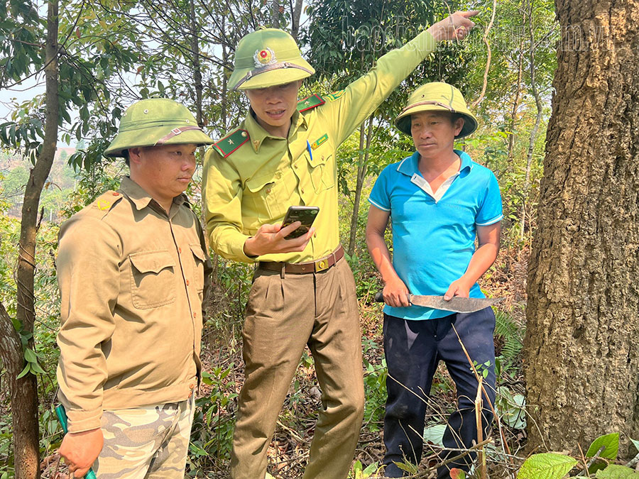
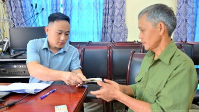
Since 2017, the Forest Protection Department has been using GIS remote sensing technology to interpret satellite imagery sources to detect locations with potential forest changes, providing this information to local forest rangers for field verification. After six years of implementation, the accuracy rate of image interpretation has reached over 80%. The application of information technology, remote sensing, and GIS helps to quickly, promptly, and accurately detect locations with forest changes, supporting the effective monitoring of forest changes. In addition, the Forest Protection Department has applied supporting mobile software such as FRMS Mobile, Vtools Survey, iGeoTrans X… combined with the use of unmanned aerial vehicles (drones) and handheld radios in forest patrols and inspections. Currently, the Forest Protection Department has installed mobile software for 100% of its forest rangers; and equipped all 10 Forest Protection Units and specialized departments with drones and handheld radios. In forest fire prevention and control, the Forest Protection Department uses an early warning system to monitor fire risk locations daily (at https://watch.pcccr.vn/DiemChay), thereby promptly detecting and directing inspections of forest fire risk areas. Simultaneously, it has invested in installing three automatic forest fire risk warning signs at the Forest Protection Units of Nam Po, Muong Nha, and Dien Bien. In addition, the Forest Protection Department has created and used 12 reporting systems on Google Drive to compile reports from various units, reducing the time and effort required for data compilation; the reported data is timely, accurate, and accessible from anywhere. Twelve hotline numbers have been put into use, and 1,000 information sheets have been printed to help the public promptly provide information on forest fire warnings and violations of forestry laws.
Mr. Ha Luong Hong, Head of the Forest Protection Department, stated: Dien Bien province has a planned forestry area of 694,753 hectares (accounting for 72.8% of the natural land area). The forested area in 2022 was 415,361.35 hectares. The large forest area is hampered by a limited forest protection force; on average, each forest ranger is responsible for nearly 3,500 hectares of forest, with some rangers even overseeing over 10,000 hectares. The application of information technology helps to unify and streamline management and direction from the Department's leadership to the Forest Protection Units and local forest rangers. Technological solutions reduce time, effort, and costs in performing tasks, and improve efficiency. For example, previously, field inspections required carrying paper maps, compasses, and GPS; now, only a mobile phone with a mobile application is needed. For example, accessing and inspecting a location that previously took 2 hours can now be completed in just 30 minutes using a drone from a suitable location. The data is accurate, free from errors, and can be checked and verified at any time.
In 2021, the Dien Bien Dong District Forest Management Unit was equipped with a flycam (a drone with a camera) to assist in forest management and protection. The flycam can fly up to 500m high and up to 6km far, providing a wide-angle aerial view of the forest. This allows forest rangers to easily detect changes in forest cover, especially in mountainous and rugged areas.
Mr. Ly A Ta, a forest ranger in Dien Bien Dong district, said: "Previously, we had to walk to locations with changes in forest cover, which took a lot of time. Many areas were very difficult to access due to the rugged terrain. After being equipped with drones, we can now monitor 100% of the locations accurately and promptly, especially regarding cases of deforestation and illegal logging."
Muong Nha District has a total forested area of over 84,000 hectares, with a forest cover rate exceeding 50%. In 2021, the Muong Nha District Forest Protection Department was equipped with and installed automatic forest fire risk level warning signs. The device operates completely automatically, using sensors for temperature, humidity, etc., to automatically determine the appropriate forest fire risk level, which is displayed on the sign. Simultaneously, it sends this information to pre-programmed phone numbers of the Department's leaders and local forest rangers for their awareness and to advise on appropriate forest fire prevention and control measures.
Source


![[Photo] Prime Minister Pham Minh Chinh presides over the conference announcing the establishment of the International Finance Centre in Vietnam.](/_next/image?url=https%3A%2F%2Fvphoto.vietnam.vn%2Fthumb%2F1200x675%2Fvietnam%2Fresource%2FIMAGE%2F2025%2F12%2F21%2F1766309817714_ndo_br_dsc-3400-jpg.webp&w=3840&q=75)


![[Photo] Prime Minister Pham Minh Chinh presides over a meeting on private sector economic development.](/_next/image?url=https%3A%2F%2Fvphoto.vietnam.vn%2Fthumb%2F1200x675%2Fvietnam%2Fresource%2FIMAGE%2F2025%2F12%2F20%2F1766237501876_thiet-ke-chua-co-ten-40-png.webp&w=3840&q=75)


Comment (0)