
The North and Central regions are hotter than the average of many years.
According to forecasts, the average temperature from July 21 to August 20 in the North and Central regions will be 0.5-1.0 degrees higher, while other regions will generally be about 0.5 degrees higher than the average of many years.
During this period, total rainfall in the mountainous areas and the Northern Midlands and the Central region is generally approximately equal to the average of many years; in the Delta, Central Highlands and the South, total rainfall is generally 5-20% higher than the average of many years.
Heat waves are likely to appear in the last days of July and continue to appear interspersed with rains in August in the Northern and Central regions. In particular, the Central region may experience days of intense heat during the forecast period.
Thunderstorms, lightning, and possibly hail will continue to occur nationwide, especially in the North, Central Highlands, and South. In the North, rain will be concentrated in the first half of August.

Possibility of tropical depression, storm number 2
During the period from July 21 to August 20, it is forecasted that there will be about 1-2 tropical depressions/storms (storm No. 2, storm No. 3) active in the East Sea.
Previously, Dr. Hoang Phuc Lam, Deputy Director of the National Center for Hydro-Meteorological Forecasting, said that new low-pressure areas have formed in the tropical convergence zone that formed storm Talim (storm No. 1). This low-pressure area is likely to strengthen into a tropical depression and storm.
According to Mr. Hoan Phuc Lam, there is a high possibility that this will be the second storm to affect our country in the last days of July.
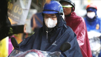
Meanwhile, due to the influence of the southern edge of the circulation after storm No. 1 (storm Talim), the North continues to have rain, especially beware of flash floods and landslides in mountainous provinces...
Currently, according to satellite cloud images and forecasts from many prestigious centers in the world , the convergence zone, also known as the disturbance area, is continuing to develop into a low pressure area on the night of July 24 and early morning of July 25 and is likely to strengthen into a tropical depression. According to hydrometeorological forecasting experts, the possibility of the low pressure area strengthening into a storm, storm number 2 in the central East Sea area, cannot be ruled out.
Head of the Weather Forecast Department Nguyen Van Huong assessed that currently, due to the impact of El Nino (the phenomenon of abnormal warming of the surface sea water in the central equatorial region and the Eastern Pacific Ocean ), the number of storms operating in the East Sea as well as affecting the Vietnamese mainland is less than the average of many years.
Source


Comment (0)