
Map showing the predicted path and intensity of Typhoon No. 5.
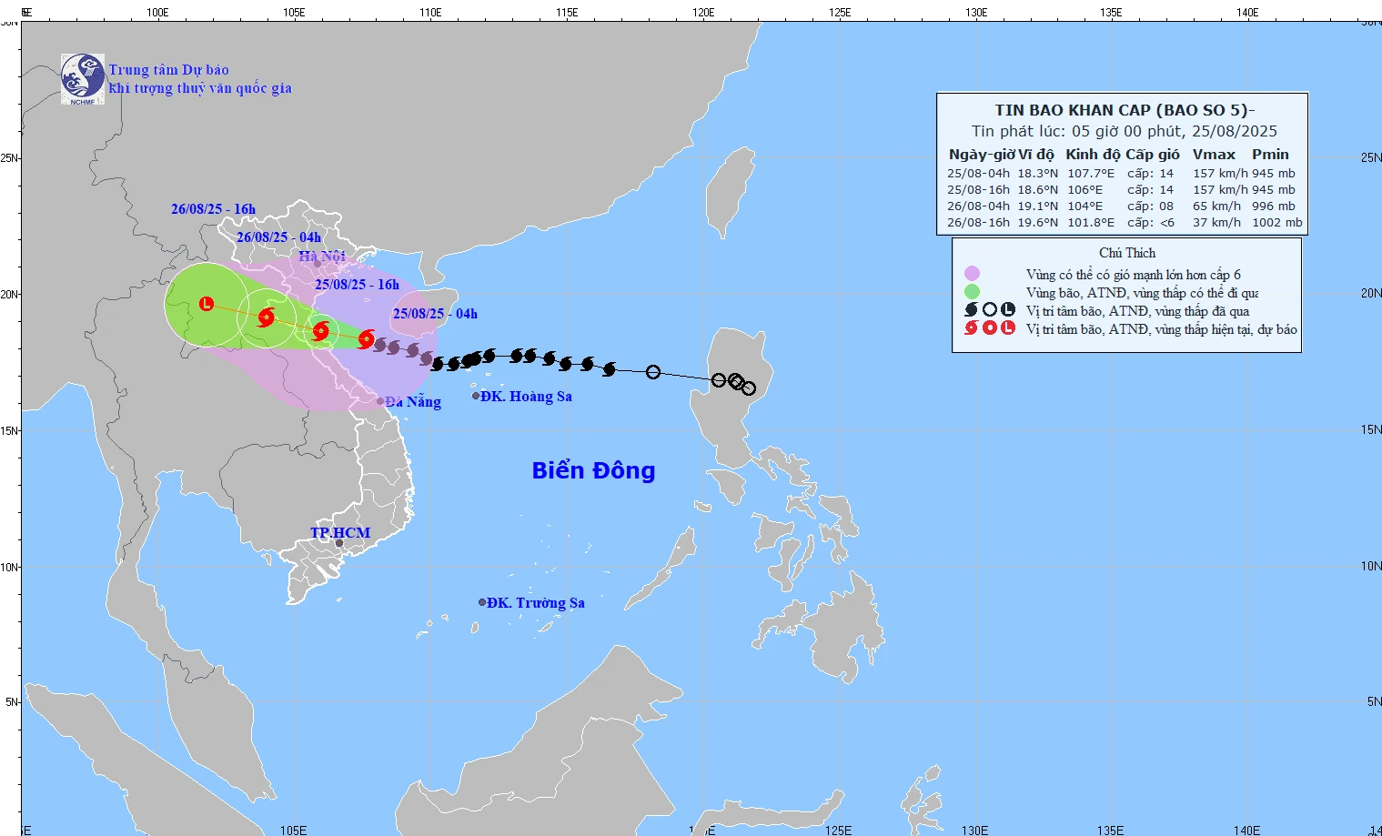
Specifically, the storm's center is located at approximately 18.3 degrees North latitude and 107.4 degrees East longitude, about 185km east-southeast of Nghe An, about 165km east of Ha Tinh , and about 160km east-northeast of northern Quang Tri.
Maximum wind speed is level 14 (150-166 km/h), gusts up to level 17.
The forecast indicates that over the next 3 hours, the storm will move in a west-northwest direction at a speed of approximately 15-20 km/h.
As of 4 PM on August 25th, the storm's center was located at 18.6 degrees North latitude and 106.0 degrees East longitude, in the coastal waters off Thanh Hoa - northern Quang Tri ; maintaining its intensity at level 14, with gusts up to level 17.
By 4:00 AM on August 26th, the storm continued to move west-northwest at a speed of approximately 20 km/h; its location was at 19.1 degrees North latitude and 104.0 degrees East longitude, over central Laos, with its intensity reduced to level 8, gusting to level 11.
At approximately 4 PM on August 26th, the storm's center was located over central Laos and gradually weakened, its intensity falling below level 6.
Natural disaster risk level warning: • Level 3: Northern South China Sea, Gulf of Tonkin, sea off Thanh Hoa - Quang Tri provinces. • Level 4: Coastal areas of Thanh Hoa - Quang Tri, inland areas of Thanh Hoa - northern Quang Tri. | |
NM
Source: https://baothanhhoa.vn/bao-so-5-chi-con-cach-nghe-an-185km-259340.htm


![[Infographics] List of diseases requiring vaccines and biological products in mandatory immunization.](https://vphoto.vietnam.vn/thumb/402x226/vietnam/resource/IMAGE/2026/05/23/1779529325271_infographics-da-w1200t0-di2620d272d6160707t11600l1-cover8.webp)


Comment (0)