
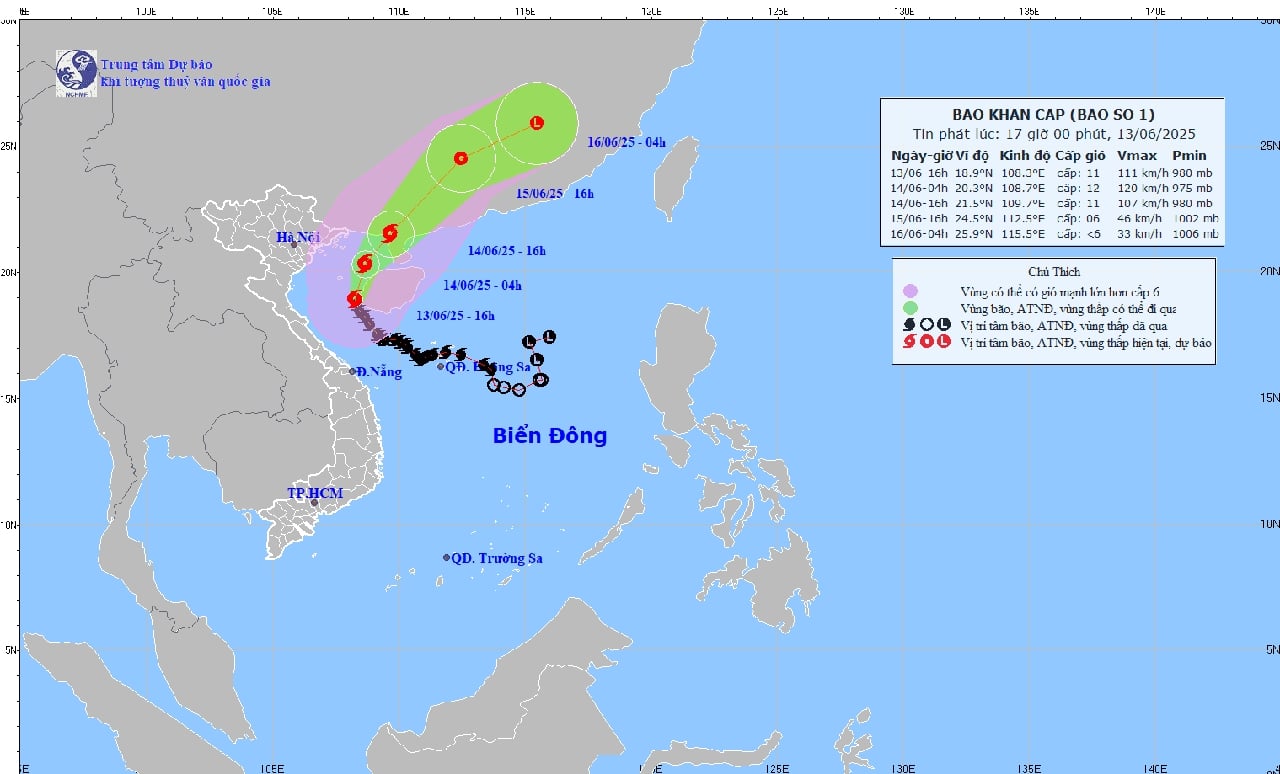
Forecast in the next 3 hours, the storm moves to the Northeast direction, speed about 10-15km/h.
Due to the influence of storm No. 1, the Gulf of Tonkin (including Co To and Bach Long Vi island districts) has strong winds of level 7-8, the area near the storm's center has winds of level 10-12, gusting to level 14. Waves are 2.0-4.0m high, especially in the East 5.0-7.0m. The sea is very rough.
The northwest of the North East Sea and offshore waters from Quang Tri to Hue have strong winds of level 6-7, near the storm center level 9-11, gusting to level 14. Waves are 2.0-4.0m high, near the storm center 3.0-5.0m high. The sea is very rough.
Ships in danger zones are at risk of storms, whirlwinds, strong winds and large waves.
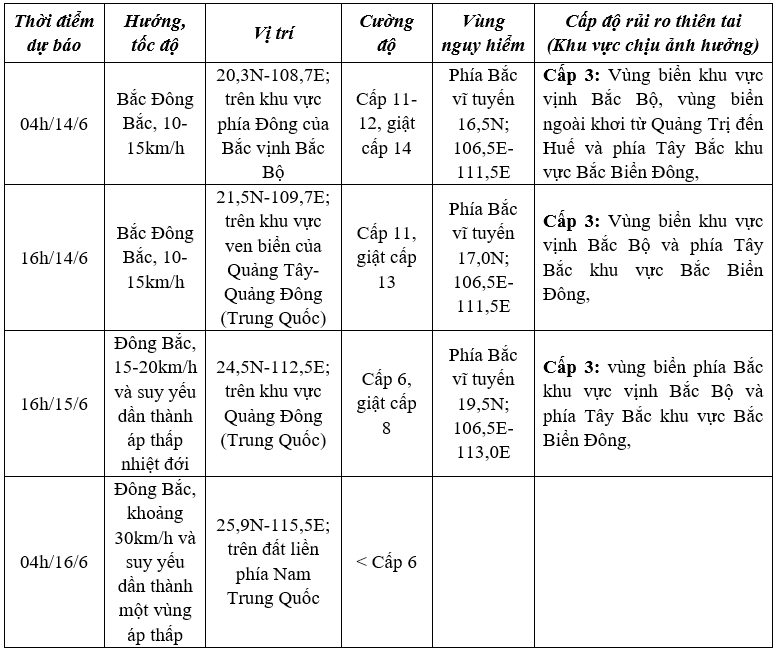
Forecast of storm No. 1.
On land, this evening and tonight (June 13), the area from Ha Tinh to Hue will have moderate to heavy rain, locally very heavy rain with common rainfall of 20-50mm, some places over 100mm. Warning of the risk of flash floods, landslides in mountainous areas, urban flooding in low-lying areas.
NDS
Source: https://baothanhhoa.vn/bao-wutip-cach-dao-bach-long-vi-khoang-215km-ve-phia-nam-dong-nam-252054.htm
![[Photo] Prime Minister Pham Minh Chinh chairs a meeting of the Government Standing Committee to remove obstacles for projects.](https://vphoto.vietnam.vn/thumb/1200x675/vietnam/resource/IMAGE/2025/10/06/1759768638313_dsc-9023-jpg.webp)


![[Photo] Prime Minister Pham Minh Chinh chaired a meeting of the Steering Committee on the arrangement of public service units under ministries, branches and localities.](https://vphoto.vietnam.vn/thumb/1200x675/vietnam/resource/IMAGE/2025/10/06/1759767137532_dsc-8743-jpg.webp)


Comment (0)