
On the evening of September 2, the National Center for Hydro-Meteorological Forecasting provided the first information about storm Yagi .
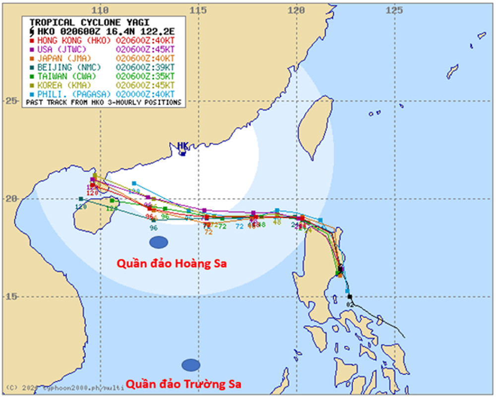
According to Mr. Nguyen Van Huong, Head of the Weather Forecast Department, last night (September 1), the tropical depression in the central region of the Philippines strengthened into a storm, the storm has the international name Yagi and is the 11th storm active in the Northwest Pacific region.
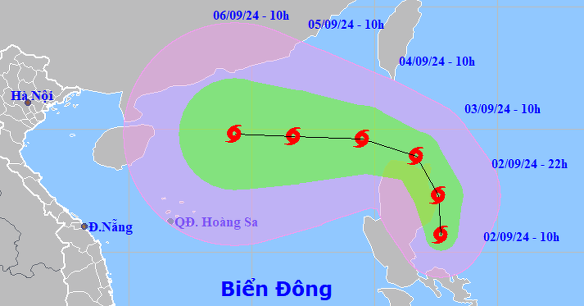
At 1:00 p.m. this afternoon, the storm center was in the sea east of Luzon Island (Philippines) with a strong intensity of level 8, gusting to level 11. It is forecasted that in the next 24 hours, storm Yagi will move mainly in the North-Northwest direction. It is likely that tomorrow night (September 3), the storm will cross the 120th meridian and enter the East Sea of our country.
“When the storm moves into the East Sea, atmospheric conditions (wind, air pressure), ocean (sea water temperature in the East Sea area is 30-31 degrees) are favorable for storm Yagi to strengthen and move westward,” said Mr. Huong.
According to Mr. Huong, up to this point (1:00 p.m. on September 2), Vietnamese and international forecasting centers agree that when entering the East Sea, the storm will move mainly in a westerly direction, with a tendency to increase in intensity.
Forecasts all predict that Typhoon Yagi will be at its strongest in the eastern part of Hainan Island (China), but there are significant differences. Specifically, Japan's forecast shows that the strongest intensity will reach level 13, gusting to level 17; China and Hong Kong forecast level 15; the US forecast level 16, gusting above level 17.
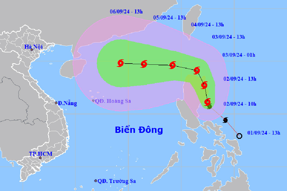
Mr. Huong added that at this point it is not yet possible to confirm whether Typhoon Yagi will pass Hainan Island and move into the Gulf of Tonkin to directly affect the mainland of our country or not. However, from tomorrow (September 3), in the northeastern sea area of the North East Sea, there will be effects of the storm's circulation. From the afternoon of the same day, in the northeastern sea area of this sea area, the wind will gradually increase to level 6, near the center of the storm, it will be level 8, gusting above level 11; the sea will be rough.
It is forecasted that from September 4-6, Typhoon Yagi may reach very strong storm level in the Northeast of the East Sea, with maximum wind speed reaching level 12, gusting to level 15 near the center of the storm. In the next 24 hours, the sea in the East of the North of the East Sea will have waves of 2-4m high. After that (September 4-6), they may increase to 5-7m. The sea will be rough and very dangerous for ships.
According to Mr. Huong, these are only preliminary assessments of the developments of Typhoon Yagi, because when it passes the north of Luzon Island, the intensity and path of the storm will continue to change due to the impact of terrain and large-scale currents. People need to continuously update the forecasts of the National Center for Hydro-Meteorological Forecasting to grasp the latest changes.
Typhoon Yagi is heading towards the East Sea, likely to reach very strong intensity.
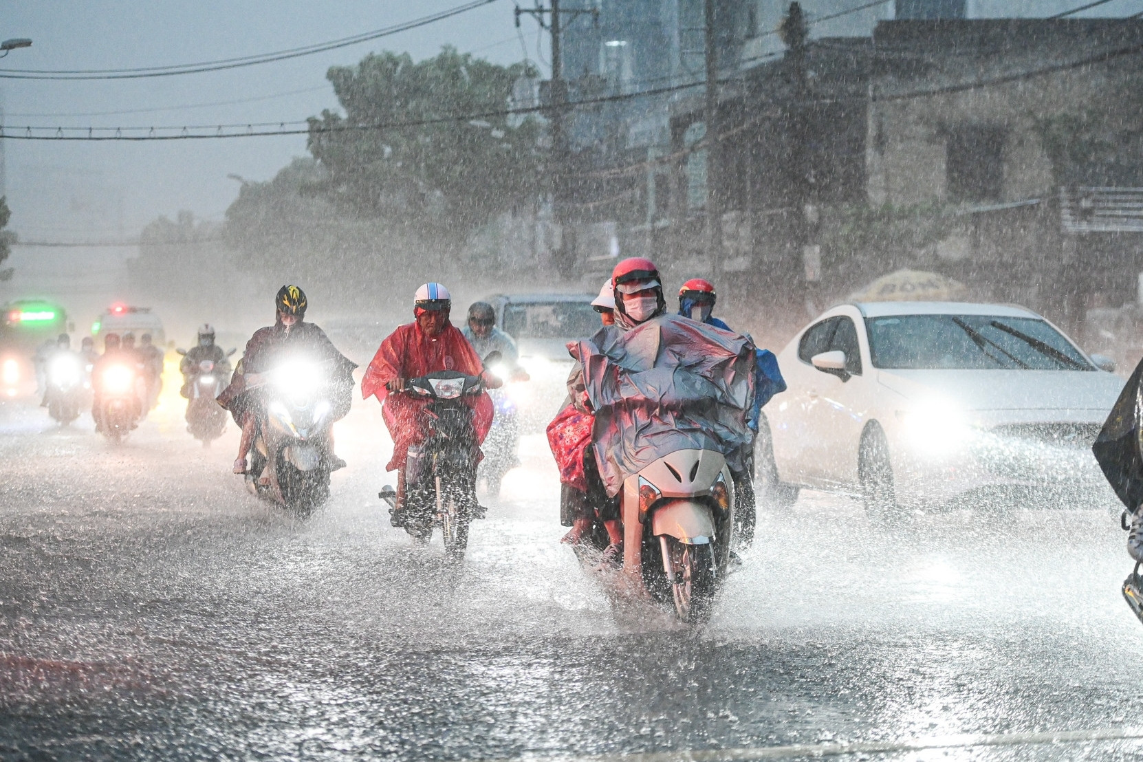
Ho Chi Minh City has many heavy rains, possibility of storms in the East Sea in September
Source: https://vietnamnet.vn/bien-dong-sap-don-bao-so-3-gio-manh-toi-da-co-the-giat-cap-15-2317946.html


Comment (0)