
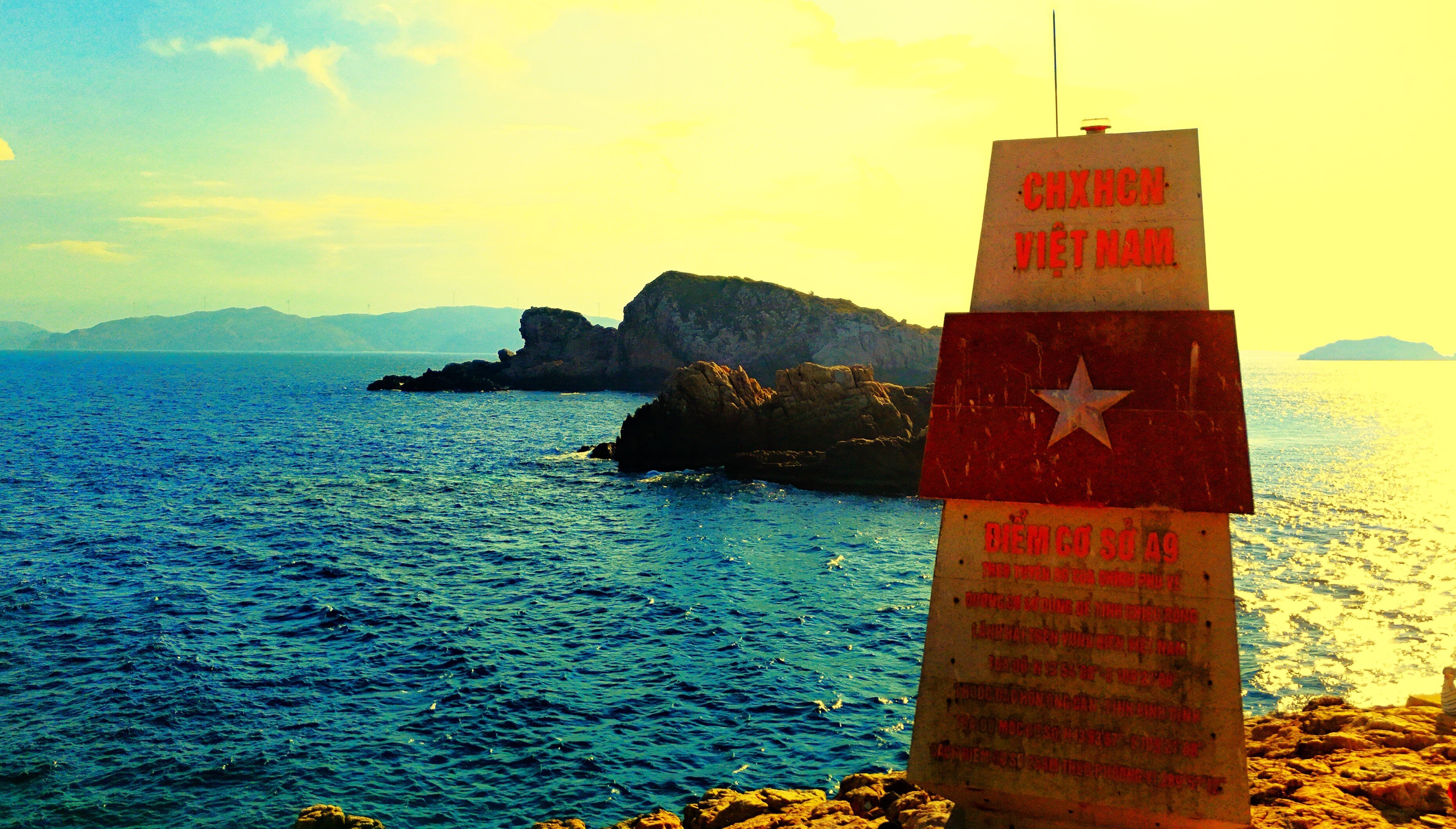
(VTC News) – Amidst the vast expanse of sea and sky, the A9 milestones (Quy Nhon City, Binh Dinh Province) mark Vietnam's sovereignty over its maritime territory.
Video : Milestone A9 on the summit of Hon Ong Can (Quy Nhon City, Binh Dinh Province)
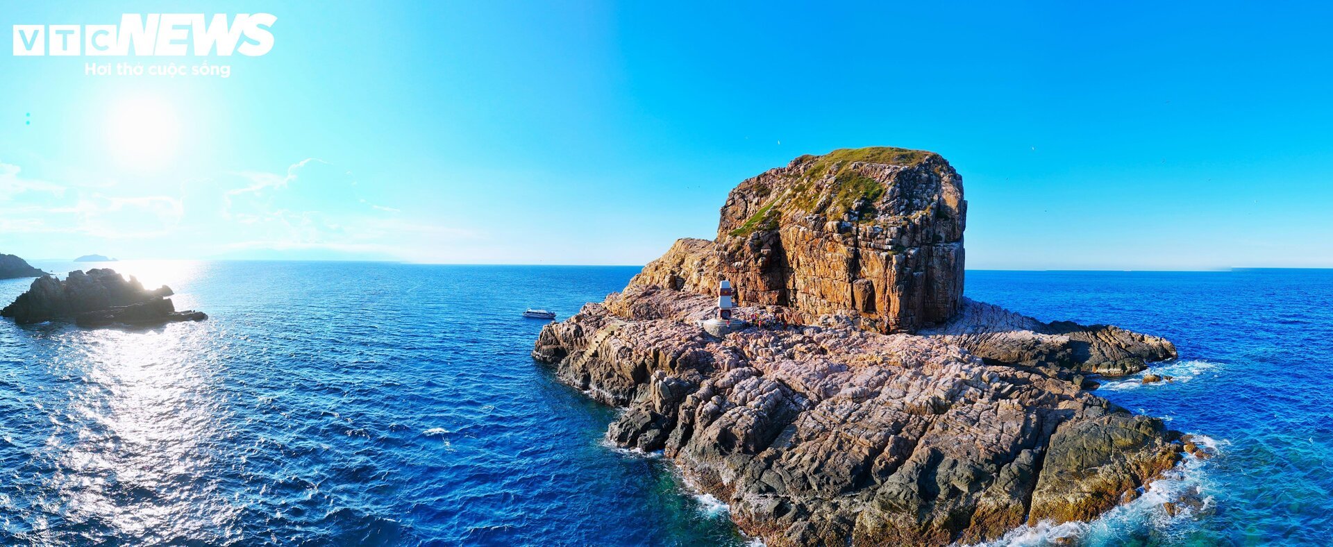
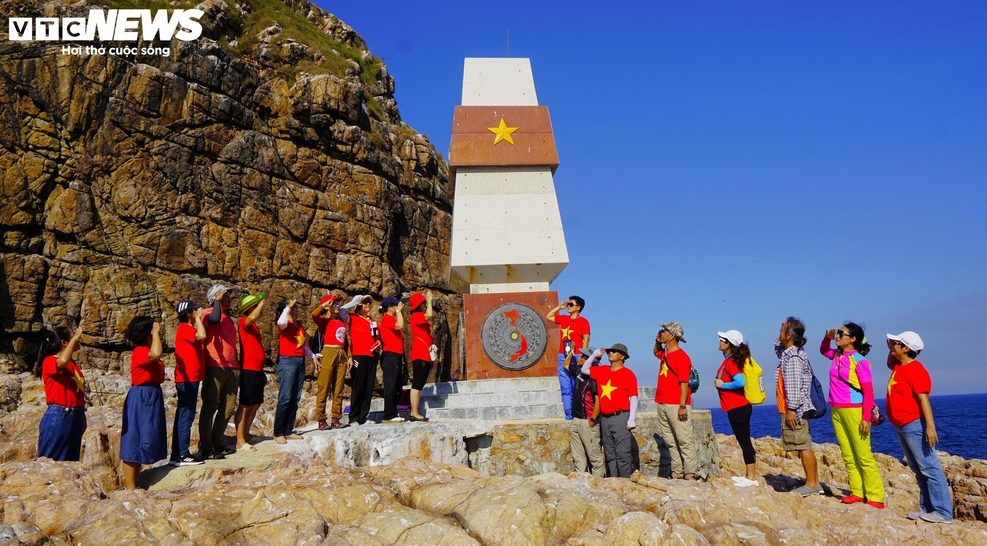
Milestone A9 is located on Hon Ong Can (in Nhon Ly commune, Quy Nhon city, Binh Dinh province).
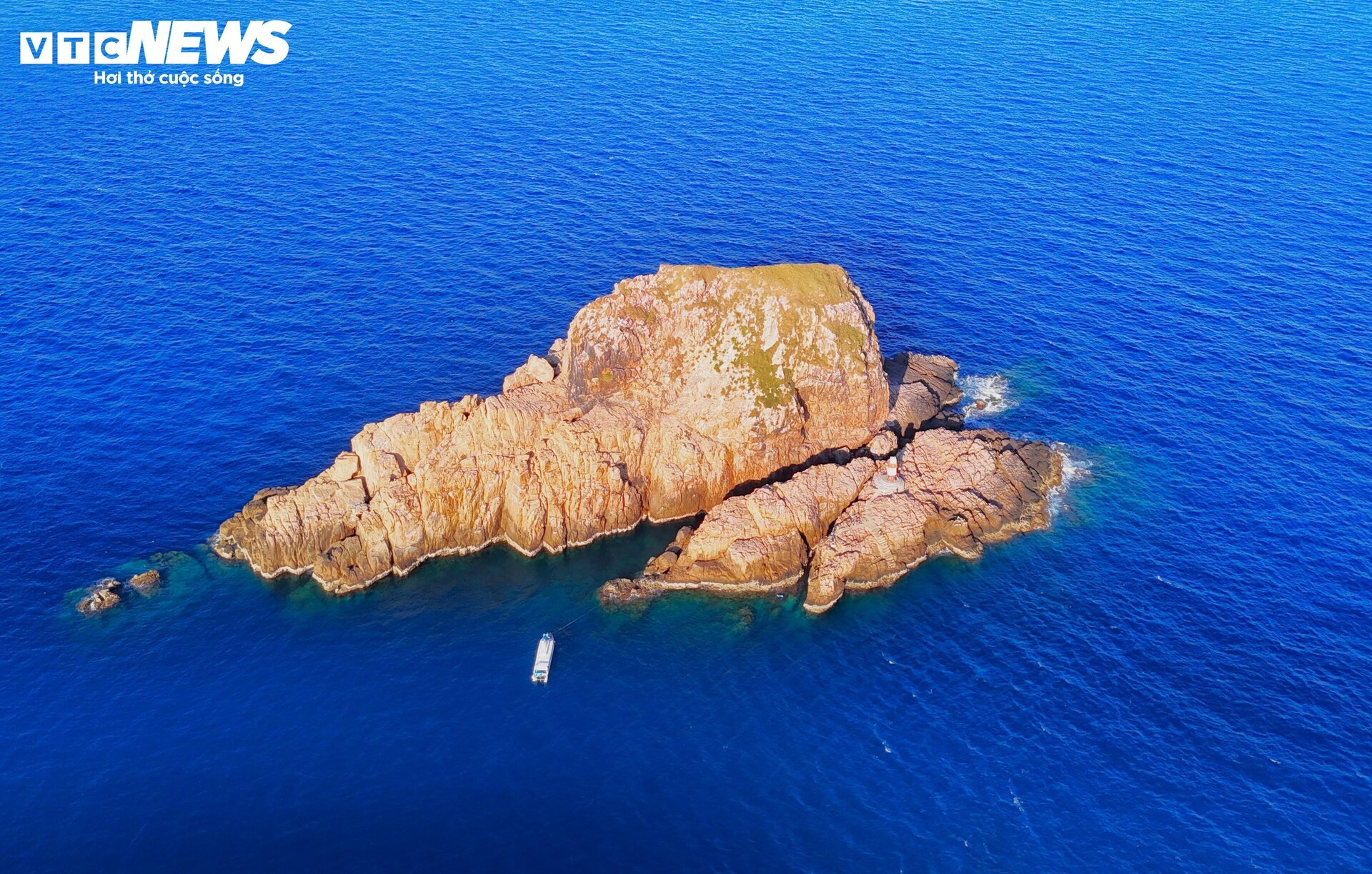
Hon Ong Can Island is located within the Hon Can island cluster. It is the furthest point in the triangle formed by the three island clusters of Hon Seo, Hon Co, and Hon Can in the Nhon Ly sea area. Seen from afar, the Hon Can island cluster appears as a continuous strip, like an animal lying sprawled out in the sea, with Hon Ong Can being the head.

Milestone A9 is located approximately 140 km south of milestone A8 at Dai Lanh Cape (Phu Yen) and approximately 170 km north of milestone A10 on Ly Son Island ( Quang Ngai ).
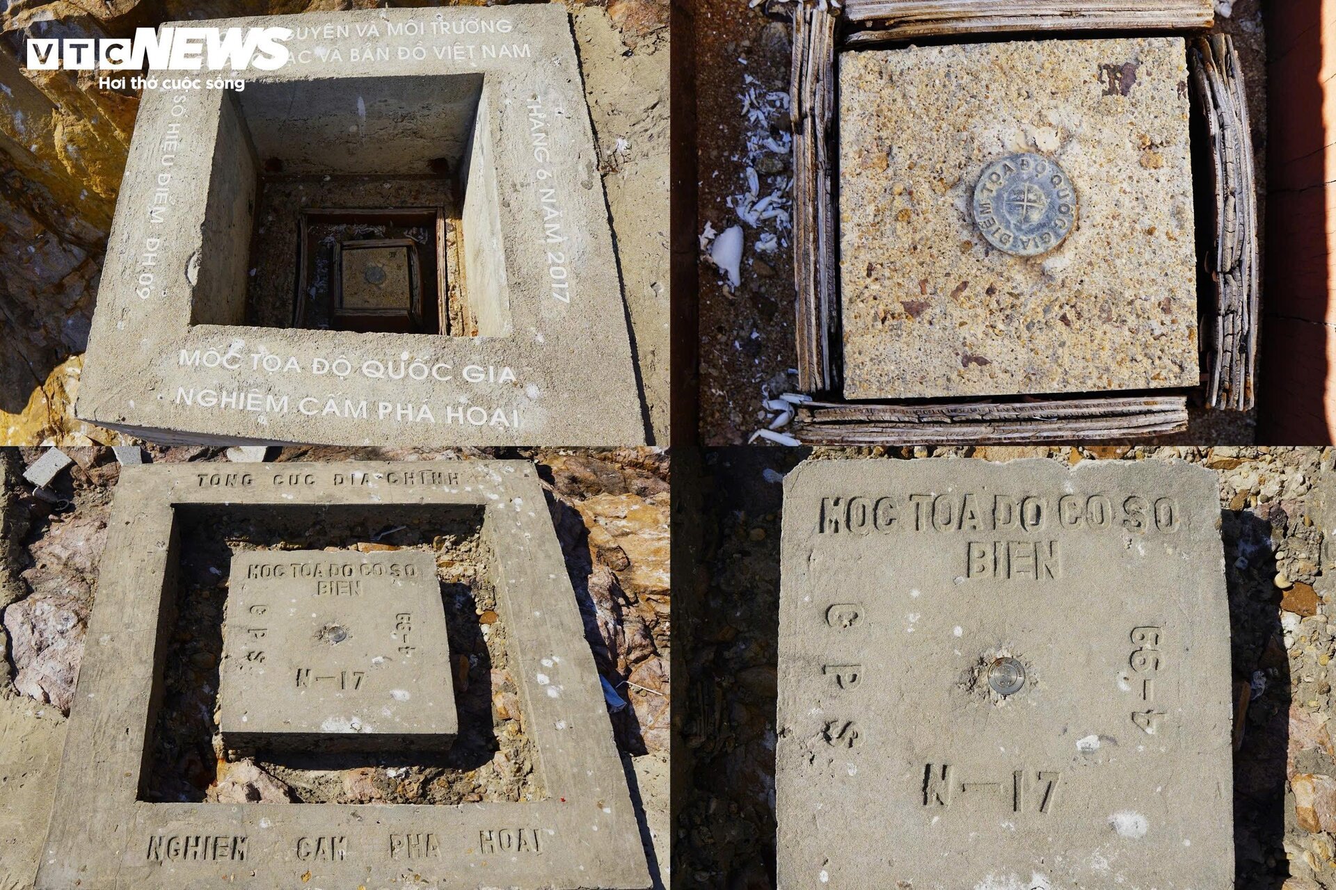
The two ends of marker A9 are national coordinate points established by the Vietnam Surveying and Mapping Department and the General Department of Land Administration (Ministry of Natural Resources and Environment) in June 2017, bearing the designation DH09. Hon Ong Can is of significant importance in determining the width of Vietnam's territorial sea according to the 1982 United Nations Convention on the Law of the Sea (UNCLOS).
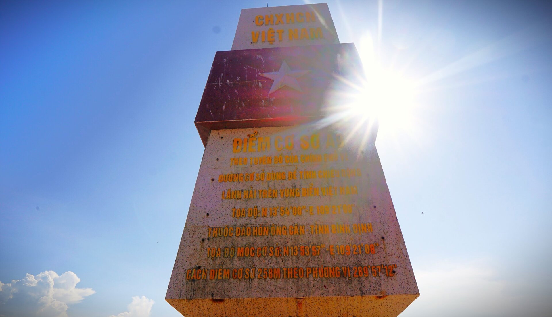
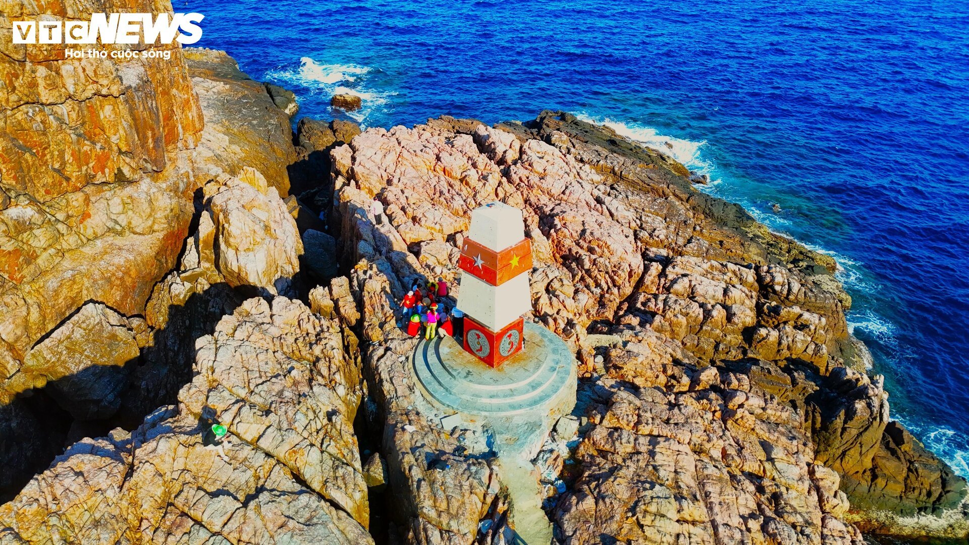
Above all four sides of the landmark is the national flag, and below is the image of the country on a bronze drum background. The eastern side also includes information about base point A9.
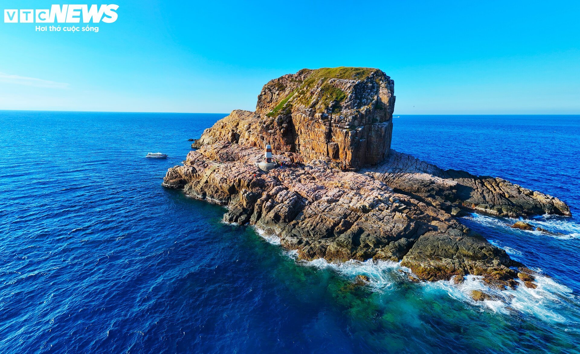
Around Hon Ong Can island, there are many submerged rocks, large waves, and steep cliffs. Locals and tourists can only reach the shore by speedboat when the sea is calm. On days with strong winds and high waves, they have to travel by boat, then use a small coracle to navigate the large waves to get close to the shore, and must leave the island before 4 PM.
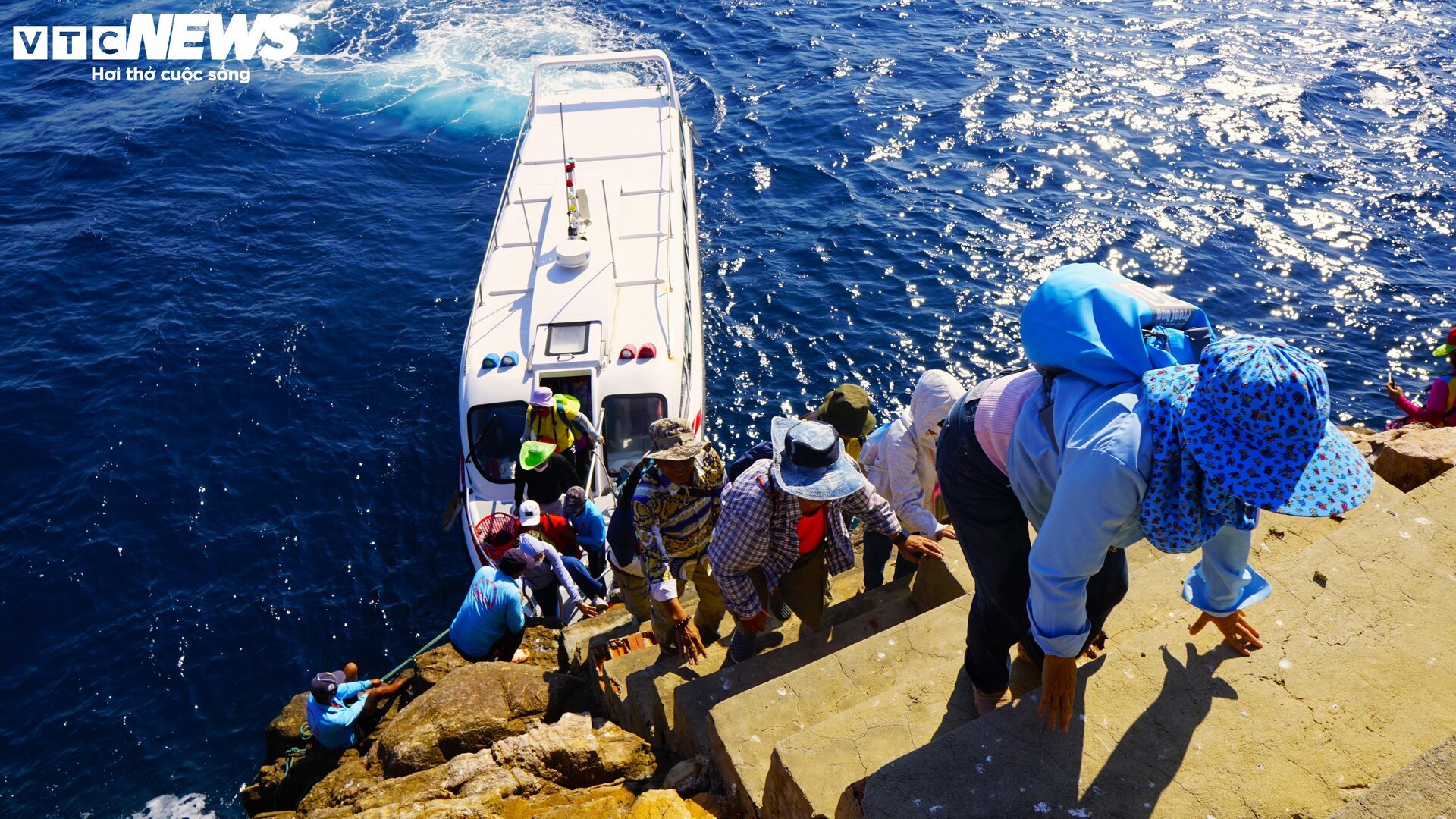
The path to milestone A9 is surrounded by waves on all four sides and steep cliffs, making it difficult to access without the assistance of experienced fishermen. The path to the milestone has been built as a staircase with about 20 steps, each spaced about 50 cm apart, with some steps up to 60 cm apart.
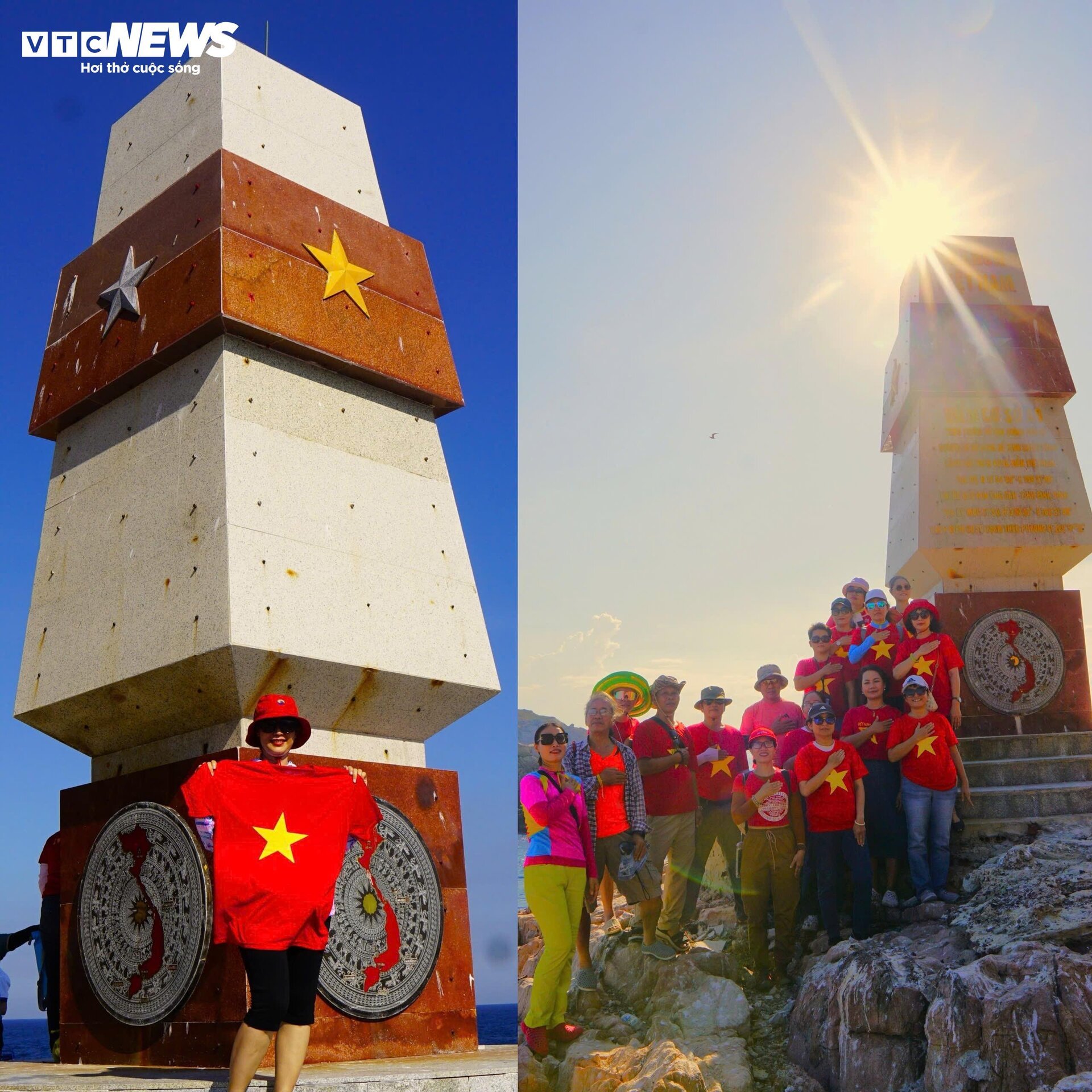
The people of Binh Dinh and tourists alike expressed their pride at seeing the sacred sovereignty marker in the middle of the ocean.
Of the 12 points connecting along the S-shaped curve towards the sea, except for base point A8 at Dai Lanh Cape (Phu Yen province), all destinations are located on islands. Therefore, to reach these base points, in addition to the necessary procedures, one may also need good weather.
![[Photo] The heat at the fireworks display site on the opening night of the Da Nang International Fireworks Festival 2026](https://vphoto.vietnam.vn/thumb/1200x675/vietnam/resource/IMAGE/2026/05/27/1779889741485_ndo_br_z7872039145157-fecaba5112f39e8352544099d7ef4738-5140-jpg.webp)

![[Photo] The courage of new recruits of Brigade 144 on the training ground.](https://vphoto.vietnam.vn/thumb/1200x675/vietnam/resource/IMAGE/2026/05/27/1779881651341_anh-man-hinh-2026-05-27-luc-18-32-52.png)


![[Photo] The courage of new recruits of Brigade 144 on the training ground.](https://vphoto.vietnam.vn/thumb/402x226/vietnam/resource/IMAGE/2026/05/27/1779881651341_anh-man-hinh-2026-05-27-luc-18-32-52.png)


Comment (0)