
Associate Professor Dr. Nguyen Hong Phuong delivered a lecture at the event.
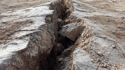
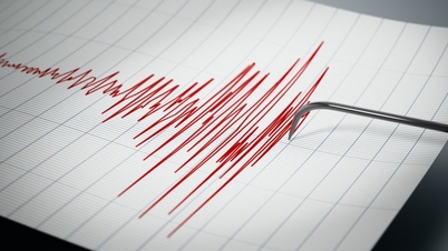
According to scientists , the destructive impact of earthquakes is primarily caused by very strong ground vibrations. Due to intense ground shaking, low-rise and high-rise buildings, towers, and pillars can tilt, crack, wobble, or collapse; roads, railways, and bridges can be broken; water pipes and other structures can be displaced; dams and similar structures can be destroyed, causing flooding and creating turbulent flows of material. Earthquakes can also cause secondary hazards such as ground liquefaction and landslides.
Medium- and long-term earthquake forecasting products are typically presented as spatial distribution maps of regions with varying earthquake hazard levels. In Vietnam, the first earthquake zoning map was published in 1985. To date, six generations of earthquake hazard maps for Vietnam have been published, reflecting continuous progress in accuracy, scientific and technological quality, practical application scope, and user convenience.
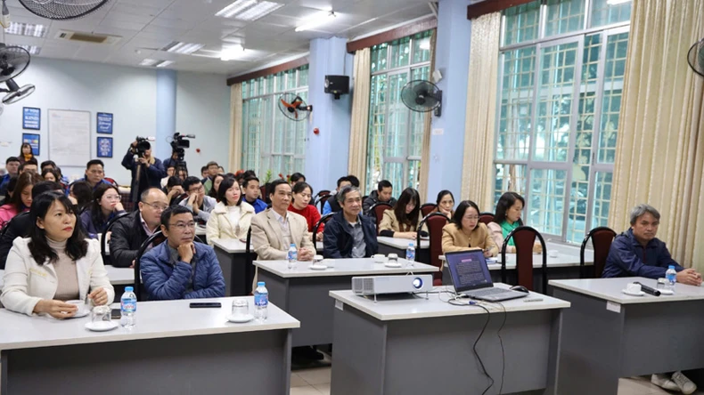 |
Scenes from the public lecture event.
To date, the 2019 edition of the earthquake hazard probability maps for Vietnam and adjacent sea areas is the latest version. All maps are presented on a unified map frame. The map set comprises three sets (types) of maps, each containing maps showing the spatial distribution of one of three ground vibration parameters: maximum ground acceleration (PGA), ground acceleration spectrum (SA), and surface seismic intensity (I) according to the MSK-64 scale. The repetition period and the probability of exceeding the ground vibration parameters in each map set vary depending on practical application requirements and compliance with construction standards. In addition, geophysics experts have also developed over 125 tsunami scenarios for the South China Sea region.
According to Mr. Dinh Quoc Van, observations of earthquakes in Vietnam suggest the following causes: tectonic activity (faults), volcanic eruptions, collapse of underground caves, and human activities (reservoirs, oil and gas drilling, mining, etc.).
Earthquake forecasting, in fact, long-term predictions, aims to calculate the probability of an earthquake of a specific magnitude occurring within a given timeframe. Therefore, acquiring knowledge about earthquakes and being prepared with response skills is key to human safety and minimizing damage when an earthquake occurs.
In Vietnam, there have been some activities to raise awareness and provide guidance on response skills to communities in earthquake-prone areas after major earthquakes; however, these activities have been small-scale and reactive, carried out by specialized agencies.
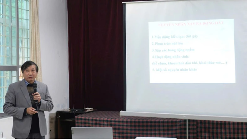 |
Mr. Dinh Quoc Van delivered a lecture at the event.
Since 2021, following a series of earthquakes in Moc Chau, Cao Bang , and other areas, the Vietnam Academy of Science and Technology has promptly directed the Institute of Geophysics to carry out the task of: "Researching, developing, and designing materials and organizing information and communication activities to disseminate knowledge and skills on earthquake prevention to the community."
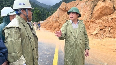
According to Dr. Bui Thi Nhung, through the book "Basic Understanding for Earthquake Safety in Vietnam," experts from the Institute of Geophysics have collaborated with local authorities to organize workshops to disseminate knowledge about earthquakes and skills to prevent earthquake risks to the community. Most recently, in August 2024, the Institute of Geophysics sent a working group to Kon Plong district, Kon Tum province, to coordinate the dissemination of information and guidance on earthquake response skills for people in the earthquake epicenter area (M=5.0).
The working group surveyed, disseminated information, provided guidance, and distributed leaflets to people in earthquake-affected areas such as the communes of Dak Tang, Dak Nen, Dak Ring, Mang But, and Mang Cang. Through this awareness campaign, experts helped people acquire practical skills to avoid panic and promptly apply safety measures for themselves and their families when an earthquake occurs.
According to Associate Professor Dr. Nguyen Hong Phuong, to enhance the effectiveness of earthquake research and forecasting, scientists need to be provided with more tools and technologies, and in addition, the dissemination of knowledge about earthquakes and tsunamis to the public must be given greater emphasis.
Ms. Nguyen Thi Van Nga, Director of the Information and Documentation Center, assessed that through organizing the public lecture "Earthquakes and Tsunamis: Risks and Responses, Lessons for Vietnam," the general public and the media in particular were provided with accurate and important scientific information about earthquakes and tsunamis, making a practical contribution to propaganda, response, and prevention efforts to minimize damage caused by earthquakes and tsunamis in Vietnam.
Source: https://nhandan.vn/du-bao-nguy-co-dong-dat-song-than-va-kich-ban-cho-viet-nam-post849505.html


![[Photo] Prime Minister Pham Minh Chinh presides over the conference announcing the establishment of the International Finance Centre in Vietnam.](/_next/image?url=https%3A%2F%2Fvphoto.vietnam.vn%2Fthumb%2F1200x675%2Fvietnam%2Fresource%2FIMAGE%2F2025%2F12%2F21%2F1766309817714_ndo_br_dsc-3400-jpg.webp&w=3840&q=75)


![[Photo] Prime Minister Pham Minh Chinh presides over a meeting on private sector economic development.](/_next/image?url=https%3A%2F%2Fvphoto.vietnam.vn%2Fthumb%2F1200x675%2Fvietnam%2Fresource%2FIMAGE%2F2025%2F12%2F20%2F1766237501876_thiet-ke-chua-co-ten-40-png.webp&w=3840&q=75)


Comment (0)