
The South Korean Ministry of Land, Infrastructure and Transport said the decision was made on the condition that strict security requirements were met.
Accordingly, military facilities and sensitive locations must be blurred on maps. The display of longitude and latitude coordinates of South Korean territory on products such as Google Earth is also restricted.
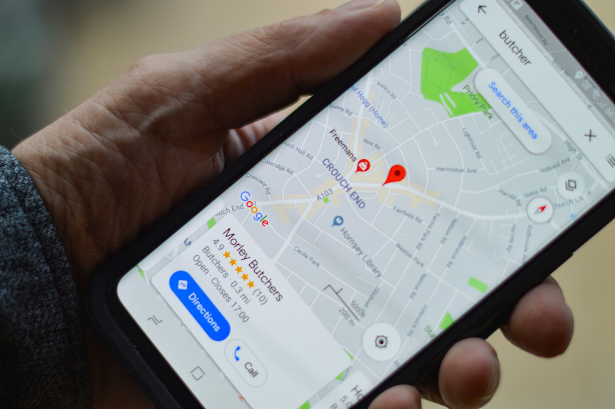
The approved data has a scale of 1:5000, meaning that 1 cm on the map corresponds to 50 meters in the field. Google argues that it is necessary to upload detailed map data to a global server system to provide full real-time directions and navigation services for users inside and outside South Korea.
According to the terms and conditions, Google must store and process detailed map data on servers located in South Korea. Only the data used for navigation and directions, after approval from the South Korean government , is allowed to be transferred overseas for integration into the company's global system.
Previously, South Korea had rejected similar proposals from Google in 2007 and 2016 due to concerns about the risk of military and security information leaks.
Google's Vice President, Cris Turner, welcomed the decision and expressed his desire to continue working with local officials to bring Google Maps to full operation in South Korea.
James Kim, president of the American Chamber of Commerce in Korea (Amcham), assessed this as a positive signal regarding the commitment to innovation, open markets, and a level playing field for global businesses operating in the country.
Source: https://congluan.vn/han-quoc-cho-phep-google-maps-hoat-dong-sau-nhieu-nam-siet-chat-10332188.html


![[Photo] General Secretary and President To Lam presides over a meeting on preparations for the review of one year of operation of the three-tiered government system.](https://vphoto.vietnam.vn/thumb/1200x675/vietnam/resource/IMAGE/2026/06/02/1780391821195_a1-bnd-4595-9717-jpg.webp)


Comment (0)