
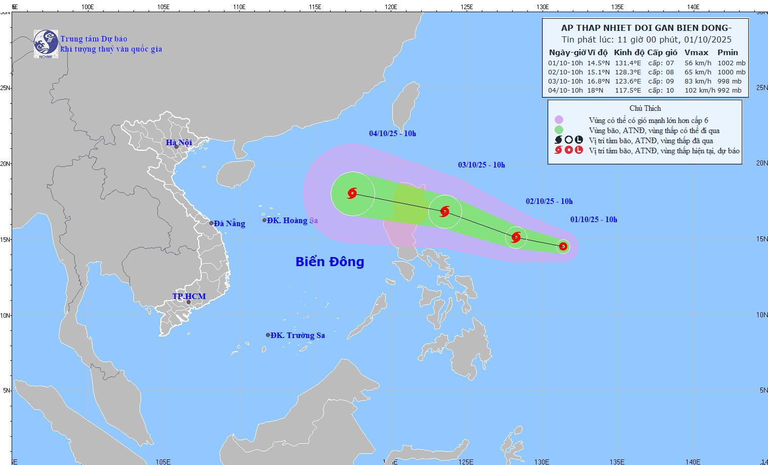
At 10:00, the center of the tropical depression was at about 14.5 degrees North latitude; 131.4 degrees East longitude, in the sea east of Luzon Island (Philippines). The strongest wind near the center of the tropical depression was level 6-7 (39-61 km/h), gusting to level 9. Moving in the West Northwest direction at a speed of about 15 km/h.
It is forecasted that by 10:00 a.m. on October 2, the tropical depression will move in a West-Northwest direction at a speed of about 15 km/h and is likely to strengthen into a storm of level 15; in the sea east of Luzon Island, there will be winds of level 8, nodding to level 10.
At 10:00 a.m. on October 3, the storm moved in a West-Northwest direction, about 20-25 km/h, with the possibility of strengthening; in the sea area east of Luzon Island (Philippines), there were winds of level 9, gusting to level 11. The affected area was the sea area east of the North East Sea.
From the next 48 to 72 hours, the storm will move mainly in the West-Northwest direction, traveling 25-30 km per hour, entering the East Sea and continuing to strengthen.
At sea, from October 3, the sea area east of the North East Sea will have winds gradually increasing to level 6-7; near the storm center, winds will be level 8, gusting to level 10, waves 2.5-4.5m high. Rough seas.
Warning: From October 4 to 6, the North East Sea area (including Hoang Sa special zone) is likely to be affected by strong winds of level 10-11, gusting to level 14. Ships operating in the above-mentioned dangerous areas are likely to be affected by storms, whirlwinds, strong winds, and large waves.
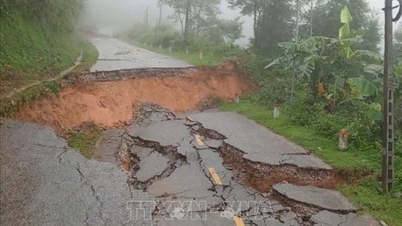
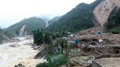
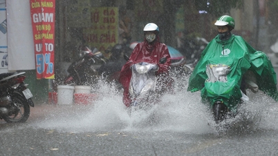
On land, in the next 3-6 hours, the Northern provinces, Thanh Hoa and Nghe An will continue to have rain with accumulated rainfall ranging from 20-50mm, in some places over 80mm. Therefore, in the next 6 hours, there is a risk of flash floods on small rivers and streams, landslides on slopes in many communes/wards in the above provinces.
* Information from the Tuyen Quang Province Hydrometeorological Station, in the past 24 hours (from 10:00 on September 30 to 10:00 on October 1), in Tuyen Quang province, there was moderate rain, heavy rain over a wide area with common rainfall of 40 - 120 mm, some places were very heavy with rainfall over 150 mm such as: Do Ward 209 mm ( Ha Giang 1 Ward), Cao Bo 2 205 mm, Cao Bo 198 mm, Cao Bo 1 is 166 mm (Cao Bo Commune), Thuan Hoa 196 mm (Thuan Hoa Commune), Ho Thau 1 is 165 mm (Ho Thau Commune), Dong Ha 1 is 158 mm, Hydroelectric Dam 154 mm, Thai An 152 mm (Lung Tam Commune), Quyet Tien 156 mm, Quan Ba 154 mm (Quan Ba Commune).
Soil moisture model shows that many areas in Tuyen Quang province are near saturation (over 85%), some areas have reached saturation. In the next 6 hours, areas in the province will continue to have rain with accumulated rainfall ranging from 10 - 30 mm, in some places over 50 mm.

Tuyen Quang Province's Hydrometeorological Station warns that in the next 6 hours, 118 communes and wards in the province are at very high risk of flash floods on small rivers and streams; flash floods, landslides in steep terrain, areas with weak and unstable soil and rock structures, construction works and flooding in low-lying areas, along rivers and streams, and urban flooding.
The warning level of natural disaster risk due to flash floods, landslides, land subsidence due to heavy rain or water flow is level 3. Landslides, land subsidence and flooding can have very negative impacts on the environment, threaten people's lives; cause local traffic congestion, affect the movement of vehicles; destroy structures causing damage to economic and social activities.
Tuyen Quang Province Hydrometeorological Station recommends that local authorities pay attention to checking the flow bottlenecks and vulnerable locations in the area to take preventive and response measures. At the same time, it recommends that people absolutely do not go through spillways and suspension bridges to ensure safety.
Flash floods and landslides can have very negative impacts on the environment, threaten people's lives; cause local traffic congestion, affect the movement of vehicles; destroy civil and economic works, causing damage to production and socio-economic activities.
Source: https://baotintuc.vn/xa-hoi/hinh-thanh-ap-thap-nhiet-doi-gan-bien-dong-20251001122559962.htm
![[Photo] Hanoi morning of October 1: Prolonged flooding, people wade to work](https://vphoto.vietnam.vn/thumb/1200x675/vietnam/resource/IMAGE/2025/10/1/189be28938e3493fa26b2938efa2059e)


![[Photo] Panorama of the cable-stayed bridge, the final bottleneck of the Ben Luc-Long Thanh expressway](https://vphoto.vietnam.vn/thumb/1200x675/vietnam/resource/IMAGE/2025/9/30/391fdf21025541d6b2f092e49a17243f)


Comment (0)