
Ca Mau mangrove forest. Photo: Thanh Dung
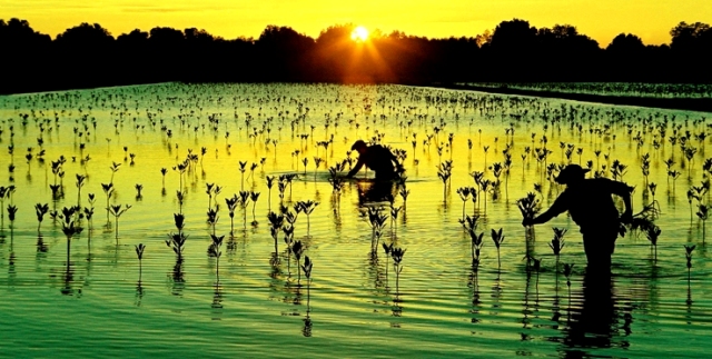
Located about 60 km from the center of Ca Mau province and after more than an hour's speedboat ride, visitors will have the opportunity to explore the Ca Mau mangrove forest – the second largest mangrove forest in the world , after the Amazon rainforest in South America. Viewed from above, the Ca Mau mangrove forest looks like a shimmering green carpet suspended against the sky.
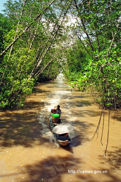
Traveling under the forest canopy. Photo: Huynh Lam
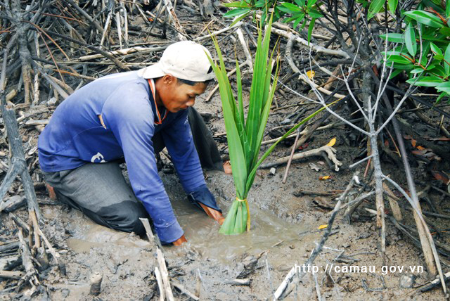
The forest here boasts a rich and diverse vegetation, with many tree species such as: mangrove, Avicennia, Sonneratia, Bruguiera, Sonneratia, Bruguiera, Sonneratia, Sonneratia, Sonneratia, date palm, ferns, vines… Among them, mangrove is the most abundant species, which is why many people also call it the Ca Mau mangrove forest.
Local residents setting up their mudskipper fish traps. Photo: Huynh Lam
Between 1961 and 1971, the US used millions of liters of Agent Orange, Agent White, and Agent Blue to spray over the forests of Ca Mau. While holding the power of "First Lady," Tran Le Xuan colluded with many bourgeois associates in Saigon to open kilns, build furnaces, and extensively exploit charcoal production in the Ca Mau mangrove forests. In many places in the Ca Mau mangrove forests, traces of "First Lady Tran Le Xuan's" charcoal kilns and furnaces still remain.
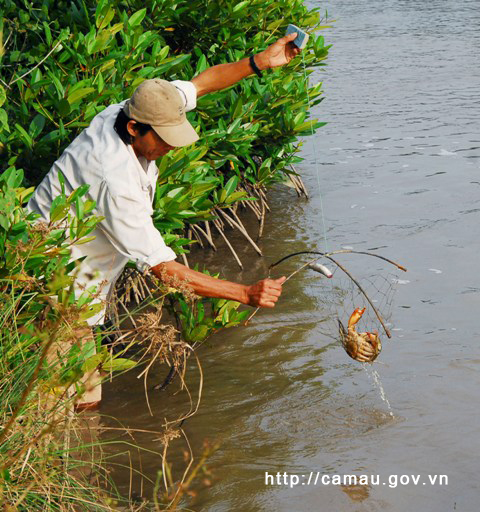
Setting up crab traps at the edge of the forest. Photo: Huynh Lam
Beneath the canopy of the Ca Mau mangrove forests are many rare animal species such as monkeys, langurs, wild boars, civets, otters, birds, shrimp, fish, and various types of plankton and flora.
A portion of the Ca Mau mangrove forest area has been recognized as the Ca Mau Cape National Park and is the world's 2,088th Ramsar site.
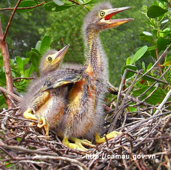
Many bird species come to build nests under the canopy of mangrove forests. Photo: Ta Nhat Huy
Every year, the alluvial plain in the Mau mangrove forest area is gradually built up by sediment, extending 50 to 80 meters into the sea. Here, the Ong Trang sand dune is formed, with sandbanks gradually rising and covered in a green carpet of mangrove trees as the land expands. Every winter, flocks of birds from the cold North stop here to find food before their journey back to distant Australia.
The riverbed is covered with mangroves in Ca Mau. Photo: Huynh Lam
Continuing their journey of discovery, visitors arrive at Ca Mau Cape. This is considered the southernmost point on the mainland of Vietnam. A five-pointed star with GPS number 0001 is located on the national landmark. The symbol of Ca Mau Cape displays the coordinates 8°37'30" North latitude - 104°43' East longitude. Ca Mau Cape has a 20.5m high observation tower. From here, visitors can gaze out and be overwhelmed by the vast expanse of forest and sea.
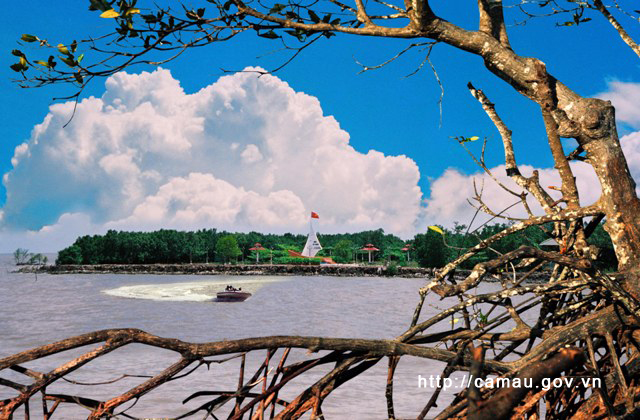
Cape Ca Mau. Photo: Thanh Dung
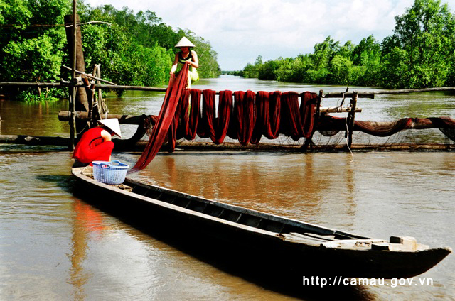
Visiting the Ca Mau mangrove forest, tourists can breathe in the fresh air; explore the Vam Lung wharf - the site of the Ho Chi Minh Trail on the sea; admire Hon Khoai Island and Khai Long beach; learn about the battles fought on the Tam Giang River; hear stories of the people of Rach Goc and Tan An "carrying water by the can, eating mangrove fruit when hungry"; watch people fishing for grouper, catching crabs, snails, clams, and mussels under the mangrove canopy; and enjoy the specialties of the forest and the sea.
Source: https://www.camau.gov.vn/diem-den/kham-pha-rung-ngap-man-ca-mau-254281


![[Photo] National Assembly Chairman Tran Thanh Man working with the Standing Committee of the Law and Justice Committee](https://vphoto.vietnam.vn/thumb/1200x675/vietnam/resource/IMAGE/2026/05/21/1779378929214_ndo_br_1-4610-jpg.webp)


![[Photo] General Secretary and President To Lam presides over a working session with the Central Policy and Strategy Committee on the development of the materials industry.](https://vphoto.vietnam.vn/thumb/1200x675/vietnam/resource/IMAGE/2026/05/21/1779359935432_a3-bnd-3129-1412-jpg.webp)


Comment (0)