
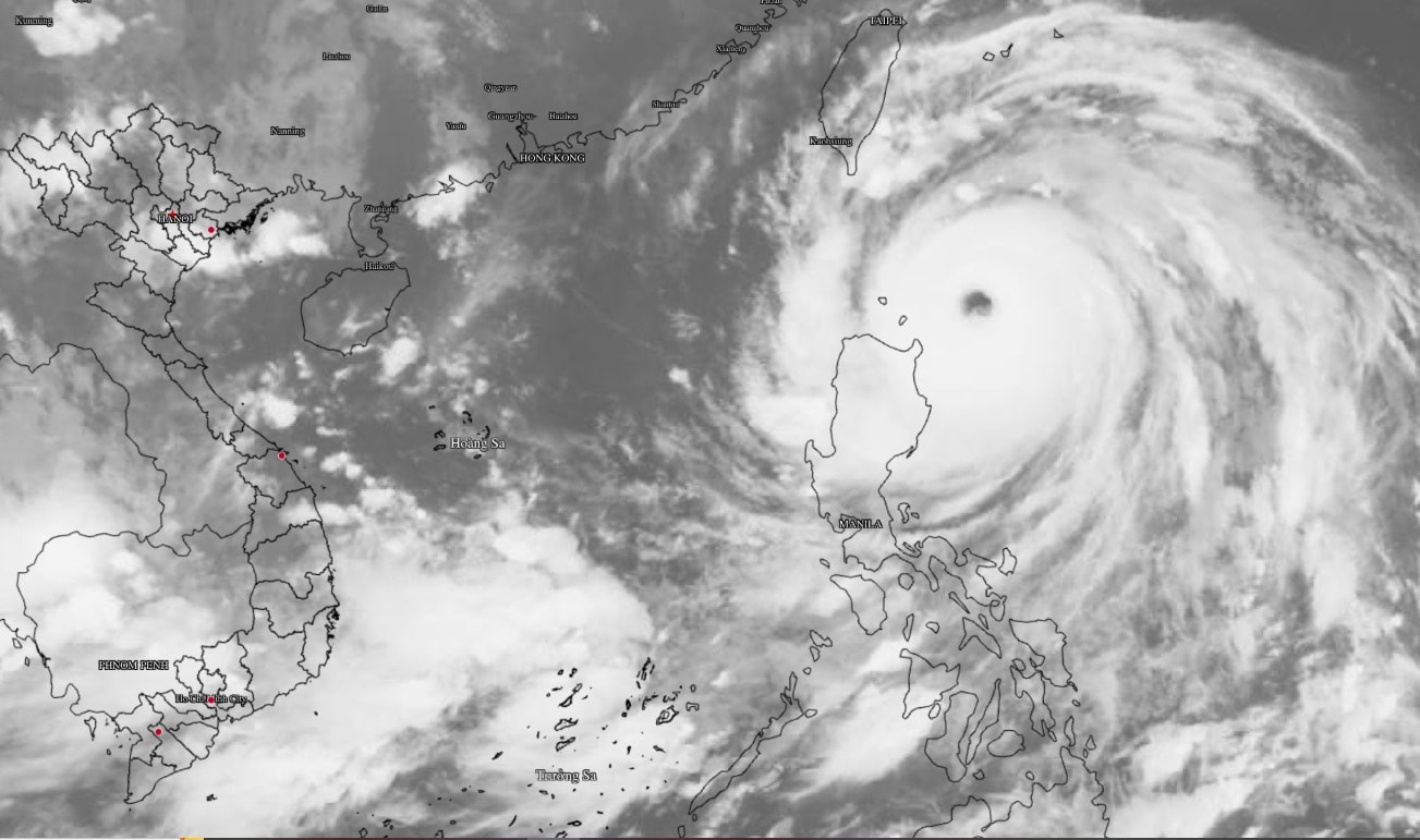
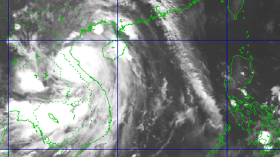
According to the National Center for Hydro-Meteorological Forecasting, at 7:00 a.m. on September 22, the center of super typhoon Ragasa was at about 19.3 degrees North latitude; 123.1 degrees East longitude, about 160km from Lu-Dong Island (Philippines). The strongest wind near the center of the storm reached level 17 (from 202-221 km/h), gusting above level 17. The storm is moving at an extremely fast speed, about 20km/h in the West-Northwest direction.
Historic storm Ragasa is approaching
Forecasts show that this storm will enter the East Sea on the evening of September 22, becoming the ninth storm of the year. The storm will maintain a terrible wind speed of level 16-17, gusting above level 17 on September 22 and 23.
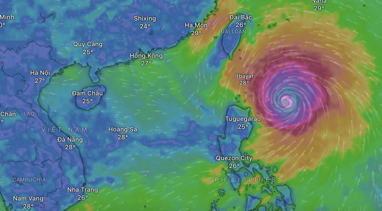
Notably, Ragasa's peak intensity is comparable to or even surpasses that of Typhoon No. 3 Yagi, which caused much damage in 2024. This is one of the strongest super typhoons ever to appear in the East Sea, posing a great threat to maritime activities.
The most dangerous seas
The Center for Hydrometeorology has identified two main danger zones that require special attention:
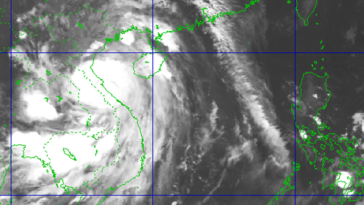
By 7am September 23: The storm will be in the northeastern sea area of the North East Sea. The dangerous area is the area north of latitude 18 degrees North, east of longitude 115.5 degrees East.
By 7am on September 24: The storm will move to the northern sea area of the North East Sea, about 370km east of Leizhou Peninsula (China). The danger zone will expand to the area north of latitude 18.5 degrees North and east of longitude 111 degrees East.
Disaster risk levels and emergency warnings
Both of the above dangerous areas are warned of level 4 natural disaster risk, the highest level. The sea area east of the North East Sea will have winds gradually increasing to level 8-9, then suddenly increasing to level 10-14. Particularly in the area near the center of the super storm, winds will be strong to level 15-17, gusting above level 17, waves over 10m high and rough seas.
All vessels operating in these dangerous sea areas are at high risk of being affected by storms, whirlwinds, extremely strong gusts of wind and large waves.
During the next 72 to 120 hours, the super typhoon is forecast to move in the West Southwest direction at a speed of about 20km/h, gradually weakening in intensity.
Source: https://baodanang.vn/quai-vat-ragasa-giat-cap-17-sap-tien-vao-bien-dong-lieu-thanh-sieu-bao-manh-nhat-xuat-hien-tren-bien-dong-3303377.html
![[Photo] High-ranking delegation of the Russian State Duma visits President Ho Chi Minh's Mausoleum](https://vphoto.vietnam.vn/thumb/1200x675/vietnam/resource/IMAGE/2025/9/28/c6dfd505d79b460a93752e48882e8f7e)

![[Photo] Joy on the new Phong Chau bridge](https://vphoto.vietnam.vn/thumb/1200x675/vietnam/resource/IMAGE/2025/9/28/b00322b29c8043fbb8b6844fdd6c78ea)
![[Photo] The 4th meeting of the Inter-Parliamentary Cooperation Committee between the National Assembly of Vietnam and the State Duma of Russia](https://vphoto.vietnam.vn/thumb/1200x675/vietnam/resource/IMAGE/2025/9/28/9f9e84a38675449aa9c08b391e153183)


Comment (0)