
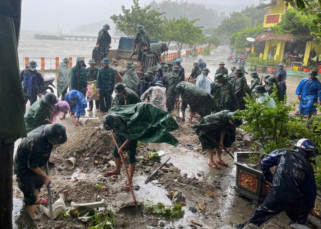
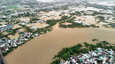
It is forecasted that this afternoon, evening and night (September 28), in the communes and wards of Da Nang city, there will be rain, some places will have moderate rain, heavy rain with common rainfall of 15-40mm, some places over 70mm; from September 29, the rain will decrease rapidly and end this heavy rain period.
The plains and mountainous areas north of Da Nang city still have winds of level 3-4, at night there are places with gusts of level 5-6; the mountainous areas south of the city have winds of level 2-3.
Localities need to guard against flash floods and landslides in mountainous areas and flooding in low-lying areas and urban areas; and against whirlwinds, lightning and strong gusts of wind during thunderstorms.
Da Nang sea area still has showers and thunderstorms in many places; visibility less than 6km in the rain; wind level 6-7, some places level 8, gusting level 9-10; wave height 2-4.5m, very rough sea.
Hoang Sa sea area has showers and heavy thunderstorms, visibility less than 6km in the rain; wind level 6-7, in some places level 8, gusting to level 9-10; waves 2-4.5m high, very rough sea.
On the night of September 29 and 30, the sea area of Da Nang and Hoang Sa had strong winds of level 6, gusts of level 7-8, rough seas, and waves 2-3m high.
All vessels operating in the above areas are at high risk of being affected by cyclones, strong winds and large waves.
Source: https://baodanang.vn/da-nang-co-gio-giat-cap-5-6-mua-to-trong-dem-28-9-3304916.html


![[Photo] General Secretary To Lam and National Assembly Chairman Tran Thanh Man attend the 80th Anniversary of the Traditional Day of the Vietnamese Inspection Sector](https://vphoto.vietnam.vn/thumb/1200x675/vietnam/resource/IMAGE/2025/11/17/1763356362984_a2-bnd-7940-3561-jpg.webp)


Comment (0)