
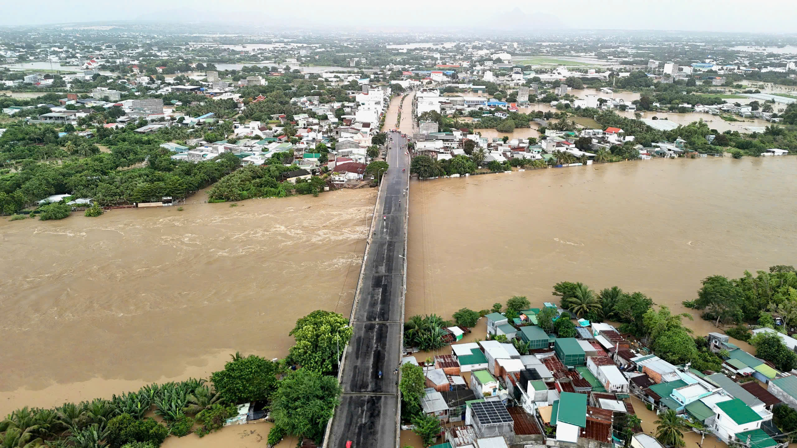
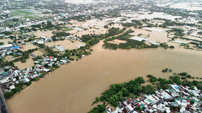
On the morning of November 17, heavy rain in the southern part of Khanh Hoa province, combined with water from upstream, pushed the water level of Cai Phan Rang River (Dinh River) to rise rapidly. In just a short time, floodwaters flooded Dong Hai and Phan Rang wards and Ninh Phuoc and Phuoc Hau communes..., causing widespread flooding.
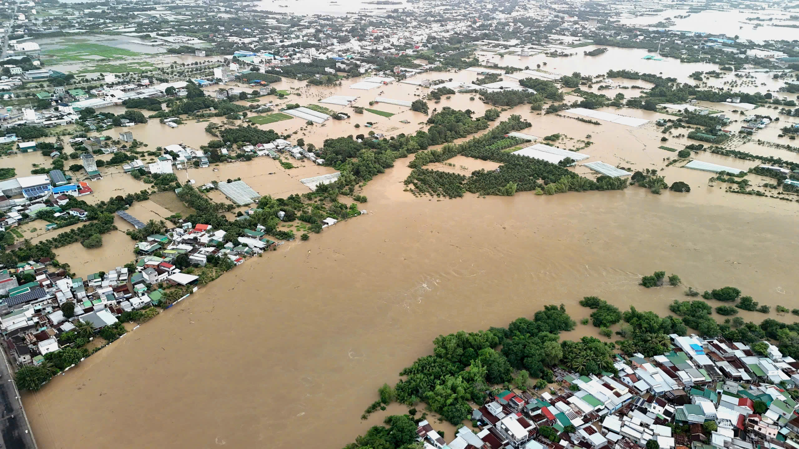
Flood water rose, inundating both banks of Cai Phan Rang River.
PHOTO: BA DUY
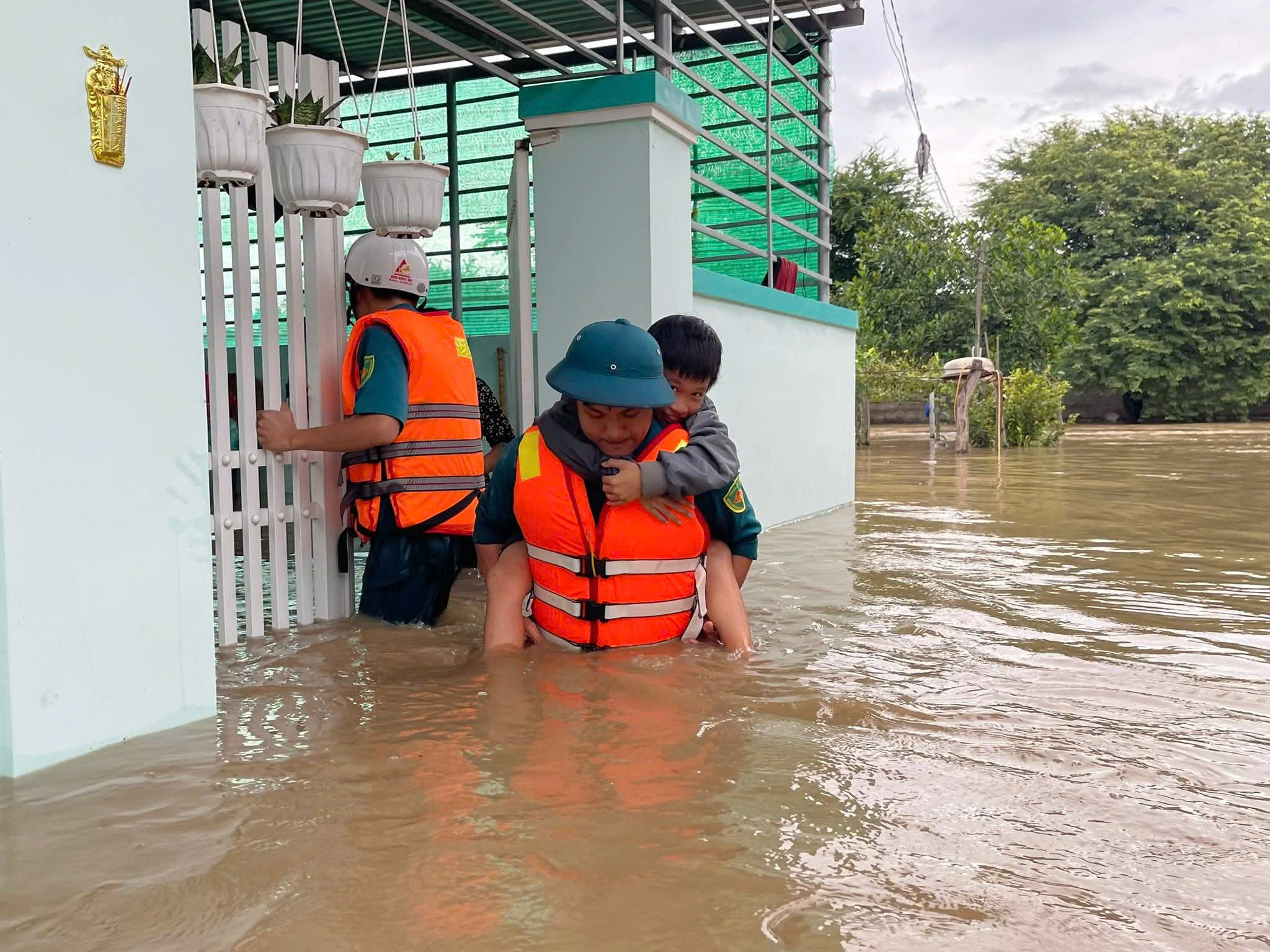
Many people living along the Cai Phan Rang River were evacuated from isolated areas.
PHOTO: PHAN RANG WARD MILITARY COMMITTEE
Residents living along the Cai Phan Rang River said the water flow was so large and rising so quickly that many households were unable to move their belongings in time. In the emergency, they could only move the elderly, children and family members to higher ground to avoid the flood.
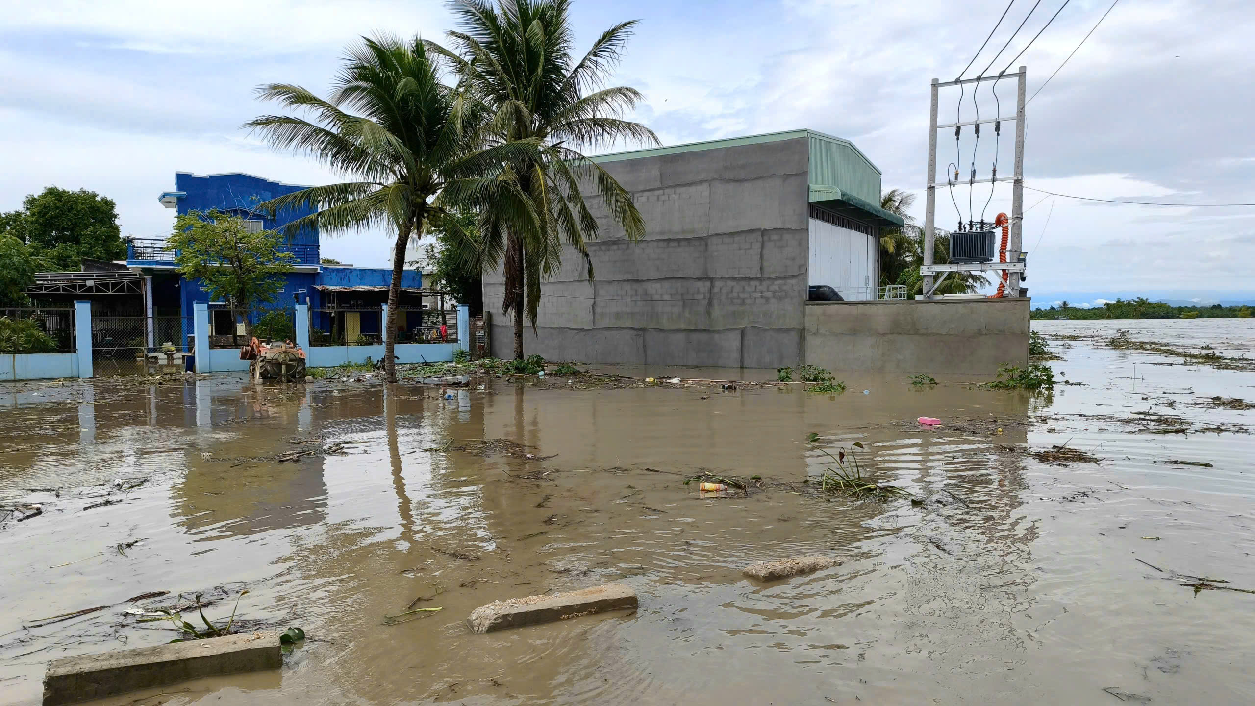
Water overflowed the dike and rushed into people's houses.
By noon of the same day, the Cai Phan Rang River water exceeded the dike, pouring into the residential area around the Dinh River downstream dam in Phuoc Dinh commune and low-lying areas in Dong Hai ward. Many houses and crops were submerged in water. Local authorities and residents urgently evacuated and moved their properties to higher ground to avoid damage.
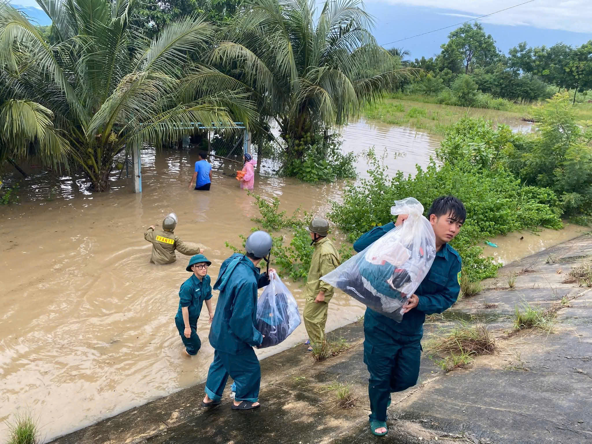
In Phuoc Dinh commune, An Thanh 1, An Thanh 2, Long Binh 1, Long Binh 2 and Hoa Thanh villages were flooded from 0.5 to 1 meter. Many traffic routes were cut off. The authorities mobilized the evacuation of 18 households (38 people) in An Thanh 1 village, and at the same time supported a fishing household to move their boats to safe anchorage. In An Thanh 2 village, the authorities promptly evacuated a resident from the dangerous area.
Authorities organized the evacuation of people from flooded areas along the Cai Phan Rang River.
PHOTO: BA DUY
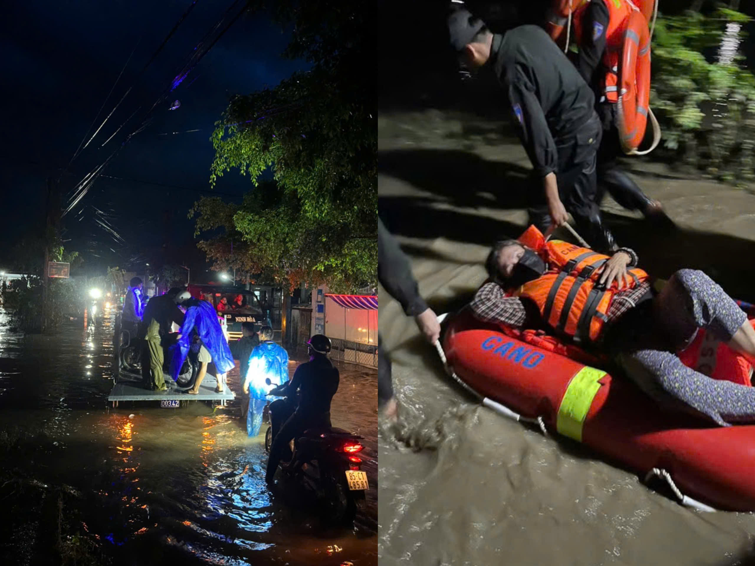
In Phan Rang Ward, by the afternoon of November 17, the authorities had organized the evacuation of 415 households with 1,330 people in residential groups 41, 42 and 26, the area near the Cai Phan Rang river dike . Shock troops were on duty at key points to guide, warn and assist people in evacuating.
Phan Rang Ward Military Command said that the militia force coordinated with the 5th Water Special Forces Brigade to deploy a working group and mobile canoes to residential areas to rescue people who were deeply flooded.
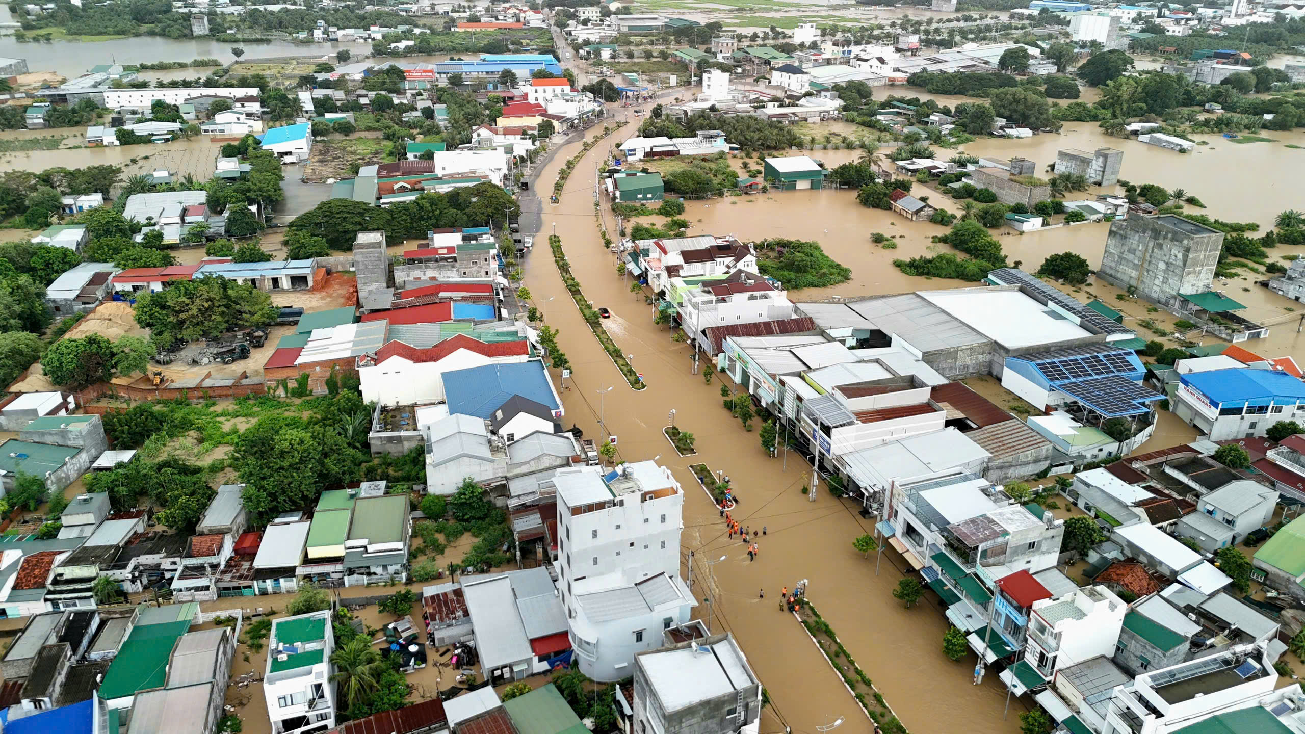
Thong Nhat Street, Phan Rang Ward was cut off by water on the afternoon of November 17.
PHOTO: QUANG VU

Phan Rang Ward militia and the 5th Special Forces Brigade evacuated people to safety.
PHOTO: PHAN RANG WARD MILITARY COMMITTEE
Phan Rang Ward authorities help people move their belongings.
PHOTO: PHAN RANG WARD MILITARY COMMITTEE
Vinh Hai Commune Police said the water from upstream poured in so quickly that many vehicles stalled mid-stream. Authorities were only able to evacuate people in deeply flooded areas. Commune police approached Khanh Nhon reservoir, where the water level rose to 1.4 meters, and the My Phong area to take people to safety.
Cai Phan Rang River water level is slowly decreasing, downstream is still heavily flooded
According to the 7 p.m. news on November 17 of Khanh Hoa Hydrometeorological Station , the water level of Cai Phan Rang River has begun to decrease but at a very slow rate. The water level at Tan My station was measured at 37.16 m (about 0.34 m below alarm level 3); at Phan Rang station it was 4.45 m (only 0.05 m below alarm level 3).
Long Dao 1 Bridge (Phan Rang Ward) on the afternoon of November 17
PHOTO: BA DUY
Water flooded into houses along Cai Phan Rang River
PHOTO: BA DUY
Although the flood has receded, many downstream areas such as Ninh Phuoc, Phuoc Hau, Vinh Hai and Thuan Nam are still deeply submerged. Local authorities are on duty 24/7, ready to respond if the water level of Cai Phan Rang River continues to have unusual developments.
Source: https://thanhnien.vn/khanh-hoa-nuoc-song-cai-phan-rang-dang-cao-nhan-chim-nhieu-khu-dan-cu-185251117214910958.htm


![[Photo] General Secretary To Lam and National Assembly Chairman Tran Thanh Man attend the 80th Anniversary of the Traditional Day of the Vietnamese Inspection Sector](https://vphoto.vietnam.vn/thumb/1200x675/vietnam/resource/IMAGE/2025/11/17/1763356362984_a2-bnd-7940-3561-jpg.webp)


Comment (0)