
 |
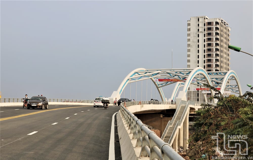
| Along the Cau River, from Don Phong to Xuan Phuong, there are now nearly 20 bridges crossing it. In the photo: Ben Tuong Bridge. |
The summit of Phia Booc, where small streams converge to form a channel, creating the source of water for the Cau River. I imagined this while standing in the Phuong Vien field, in the Cho Don area. Beneath the vegetation, countless clear, sweet streams, millions of years old, trickled down, contributing to the river's grandeur.
I once dreamed of one day sailing down the river from the upstream of Phuong Vien to the Thai Binh estuary – a distant dream. Mr. Tran Van Minh, 84 years old, from Dong Bam, told me this. He then continued with pride: "In the 1970s, I worked as a laborer at a forestry farm in Bac Thai province, specializing in building rafts, securing them, and driving bamboo, reed, and wooden rafts from the upstream forests downstream. I knew every river's course by heart, from Bac Kan to the end of Thai Nguyen province. I didn't go any further, because if I wasn't careful, the raft would drift into the Kinh Bac region, known for its Quan Ho folk music."
"The Cau River flows in a single stream" was a saying among the burly men like Mr. Minh when he worked as a raft driver for the forestry industry. The events of yesterday are now in the past. Memories of those old raft journeys have been carried away by the current. But the source of the Cau River at the summit of Phia Booc still gathers its fragile waters. Starting from Phuong Vien, the Cau River takes shape. Without choosing its destination, regardless of the rocky slopes and treacherous terrain, the Cau River silently flows downstream according to the laws of nature.
Leaving the forest, as it flows along, the Cau River continuously receives reinforcements from the Na Cang, Khuoi Toc, Khuoi Luoi, Khuoi Cun rivers… carrying a natural vitality to the lands of Bac Kan and Thai Nguyen, creating prosperity, warmth, and abundance for the villages.
Along the riverbank, the natural scenery changes with the seasons like a painting. Within this painting are people dressed in indigo, busy with their farm work. Every late afternoon, after a tiring day's labor, they all rush to the riverbank to bathe, wash their clothes, and wash away the worries of the day.
It's July now. But July of 2025 will be completely different. The two regions of Thai Nguyen and Bac Kan will merge under the common name of Thai Nguyen province. With the Cau River, the separation or merger of provinces is merely a matter of administrative division and demarcation. It doesn't matter because all rivers on Earth flow towards the sea. The Cau River is no different; in the dry season, it quietly contributes. In the rainy season, it surges and roars, like millions of laborers carrying silt to enrich the fields that nourish the rice and potato crops.
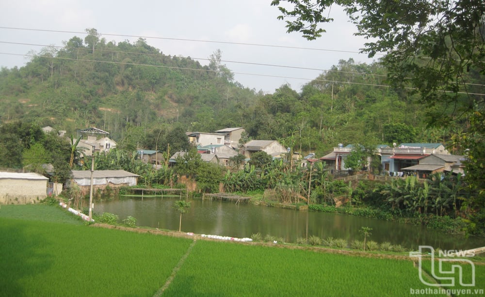 |
| A corner of the countryside at the headwaters of the Cau River. |
Looking at the river, red with silt, a sturdy, healthy old man said to me in a gentle voice: "I don't know when the Cau River originated, but since we were children, we've swum in it, caught fish, and as we grew older, young men and women would sing love songs and become husband and wife. Through countless rainy seasons and floods, the river surged up, and when it returned to its source, it never forgot to give back its banks with silt. Thanks to the river, the village fields are fertile."
In the era of Industry 4.0, when a new day dawns, the previous one has already passed. But the Cau River remains unchanged, still murmuring stories of the past, with many old docks where ferries and boats once moored. Now, those old ferry docks have been replaced by sturdy concrete bridges stretching across the river, bringing the two banks closer together.
I've heard many stories about this river flowing through the mountains and forests of Northern Vietnam. Before merging into the Luc Dau Giang River, following the current from Thai Nguyen to Bac Kan, to the upper reaches of Phia Booc, where the river begins its journey of millions of years. This is also the most rugged section of the Cau River. With countless large and small rocks, many sections are covered with rocks that resemble giant buffaloes wallowing in the river.
Mr. Minh's story continues: When we encountered that stretch of river, we raft drivers had to spread our legs wide like someone in a fighting stance, splaying our arms outstretched to calculate and react with the poles in our hands. The people at the front and back of the raft had to coordinate perfectly and precisely; a slight mistake could cause the raft to break apart, shattering the structure and ruining our livelihood. Especially the section of the river passing through the Cho Moi area, where the water was squeezed by two mountain ranges on the banks, creating a steep slope. The water flowed swiftly because the riverbed was "furious" with boulders and slabs hidden beneath the surface.
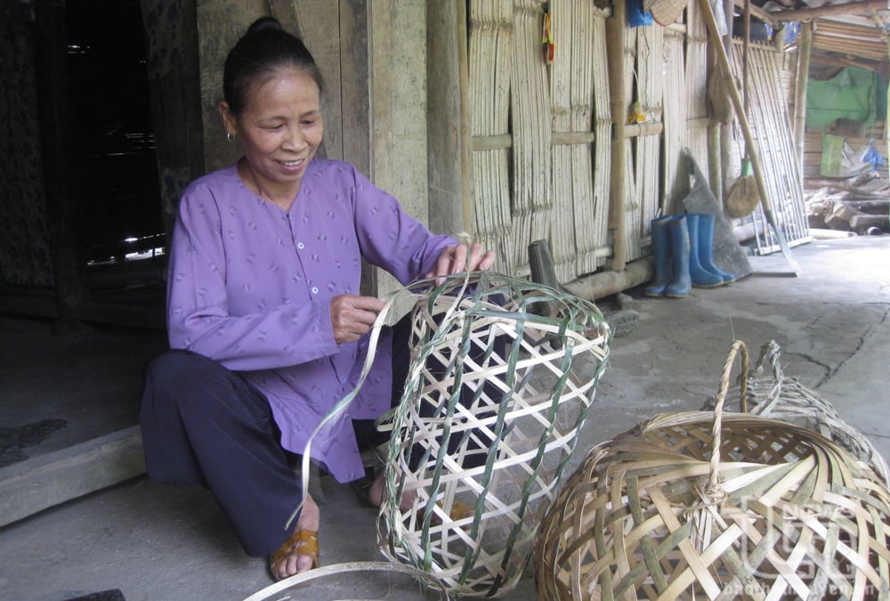 |
| During the off-season, many farmers in the upstream areas of the Cau River take up weaving as an additional occupation to improve their livelihoods. |
Returning to the gently floating boat of my dreams. The boat drifted along the Cau River through the years. It was then that I realized something interesting: The Cau River, passing through Bac Kan and Thai Nguyen provinces, despite its clearly defined administrative boundaries—the boundary between Cho Moi (Bac Kan) and Van Lang (Thai Nguyen)—meant nothing to the river itself.
Silently flowing, silently carrying away, yet remaining are the villages sharing the Then and Sli songs and the enchanting flute melodies, along with their traditional festivals. After leaving Thai Nguyen province, the Cau River anchors itself in the unique culture of the Viet Bac mountains. Entering Bac Giang province, the Cau River still flows, but carries the smooth melodies of Quan Ho folk songs, completely unrelated to the symbolic cultural beauty of the Viet Bac region.
Only the people of Bac Kan and Thai Nguyen provinces hope that one day, especially after the river is no longer defined by administrative boundaries creating an invisible dividing line, there will be ferry services carrying passengers downstream from Phuong Vien to Thuan Thanh. From Thuan Thanh, they can then travel upstream along the river, admiring the prosperous villages and towns reflected in the river's surface.
I will take a boat trip like that. Sitting and enjoying tea, savoring peanut candy made from tea leaves and other ingredients. Leisurely admiring the scenery along the riverbank, listening to the mountain girl playing the zither, singing folk songs, or letting the melodies of Sli songs drift across the river, my heart swaying with the intoxicating essence of nature, creating ripples of joyful songs along the Cau River.
Source: https://baothainguyen.vn/van-hoa/202507/song-cau-mot-dai-e0304ce/

![[Photo] Admire the coral "masterpiece" amidst the million-year-old heritage of Dak Lak province.](https://vphoto.vietnam.vn/thumb/1200x675/vietnam/resource/IMAGE/2026/05/31/1780221235105_anh-man-hinh-2026-05-31-luc-16-53-27.png)
![[Photo] Solemn bathing ceremony and Buddha procession in Hue](https://vphoto.vietnam.vn/thumb/1200x675/vietnam/resource/IMAGE/2026/05/31/1780228263543_1-jpg.webp)


![[Video] Sunset at Lap An Lagoon – Where the sun sets over the fishing nets](https://vphoto.vietnam.vn/thumb/340x192/vietnam/resource/IMAGE/2026/05/31/1780192137701_beach-landscape-sea-water-nature-grass-745871-pxhere-com.jpeg)


![[Photo] Admire the coral "masterpiece" amidst the million-year-old heritage of Dak Lak province.](https://vphoto.vietnam.vn/thumb/402x226/vietnam/resource/IMAGE/2026/05/31/1780221235105_anh-man-hinh-2026-05-31-luc-16-53-27.png)


Comment (0)