
This warning is mentioned in the Prime Minister 's recently issued dispatch on responding to super typhoon Ragasa.
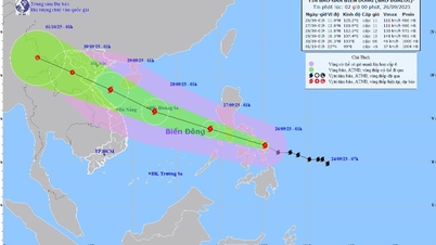
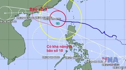
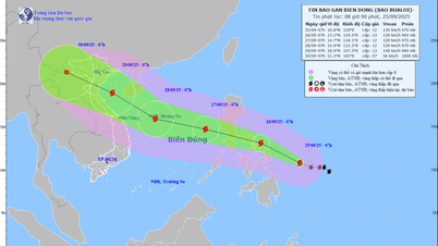
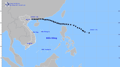
According to the National Center for Hydro-Meteorological Forecasting, around the evening of May 22, storm Ragasa will move into the East Sea, becoming the 9th storm in the East Sea this year.
After entering the East Sea, the storm moved faster at a speed of about 20km/h and maintained its maximum intensity of level 16-17, gusting above level 17 on September 22-23. This wind speed is equivalent to and stronger than the maximum intensity of Typhoon Yagi in 2024.
According to forecasts, from the night of September 24 to the early morning of September 25, the storm will pass Leizhou Island (China) into the Gulf of Tonkin with a strong intensity of level 12-14, gusting to level 15-16. On September 25, the storm may make landfall directly on the Vietnamese mainland in the area from Quang Ninh to Ha Tinh .
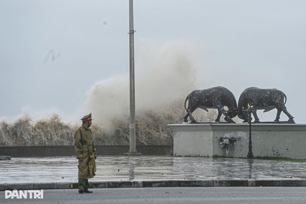
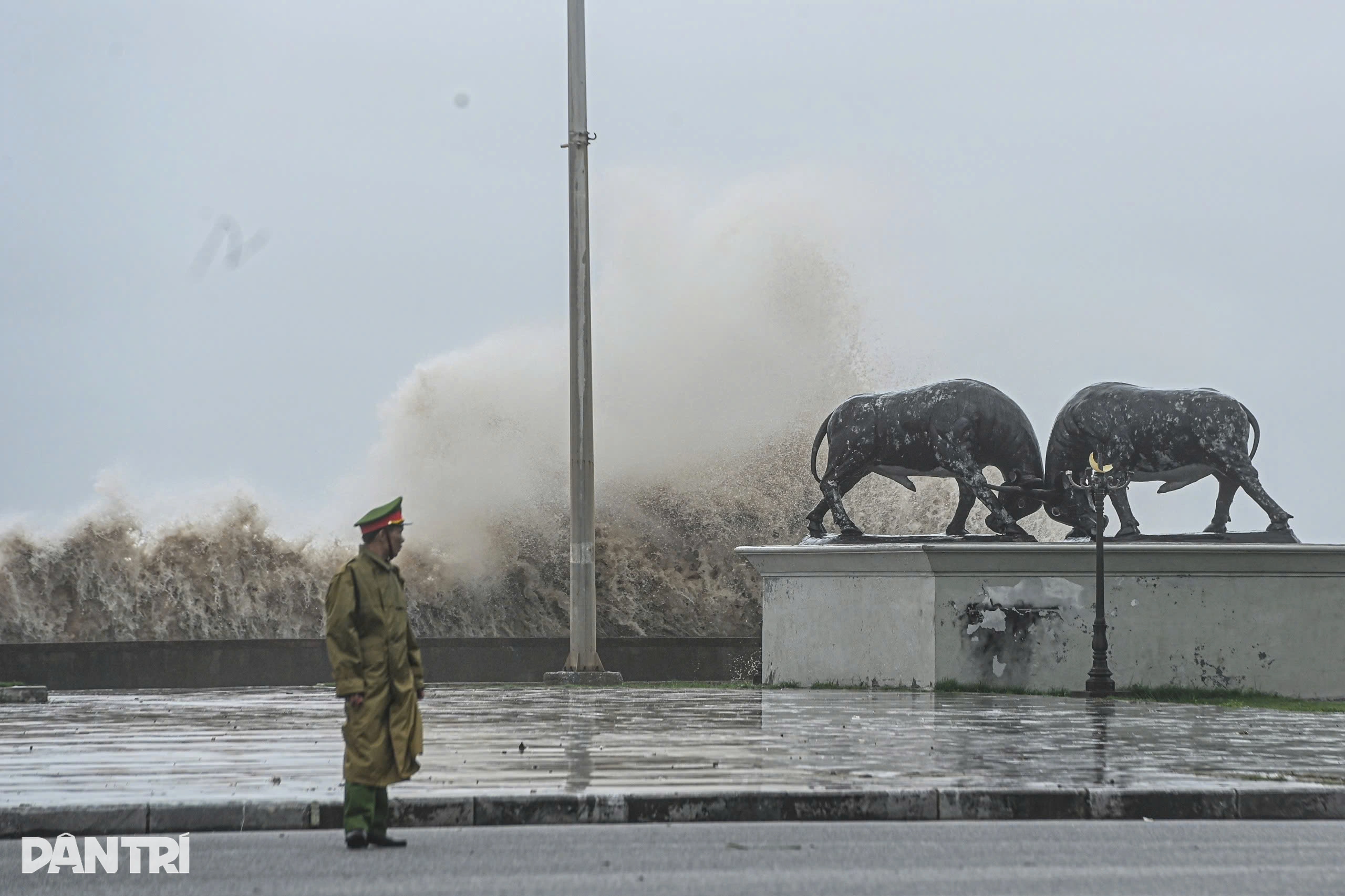
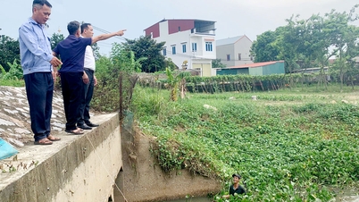
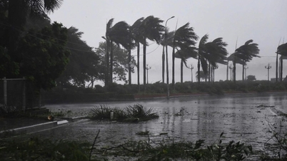
Image of storm No. 3 causing big waves in Do Son sea, Hai Phong city (Photo: Hai Long).
The Prime Minister's telegram emphasized that this is a very strong storm, currently reaching super typhoon level and will continue to maintain super typhoon level for the next 2 days when operating in the East Sea. The range of strong wind impact is very wide, especially needing to be on guard against thunderstorms before the storm directly affects (even when the storm's center is still about 300-400km away).
To respond to super typhoon Ragasa early and from afar, the Prime Minister requested localities from Quang Ngai and beyond, along with relevant units, not to be negligent or subjective, but to organize monitoring, updating, and firmly grasping the storm's developments.
Units need to update their plans and be ready to immediately deploy measures to respond to super typhoon Ragasa with the most drastic spirit, early and from afar, proactively taking response measures at the highest level, anticipating the worst-case scenario to ensure people's safety and limit property damage.
The Prime Minister requested the secretaries and chairmen of coastal provinces and cities from Quang Ninh to Quang Ngai to postpone unnecessary meetings, mobilize the entire political system, focus on leading, directing, implementing, and urging the response to super typhoon Ragasa.
In particular, the Government leader noted that localities must urgently use all measures to inform ships still operating at sea about the developments and forecast of the storm's movement; and guide them to move away from and not enter areas at risk of being affected by the storm.
Localities also need to base on the situation to decide to restrict ships and vehicles from going out to sea, operating at sea or ban the sea when necessary; decide to control and limit traffic during storms causing strong winds and heavy rain to limit incidents and ensure people's safety.
In addition, according to the Prime Minister, it is necessary to review plans, forces, and means to be ready to organize and deploy evacuation support and relocation of people in unsafe areas before the storm directly affects them and to deploy response, rescue, and relief work when bad situations occur.
On the other hand, the Prime Minister requested hydrometeorological forecasting agencies to closely monitor and refer to international forecast information to forecast and provide the earliest, most complete and accurate information on the developments and impacts of storms, and at the same time identify the worst possible scenarios so that authorities and people can proactively deploy appropriate, timely and effective response measures.
The Ministry of National Defense and the Ministry of Public Security were assigned to direct units located in areas at risk of being affected by storm Ragasa to proactively review plans, arrange forces and means to be ready to support localities in evacuating and relocating residents, responding to storms, and conducting rescue operations when requested.
Source: https://dantri.com.vn/thoi-su/suc-gio-cua-sieu-bao-ragasa-tuong-duong-va-manh-hon-bao-yagi-20250922130823180.htm


![[Photo] Prime Minister Pham Minh Chinh receives Secretary of Shandong Provincial Party Committee (China) Lin Yu](https://vphoto.vietnam.vn/thumb/1200x675/vietnam/resource/IMAGE/2025/9/26/821396f0570549d39f33cb93b2e1eaee)


Comment (0)