
 |
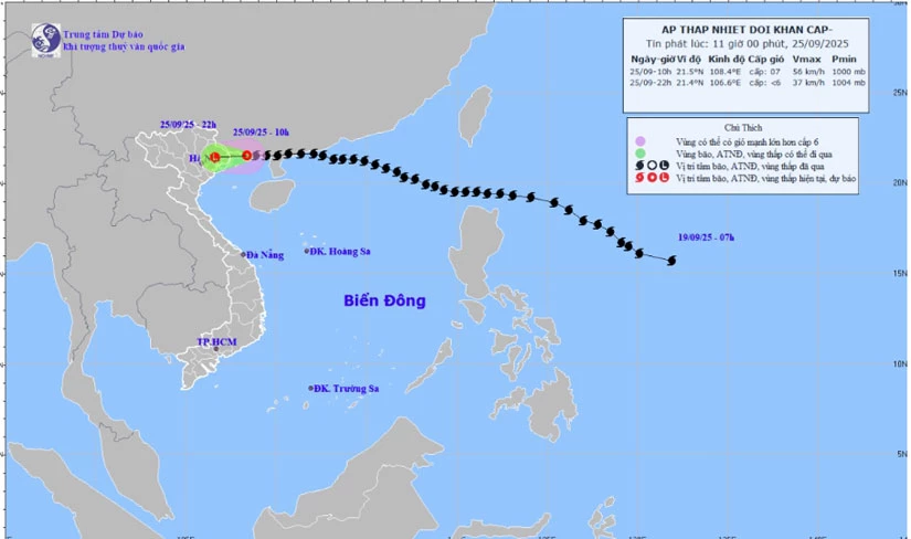
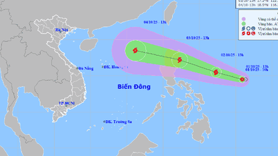
| Forecast map of the trajectory and intensity of the tropical depression issued at 11:00 on September 25, 2025 |
At 10:00, the center of the tropical depression was at about 21.5 degrees North latitude; 108.4 degrees East longitude, over the sea of Quang Ninh . The strongest wind near the center of the tropical depression was level 7 (50-61km/h), gusting to level 9. Moving westward at a speed of 15-20km/h.
Due to the influence of the tropical low pressure circulation, from the morning of September 25 to the end of the night of September 26, Tuyen Quang province will have moderate to heavy rain (locally very heavy rain) and scattered thunderstorms with common rainfall of 70-150mm, locally over 200mm. Warning of the risk of heavy rain >80mm/3 hours.
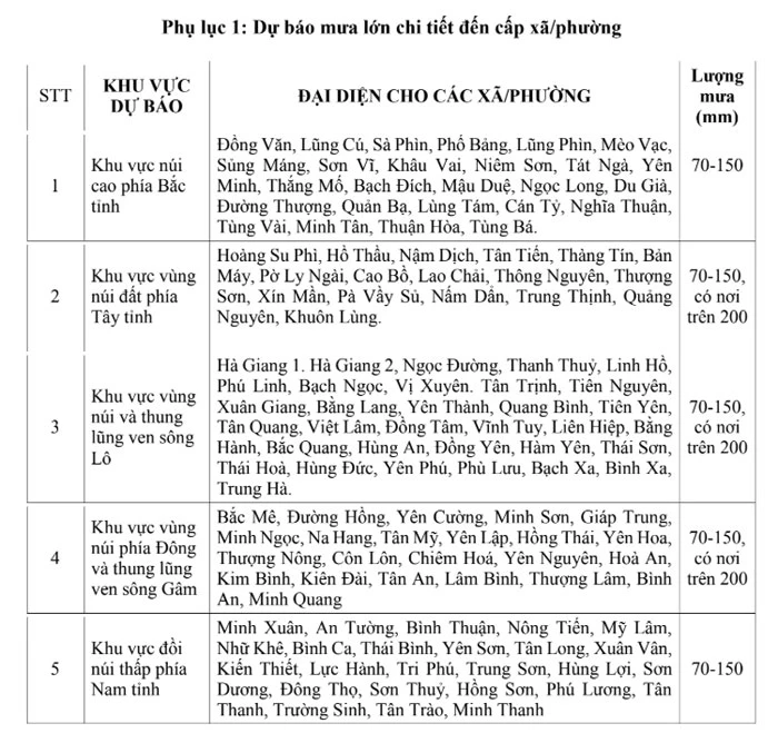 |
| Heavy rain forecast in communes/wards in the province |
Thunderstorms can be accompanied by tornadoes, lightning and strong gusts of wind that can cause trees to fall, damage houses, traffic works and infrastructure. Heavy rain in a short period of time can cause landslides in mountainous areas with steep terrain.
Le Lam
Source: https://baotuyenquang.com.vn/xa-hoi/202509/ap-thap-nhiet-doi-suy-yeu-tu-bao-so-9-tuyen-quang-co-mua-to-e954773/
![[Photo] Hanoi morning of October 1: Prolonged flooding, people wade to work](https://vphoto.vietnam.vn/thumb/1200x675/vietnam/resource/IMAGE/2025/10/1/189be28938e3493fa26b2938efa2059e)


![[Photo] Panorama of the cable-stayed bridge, the final bottleneck of the Ben Luc-Long Thanh expressway](https://vphoto.vietnam.vn/thumb/1200x675/vietnam/resource/IMAGE/2025/9/30/391fdf21025541d6b2f092e49a17243f)


Comment (0)