

On the afternoon of May 29th, the Department of Agriculture and Environment, in coordination with the Land Management Department, organized a training session to provide technical guidance on building and updating land databases for officials from the wards and communes of Bac Giang, Tan Tien, Tien Phong, Da Mai, Tan Dinh, and My Thai.
 |
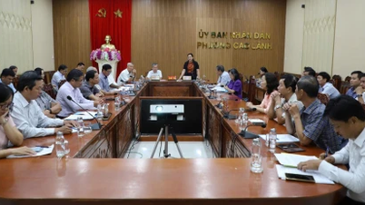
Comrade Phi Thanh Binh chaired the training conference on land database. |
Attending the conference were Comrade Phi Thanh Binh, Deputy Director of the Department of Agriculture and Environment, Deputy Head of the Steering Committee for the implementation of land surveying, cadastral mapping, and completion of the land database in the province; representatives of the Department of Land Management; and leaders and professional staff from various localities.
In his opening remarks at the conference, Comrade Phi Thanh Binh emphasized that practical inspections in various localities have revealed that the process of building, updating, and cleaning up land databases still faces many difficulties and obstacles.
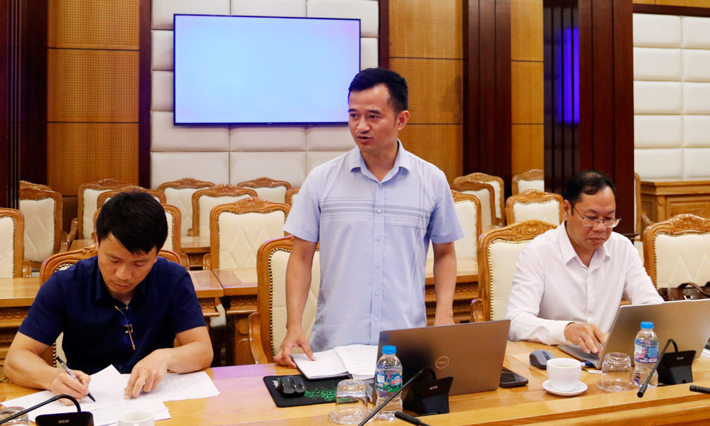 |
Representatives from Bac Giang ward highlighted the difficulties encountered during the data update process. |
The comrade affirmed that organizing the training conference is of great importance, helping localities to directly exchange information with specialized agencies of the Central Government, unify methods, and resolve difficulties in the process of updating data, ensuring the progress of completing the land database cleaning work according to the province's plan.
At the same time, we request that participating officials proactively discuss any remaining issues to receive specific guidance, thereby enabling effective implementation at the grassroots level.
 |
Technical training conference on building and updating land database. |
At the conference, localities reported many difficulties in the process of updating land data. Specifically, many places encountered difficulties in matching the sheet and parcel numbers between the field and the data on the VBDLIS system; some areas experienced significant changes after land consolidation, making it difficult to determine the location of land parcels and convert map sheet numbers.
Furthermore, classifying, standardizing, and updating information on the software also presents many challenges. Local authorities desire tools to help categorize data groups, facilitating data updates.
Based on the discussions, representatives from the Land Management Department directly guided the wards and communes on the process of collecting, updating, correcting, and supplementing information into the land database; assigning land parcel identification codes; reviewing land use right certificates and house ownership certificates that have not yet been updated to the system; and integrating citizen identification information of land users and house owners.
Simultaneously, provide guidance on how to fill out form number 01 and answer any questions that arise during the process. Furthermore, focus on separating and classifying data in detail according to the correct target groups, avoiding a scattered approach.
 |
Representatives from the Department of Land Management provided technical guidance and information on cleaning up land data. |
According to the plan, the province aims to complete the land data cleaning process by June 2026, with over 427,000 land parcels requiring cleaning. Communes and wards will complete updating information before June 12, 2026, to hand over to the Land Registration Office for updating into the national land database.
Through the conference, localities were able to overcome professional difficulties, improve the efficiency of exploiting and operating the software, and contribute to accelerating the progress of completing the land database in the province.
Source: https://baobacninhtv.vn/bac-ninh-thao-go-kho-khan-trong-cap-nhat-co-so-du-lieu-dat-dai-postid446743.bbg


![[Photo] Ba Lang An Lighthouse - the "eye of the sea" amidst the "rock museum" of Quang Ngai province.](https://vphoto.vietnam.vn/thumb/1200x675/vietnam/resource/IMAGE/2026/05/29/1780038698840_anh-man-hinh-2026-05-29-luc-14-10-42.png)

![[Image] Pleasant weather helps students enter the 10th grade entrance exam with confidence.](https://vphoto.vietnam.vn/thumb/1200x675/vietnam/resource/IMAGE/2026/05/29/1780034401612_ngay-1-thi-lop-10-minh-duy-8-5009-jpg.webp)












































































Comment (0)