The activity was part of the project "Proactive Response and Enhancement of Flood Resilience in Tuyen Quang". Attendees included representatives from the Tuyen Quang Provincial Meteorological and Hydrological Station, the Center for Disaster Prevention and Control Policy and Technology (Department of Dyke Management and Disaster Prevention and Control), the Tuyen Quang Provincial Department of Agriculture and Environment, and the authorities of four communes: Quang Binh, Tan Trinh, Bang Lang, and Tien Yen; as well as representatives from the Song Chung and Song Bac hydropower plants.
According to Mr. Nguyen Xuan Hien, Deputy Director of the National Center for Meteorological and Hydrological Forecasting, the early warning system for floods in Tuyen Quang province is being built to enhance the community's resilience by providing accurate and timely forecast information. Since October 2025, the Center has surveyed and assessed the current state of natural disasters in the locality and their specific impacts; consulted with the government, the people, and hydropower plants on how to coordinate in disaster prevention and control; and discussed methods for transmitting information and warnings about natural disasters at all levels and in the community. Experts have also surveyed the topography, hydrology, and infrastructure to propose an early warning system for natural disasters.

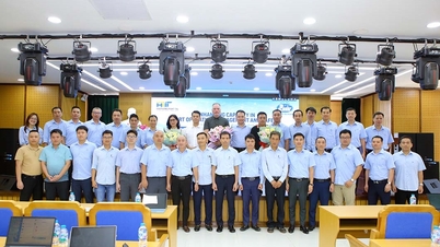
Mr. Nguyen Xuan Hien, Deputy Director of the National Center for Meteorological and Hydrological Forecasting, provided information on the investigation and survey activities to build an early warning system. Photo: Hoai Linh.
To date, the project has successfully established a real-time data transmission and warning system, guided people in accessing flood warning information, and implemented standard operating procedures (SOPs) to proactively respond to natural disasters.
In forecasting, monitoring rainfall and river levels is crucial. Rainfall is specifically classified from moderate to heavy to very heavy (over 100mm in 24 hours), helping to identify early risks of widespread or localized flooding in low-lying areas. Simultaneously, river levels are closely monitored according to three alert levels (I, II, and III) at hydrological stations on the Chung and Bac rivers. Understanding these alert levels allows authorities and residents in downstream areas to promptly implement measures to protect lives and property.

Users can access disaster risk maps on digital platforms via their phones. Photo: Hoai Linh.
The project has developed a digital disaster risk map that integrates data on rivers, streams, topography, rain gauges, water level stations, and operational information from reservoirs such as the Song Chung and Song Bac reservoirs. This platform allows for detailed warnings about floods, flash floods, and landslides based on administrative areas, providing strong support for government management. Meanwhile, standard operating procedures (SOPs) serve as a guide for response actions.
In the event of heavy rainfall or reservoir water release, the commune-level civil defense command and residents in the four project-area communes must strictly carry out their assigned tasks. Residents are encouraged to regularly update information through the project website and mass media to proactively assess the level of risk to their families and implement preventive measures as guided by local authorities to minimize damage.
Over the past period, the project has organized training on disaster prevention and mitigation for 83 local officials, village heads, and community group leaders. The trainees were guided in building digital disaster risk maps based on a two-tiered government model.
At the conference, the expert group from the National Center for Meteorological and Hydrological Forecasting continued to share details about the early warning system, SOP procedures, and the transfer of related website systems. Regarding the digital disaster risk map, representatives from the Center for Disaster Prevention and Control Policy & Technology guided the updating of maps according to local realities, instructed local officials on accessing the system, identifying warnings, locating risk areas and evacuation points, etc. The expert group will also summarize lessons learned from local experiences to improve the system in the future.
According to representatives from the communes, the transferred techniques are effective support that helps commune authorities promote the "four on-the-spot" principle and be more proactive in disaster prevention and control. The synchronized implementation of these solutions will contribute to minimizing risks and damage when natural disasters occur.
Source: https://nongnghiepmoitruong.vn/ban-giao-he-thong-canh-bao-som-lu-lut-cho-cong-dong-d802248.html


Comment (0)