

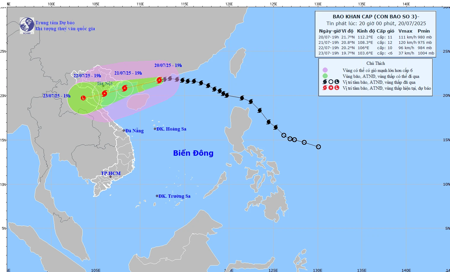
The predicted path of typhoon number 3 is based on the bulletin issued at 8 PM on July 20, 2025, by the National Center for Meteorological and Hydrological Forecasting.
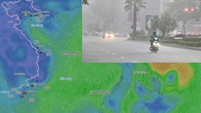
At 7 PM today, the storm's center was located at approximately 21.7 degrees North latitude and 112.2 degrees East longitude, in the northwestern part of the South China Sea, about 480km east of Quang Ninh - Hai Phong . The strongest winds were at level 11 (103-117 km/h), with gusts up to level 14. The storm was moving westward at a speed of about 20 km/h.
Forecast of storm developments (next 24 to 72 hours):
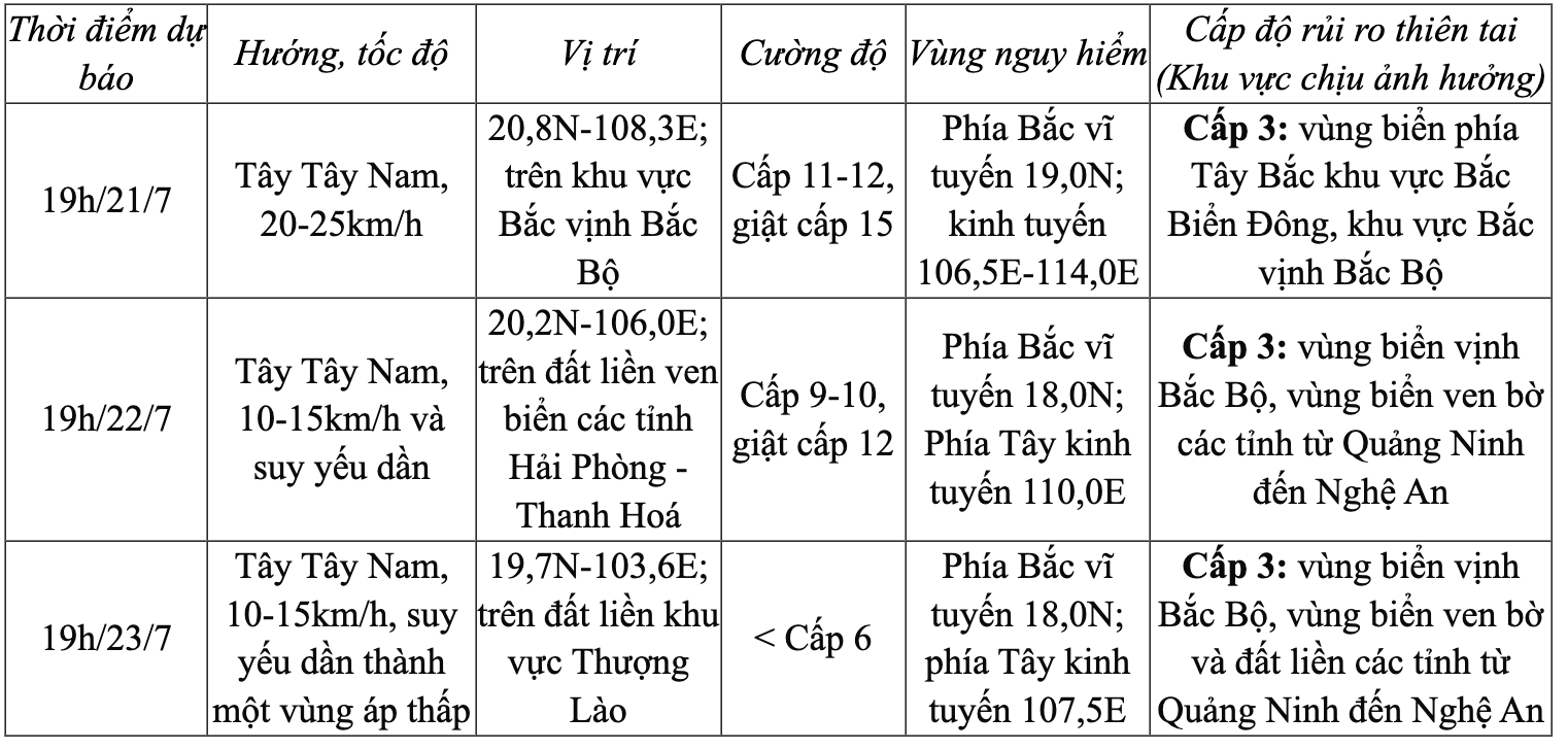
The storm brought strong winds and rough seas.
At sea:
Northwestern sea area of the North East Sea: Winds of force 8-9, near the storm center force 10-11, gusts up to force 14; waves 5-7m high, extremely rough seas.
Northern Gulf of Tonkin: Winds will gradually strengthen to force 6-7, then increase to force 8-9, reaching force 10-12 near the storm's center, with gusts up to force 15; waves will be 2-5 meters high, with extremely rough seas.
Southern Gulf of Tonkin: Winds of force 6-7, near the storm's center force 8-9, gusts up to force 11; waves 2-4m high, very rough seas.
On land: From the evening and night of July 21st, coastal areas from Quang Ninh to Nghe An will experience strong winds of force 7-9, near the storm's center force 10-11, gusting to force 14. Inland areas will experience strong winds of force 6-7, gusting to force 8-9.
Recommendation: No boats or ships are allowed to operate in the affected area. Warning of prolonged heavy rain, risk of flash floods and landslides in mountainous areas, and flooding in low-lying areas. Special attention should be paid to areas with total rainfall exceeding 200-300mm per event. |
NDS
Source: https://baothanhhoa.vn/bao-so-3-giam-cap-cach-quang-ninh-hai-phong-khoang-480km-255462.htm



















![[Infographics] Criteria and procedures for evaluating and classifying OCOP products](https://vphoto.vietnam.vn/thumb/402x226/vietnam/resource/IMAGE/2026/06/01/1780307493571_infographics-bo-w1200t0-di2622d199d1164352t11358l1-ocop-023.webp)

![[Photo] Reception to welcome General Secretary and President To Lam and his wife on their State visit to the Philippines](https://vphoto.vietnam.vn/thumb/1200x675/vietnam/resource/IMAGE/2026/06/01/1780295488620_vna-potal-chieu-dai-chao-mung-tong-bi-thu-chu-tich-nuoc-to-lam-va-phu-nhan-tham-cap-nha-nuoc-toi-philippines-8798060-7855-jpg.webp)























































Comment (0)