

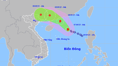
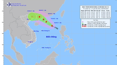
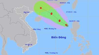
The National Center for Hydro-Meteorological Forecasting reported that this afternoon, September 6, the tropical depression in the northeastern part of the East Sea has strengthened into storm number 7.
At 4 p.m., the storm center was at about 18.4 degrees North latitude - 116.3 degrees East longitude, with the strongest wind at level 8 (62-74 km/h), gusting to level 10. The storm was moving northwest at a speed of 15 km/h.
")
In the next 24-48 hours, the storm will continue to strengthen. By tomorrow afternoon, September 7, the storm center will be at 20.2 degrees North latitude - 113.8 degrees East longitude, about 420km northeast of Hoang Sa archipelago, with strong winds increasing to level 9-10, gusting to level 12.
The danger zone is 17-22 degrees North latitude and 112-117.5 degrees East longitude. By dawn on September 8, the storm was near Hong Kong (China), with winds of level 10, gusts of level 13. The northern and northwestern waters of the East Sea were warned of a natural disaster risk level of level 3.
In the next 48-72 hours, the storm will move northwest at a speed of about 15km/h. On the afternoon of September 8, the center of the storm was located on the mainland of Guangdong province (China), with strong winds of level 9, gusting to level 12. On September 9, the storm continued to move deep into the mainland of Guangxi, weakening into a tropical depression and then dissipating into a low pressure area.
Source: https://www.sggp.org.vn/bao-so-7-da-hinh-thanh-tren-bien-dong-post811904.html
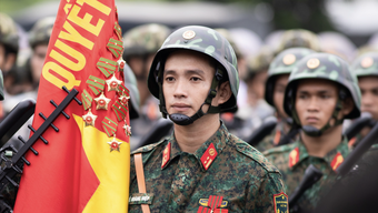
![[Photo] 80th Anniversary of the General Staff of the Vietnam People's Army](https://vphoto.vietnam.vn/thumb/1200x675/vietnam/resource/IMAGE/2025/9/6/49153e2a2ffc43b7b5b5396399b0c471)
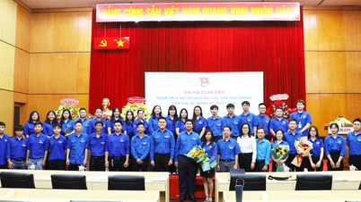
![[Photo] Prime Minister Pham Minh Chinh attends the 80th Anniversary of the Vietnam Posts and Telecommunications Group](https://vphoto.vietnam.vn/thumb/1200x675/vietnam/resource/IMAGE/2025/9/6/39a89e5461774c2ca64c006d227c6a4e)


![[Photo] General Secretary To Lam attends the 80th Anniversary of the General Staff of the Vietnam People's Army](https://vphoto.vietnam.vn/thumb/1200x675/vietnam/resource/IMAGE/2025/9/6/126697ab3e904fd68a2a510323659767)
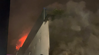
![[Photo] Rescuing people in flooded areas at the foot of Prenn Pass overnight](https://vphoto.vietnam.vn/thumb/1200x675/vietnam/resource/IMAGE/2025/9/6/19095b01eb844de98c406cc135b2f96c)


![[Photo] Many people directly experience beloved Uncle Ho and the General Secretaries](https://vphoto.vietnam.vn/thumb/1200x675/vietnam/resource/IMAGE/2025/9/6/2f4d9a1c1ef14be3933dbef3cd5403f6)


Comment (0)