

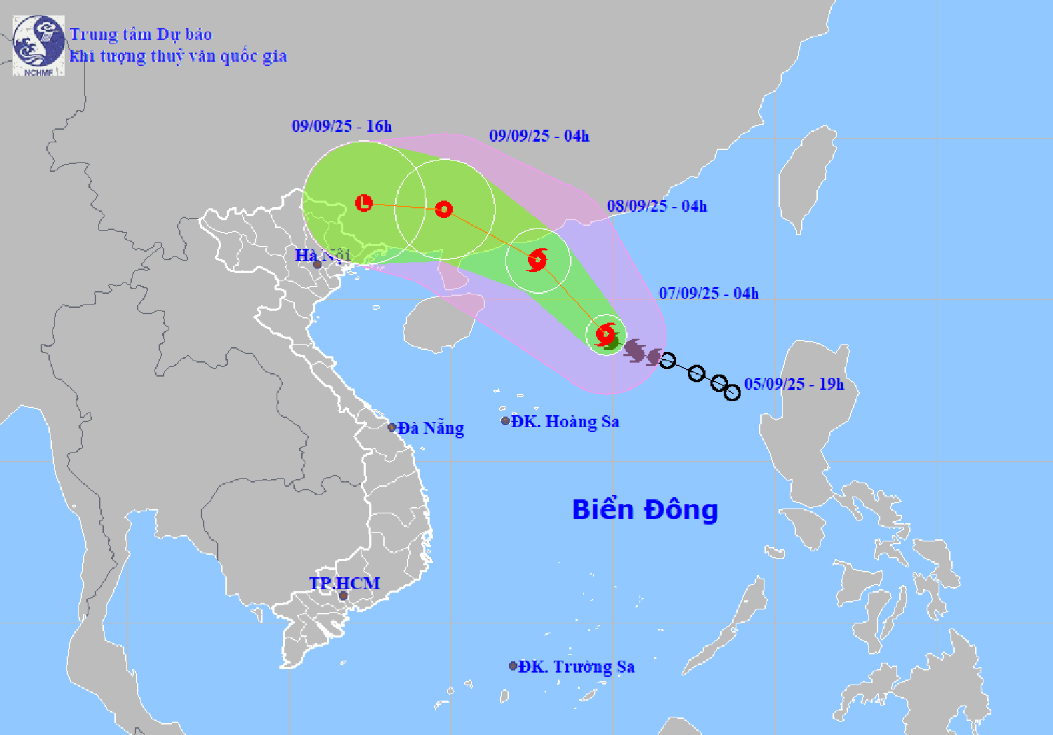
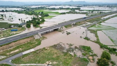
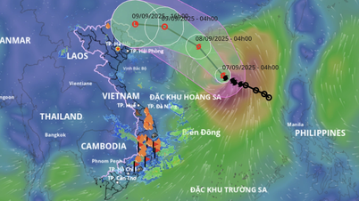
According to the National Center for Hydro-Meteorological Forecasting, at 4:00 a.m. on September 7, the center of storm No. 7 was at about 18.9 degrees north latitude, 114.8 degrees east longitude.
East longitude, on the northern sea area of the North East Sea. The strongest wind near the storm center is level 8 - 9 (62 - 88 km/h), gusting to level 11; moving northwest at a speed of 10 km/h.
It is forecasted that in the next 24 hours, storm No. 7 will move northwest at a speed of about 10-15 km/h and is likely to strengthen. At 4:00 a.m. on September 8, the center of the storm was located in the sea south of Guangdong province (China), with a strength of level 10, gusting to level 13.
In the next 24 hours, storm No. 7 will continue to move northwest at a speed of about 15 km/h and gradually weaken. At 4:00 a.m. on September 9, the storm center will be on the mainland of Guangdong province (China), with strong winds of level 6-7, gusting to level 9.
At 4:00 p.m. on September 9, storm No. 7 weakened into a low pressure area over the mainland of Guangxi province (China).
Due to the impact of the storm, the northern sea area of the North East Sea has strong winds of level 7-8, near the storm center level 9-10, gusting to level 13; waves 3-5 m high, very rough seas. Ships operating in the above-mentioned dangerous areas are likely to be affected by storms, whirlwinds, strong winds, and large waves.
PVSource: https://baohaiphong.vn/bao-so-7-se-do-bo-vao-trung-quoc-520131.html
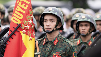
![[Photo] 80th Anniversary of the General Staff of the Vietnam People's Army](https://vphoto.vietnam.vn/thumb/1200x675/vietnam/resource/IMAGE/2025/9/6/49153e2a2ffc43b7b5b5396399b0c471)


![[Photo] Prime Minister Pham Minh Chinh attends the 80th Anniversary of the Vietnam Posts and Telecommunications Group](https://vphoto.vietnam.vn/thumb/1200x675/vietnam/resource/IMAGE/2025/9/6/39a89e5461774c2ca64c006d227c6a4e)
![[Photo] General Secretary To Lam attends the 80th Anniversary of the General Staff of the Vietnam People's Army](https://vphoto.vietnam.vn/thumb/1200x675/vietnam/resource/IMAGE/2025/9/6/126697ab3e904fd68a2a510323659767)
![[Photo] Rescuing people in flooded areas at the foot of Prenn Pass overnight](https://vphoto.vietnam.vn/thumb/1200x675/vietnam/resource/IMAGE/2025/9/6/19095b01eb844de98c406cc135b2f96c)


![[Photo] Many people directly experience beloved Uncle Ho and the General Secretaries](https://vphoto.vietnam.vn/thumb/1200x675/vietnam/resource/IMAGE/2025/9/6/2f4d9a1c1ef14be3933dbef3cd5403f6)


![[COMING UP] Workshop: Resolving concerns for Business Households about eliminating lump-sum tax](https://vphoto.vietnam.vn/thumb/402x226/vietnam/resource/IMAGE/2025/9/7/5627bb2d0c3349f2bf26accd8ca6dbc2)


Comment (0)