
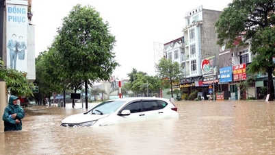
From above, the central area of Cao Bang appears like a vast river area. Many residential areas were submerged, floodwaters rose high enough to cover roofs in the historic flood caused by the circulation of storm No. 11 (Matmo).
At noon on October 8, the rain stopped and water in some riverside areas in the center of Cao Bang province began to recede slowly.
Mr. Ha Kim Cuong, a blogger specializing in reporting news about Cao Bang, used a flycam to capture the flooded areas in the wards of Thuc Phan, Tan Giang, and Nung Tri Cao. From above, the center of Cao Bang was submerged in floodwater. In particular, the main streets of the old Hop Giang Ward, now Thuc Phan Ward, were severely flooded.

Central Cao Bang area flooded, exceeding the historical flood peak of 1986
PHOTO: HA CUONG
From above, the muddy water surrounded the rows of houses here, many houses were flooded up to the first floor.
PHOTO: HA CUONG
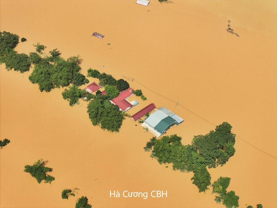
Some other areas were deeply flooded, flood water rose to the roof.
PHOTO: HA CUONG
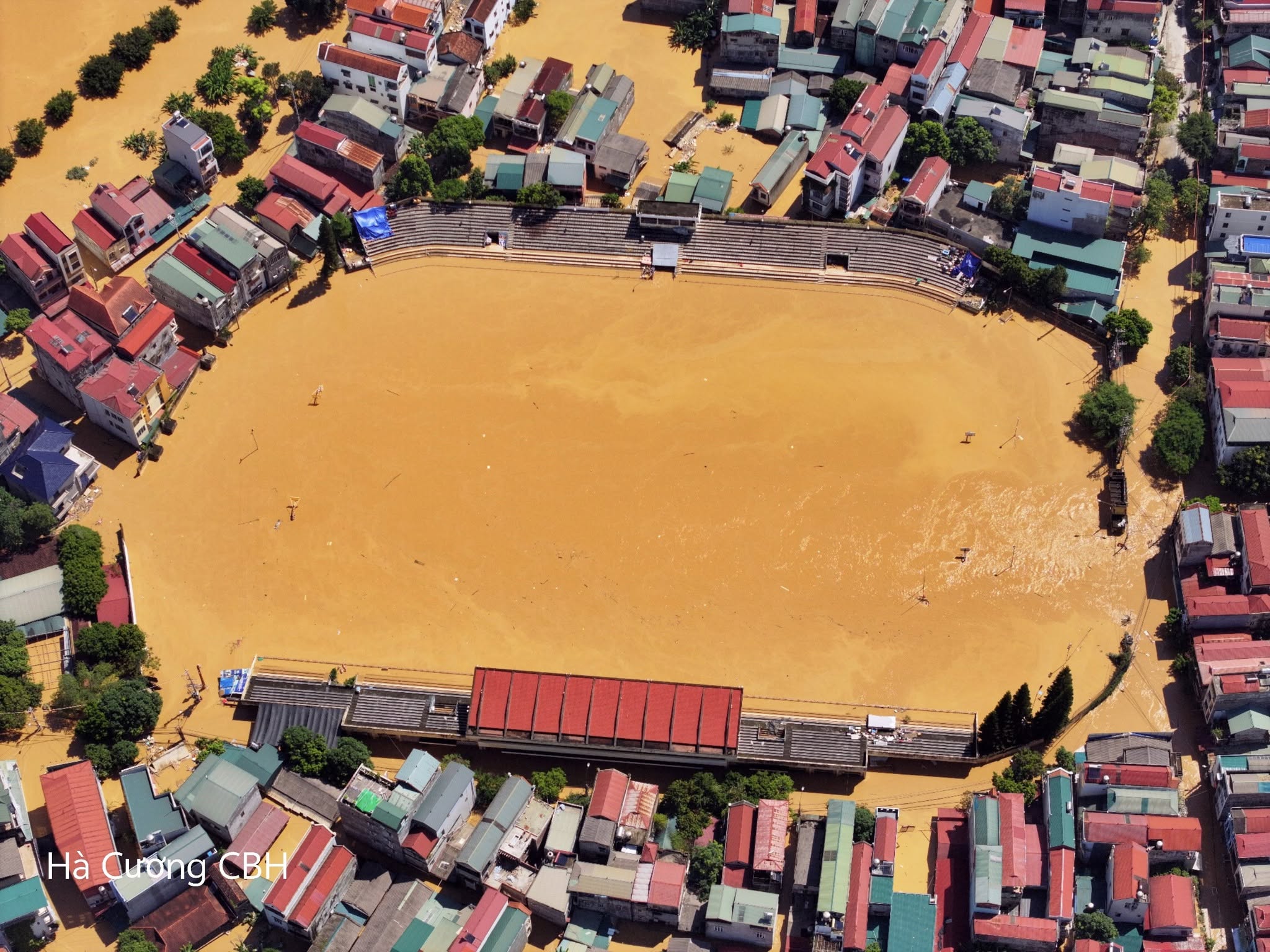
Muddy water surrounded the old Cao Bang City Stadium (now Thuc Phan Ward)
PHOTO: HA CUONG
When will Thai Nguyen, Cao Bang, and Lang Son be flooded?
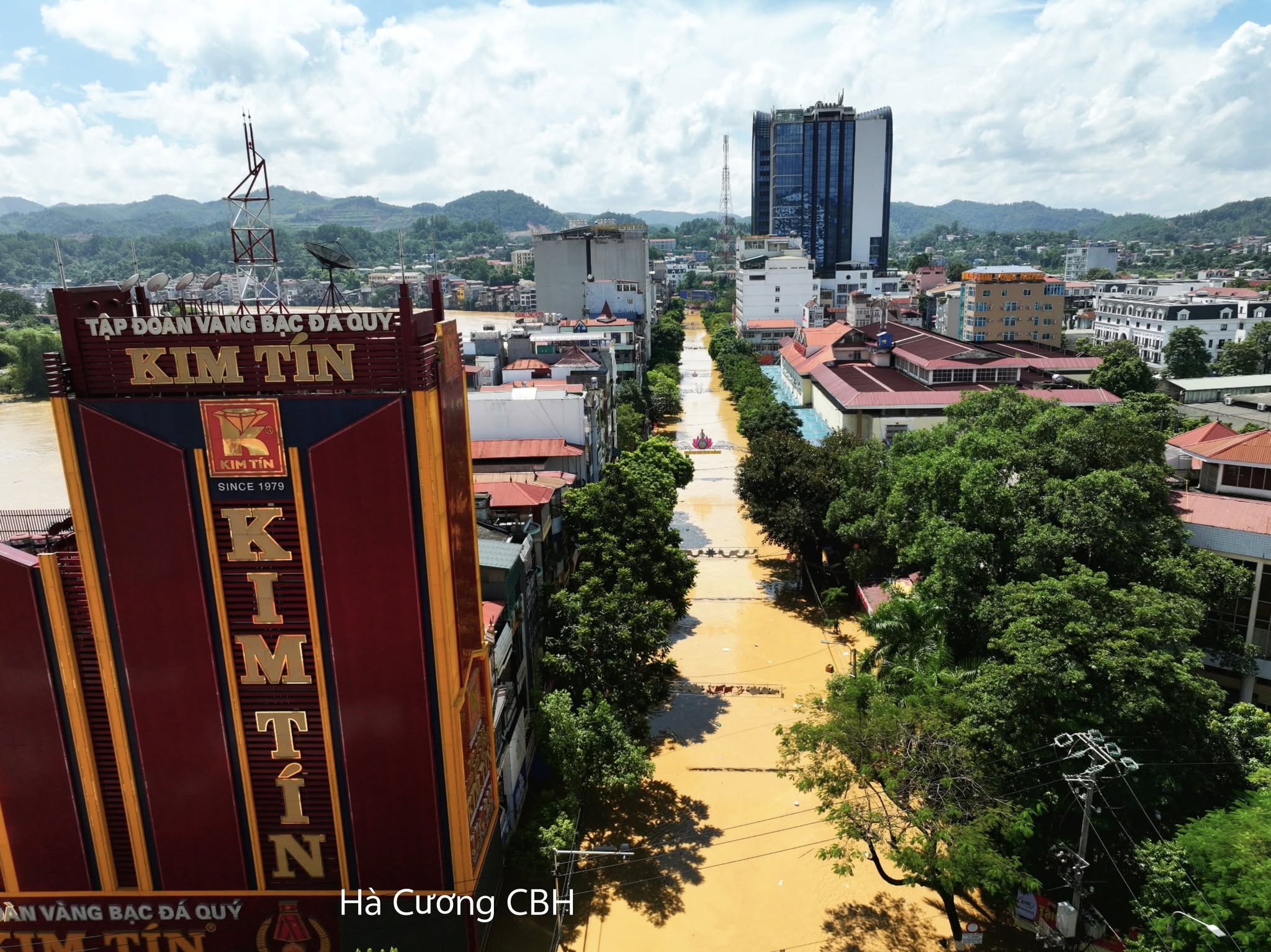
Cao Bang center is also in a state of severe flooding.
PHOTO: HA CUONG

Vast floodwaters have submerged rice fields in Cao Bang. According to the forecast from the Cao Bang Provincial Hydrometeorological Center, in the next 6-24 hours, the flood on the Bang River will continue to decrease slowly, the flood level will remain above BĐ 3.
PHOTO: HA CUONG
Thanhnien.vn
Source: https://thanhnien.vn/cao-bang-van-chim-nghim-trong-tran-lu-lich-su-185251009082714485.htm


![[Photo] Impressions of the Can Gio Whale Festival](https://vphoto.vietnam.vn/thumb/1200x675/vietnam/resource/IMAGE/2025/10/09/1759984089762_image12334-5642-jpg.webp)

![[Photo] Prime Minister Pham Minh Chinh chairs the Conference to deploy the National Target Program on Drug Prevention and Control until 2030](https://vphoto.vietnam.vn/thumb/1200x675/vietnam/resource/IMAGE/2025/10/09/1759990393779_dsc-0495-jpg.webp)


Comment (0)