
 |
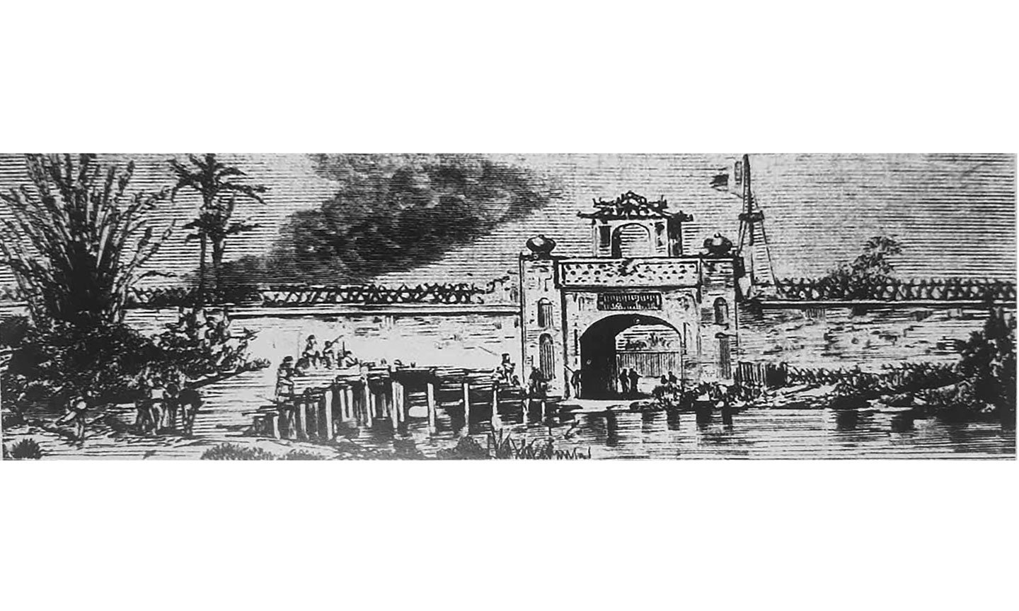
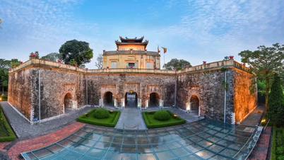
| Nam My Tho Citadel Gate. Photo: Document |
In 1679, a group of Minh Huong people led by Duong Ngan Dich, with the permission of Lord Nguyen, entered My Tho to settle down. In the new land, with the protection of Lord Nguyen's government and the care and support of the Vietnamese people, these Minh Huong people specialized in commercial activities.
On that basis, My Tho Dai Pho, or My Tho Big Market, was established in My Chanh village, Kien Hoa district. At that time, My Tho Dai Pho was one of the two largest economic and commercial centers in the South. Trinh Hoai Duc in his book Gia Dinh Thanh Thong Chi described the prosperity of My Tho Dai Pho as follows: "My Tho Dai Pho has tiled houses with carved pillars, high communal houses, large pagodas.... River and sea boats from all directions come and anchor crowdedly, creating a bustling, bustling metropolis..." and "all merchant ships passing by must anchor on My Tho River, enjoy the cool breeze, watch the moon, wait for the tide to rise, and go with the flow to the west or down to the east".
The prosperity of My Tho market proves that agricultural production and the commodity economy here have made significant progress. Agricultural products are not only sufficient for the needs of My Tho residents, but also have a large surplus, becoming goods traded in the national market and exported abroad.
Thus, the outstanding strength of My Tho city is trade and trade here has reached the world level. That strength comes from the connection between agricultural production and processing and exporting agricultural products, especially rice, dried areca nuts and seafood.
On that basis, in 1781, the headquarters of Tran Dinh citadel from Kien Dinh mound (before July 1, 2025, Tan Hiep town, Chau Thanh district, Tien Giang province) was moved to My Chanh village - My Tho market (Ward 2, old My Tho city, now My Tho ward, Dong Thap province). Since then, My Tho has become the political, economic and cultural center of the whole region.
In 1792, also at the headquarters of Tran Dinh citadel, obeying the order of Lord Nguyen Phuc Anh (later King Gia Long), Tran Van Hoc drew a map of My Tho citadel. The main part of the book Dai Nam liet truyen recorded: "Hoc presented a map (of My Tho citadel), Hoc was good at drawing, building fortifications, measuring roads, drawing maps, and marking out the landmarks, all were done by Hoc's hands."
The person who designed My Tho citadel in 1792 was Tran Van Hoc. His year of birth is unknown, he was from Binh Duong district, Phien An town (before July 1, 2025, it belonged to Binh Thanh district, Ho Chi Minh City). It can be said that Mr. Tran Van Hoc was both a military general of the Nguyen Dynasty and a talented cartographer and technical designer. He is considered the first Vietnamese to draw maps and design ramparts with reference to advanced Western rampart construction methods. |
Trinh Hoai Duc described My Tho citadel in Gia Dinh Thanh Thong Chi as follows: “The citadel is square in shape, with a perimeter of 998 fathoms (about 2,000 m), with two gates on the left and right sides. At the gate, there is a bridge built across the moat. The moat is 8 fathoms (about 16 m) wide and 1 fathom (about 2 m) deep. Under the bridge is a small sluice gate to connect with the big river (Tien River). Outside the moat, there is an earthen rampart, with convex and concave corners like the shape of an apricot blossom. At the foot of the rampart, the frontage is 30 fathoms (about 60 m) to the big river. Inside the citadel, there are rice warehouses, ammunition warehouses, military camps and large guns, fully and strictly stocked.”
My Tho Citadel has 3 sides bordering rivers, canals, and streams, which are considered natural ramparts: The South borders Tien River (the citadel wall is now Dinh Bo Linh Street), where there is a place for horse bathing, now known as Horse Bathing Wharf; the East borders Bao Dinh Canal (the citadel wall is now Thai Sanh Hanh Street); the West borders a natural canal (today's Nguyen Huynh Duc Street was at that time a canal connecting Tien River with Bao Dinh Canal at Vy Bridge; this canal was filled in around 1934 - 1935 according to the urban renovation plan of the French colonial government).
At that time, the whole South had only two large-scale citadels: My Tho citadel and Gia Dinh citadel (built in 1790, also designed by Tran Van Hoc). Thus, by the end of the 18th century, because there was a bustling market street (My Tho Dai Pho); a complete administrative system (Tran Dinh palace) and a solid citadel (My Tho citadel) with a permanent army to protect it, My Tho had become a true urban area.
As a military general, he helped Lord Nguyen Phuc Anh with many things, the most important of which was communication with Siam (Thailand), Portugal, France... Because he had traveled to many countries, including some European countries, he had knowledge of Western science and technology.
In particular, he was also good at foreign languages, so he was always a powerful assistant to Lord Nguyen Phuc Anh in the work of interpretation, book translation, and also in the manufacture of fire chariots (a type of war tool), landmines, and other types of weapons.
In 1790, Lord Nguyen Phuc Anh ordered the construction of Gia Dinh citadel (also known as Bat Quai citadel or Quy citadel). Knowing that he had knowledge of Western graphic techniques, he was assigned the task of "measuring the land and the intersections", that is, drawing the roads and dividing the streets inside the citadel. Later, he also learned how to build copper-clad ships in the new style of the French and, together with Vannier (recorded in Nguyen Dynasty history as Nguyen Van Chan), commanded large copper-clad ships in Lord Nguyen Phuc Anh's navy.
In 1792, he drew a map of My Tho citadel. This citadel (including Gia Dinh citadel in 1790) was designed with reference to the style of Vauban citadel of France. It is known that Vauban is the name of a French architect under Louis XIV with the full name of Sébastien Le Prestre de Vauban (1633 - 1707). Vauban citadel is a complex system of closely related architectural works with comprehensive defense from the citadel wall, fortress, guard tower, cannon gate, firing wall... to the citadel moat and the outer moat perimeter. When carefully calculated in terms of arrangement and size, that massive construction can completely create "impregnable cities".
In 1803, he was appointed Cai Co; then promoted to Giam Thanh Su Kham Sai Chuong Co. In 1815, he drew the map of Gia Dinh citadel for the second time. In 1821, despite his old age, he was still trusted by King Minh Mang, who granted him 100 quan of money to 5 towns: Phien An, Bien Hoa, Dinh Tuong, Vinh Thanh, An Giang belonging to Gia Dinh citadel and the border between our country and Chan Lap (Cambodia) to draw maps of mountains, rivers, and roads. However, while the work was still in the preparation stage, he fell ill and died.
NGUYEN PHUC NGHIEP
Source: https://baoapbac.vn/van-hoa-nghe-thuat/202507/chuyen-ve-nguoi-ve-hoa-do-thanh-my-tho-1046801/


Comment (0)