

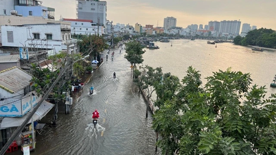
During business trips or whenever I have the chance to return to my hometown of Quang Tri, I always make time to visit Hien Luong Bridge, which spans the Ben Hai River and has become a part of the history of the war against the US. That river, unintentionally, has become a historical witness, flowing gently downstream through my village before reaching the Cua Tung sea. Today, the historical sites on both banks of Hien Luong - Ben Hai have become part of Quang Tri's DMZ (Demilitarized Zone ) tours, attracting domestic and international tourists.
River line
During a recent business trip with young people from the Binh Thuan Department of Industry and Trade to attend the "Meeting Thailand" program in Dong Ha city, I noticed a shared interest among the young people in the group in visiting historical sites related to the Hien Luong Bridge. The DMZ tourist destination is only about 24 km north of Dong Ha, making it convenient for a weekend visit. That summer morning, without the usual dry, hot winds, the air was pleasantly cool, seemingly welcoming the young people from Binh Thuan to the Hien Luong Bridge and Ben Hai River. The members of the group were excited to visit the famous historical sites in this border region, a place once marked by war and conflict. This "red address" is now the Special National Historical Site of Hien Luong - Ben Hai, covering 9 hectares and including: a historical exhibition house; a border flagpole; a combined building; a police station; the historic Hien Luong Bridge; loudspeaker systems; and a watchtower...
The historical exhibition hall at the historical site commemorates a time when, after the Geneva Accords were signed (July 1954), our country was temporarily divided into two regions, North and South, with the 17th parallel on the Ben Hai River as the boundary, awaiting a general election in July 1956 to unify the country. However, due to the sabotage of hostile forces, it took us 21 years, until 1975, with the blood and sacrifice of our soldiers and people, to achieve independence and national reunification.
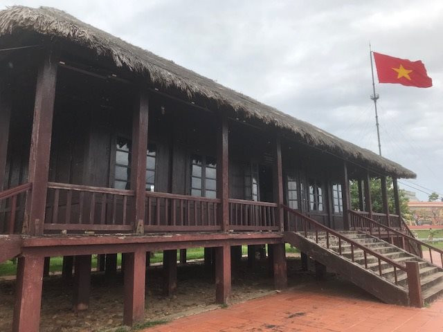
Now, the Joint House – a structure restored in July 2004 in the historical site as a landmark of that period of division – is a stilt house made of precious wood, with a thatched roof, airy and cool, serving as the workplace of the 76th International Monitoring Team for the implementation of the Geneva Agreement.
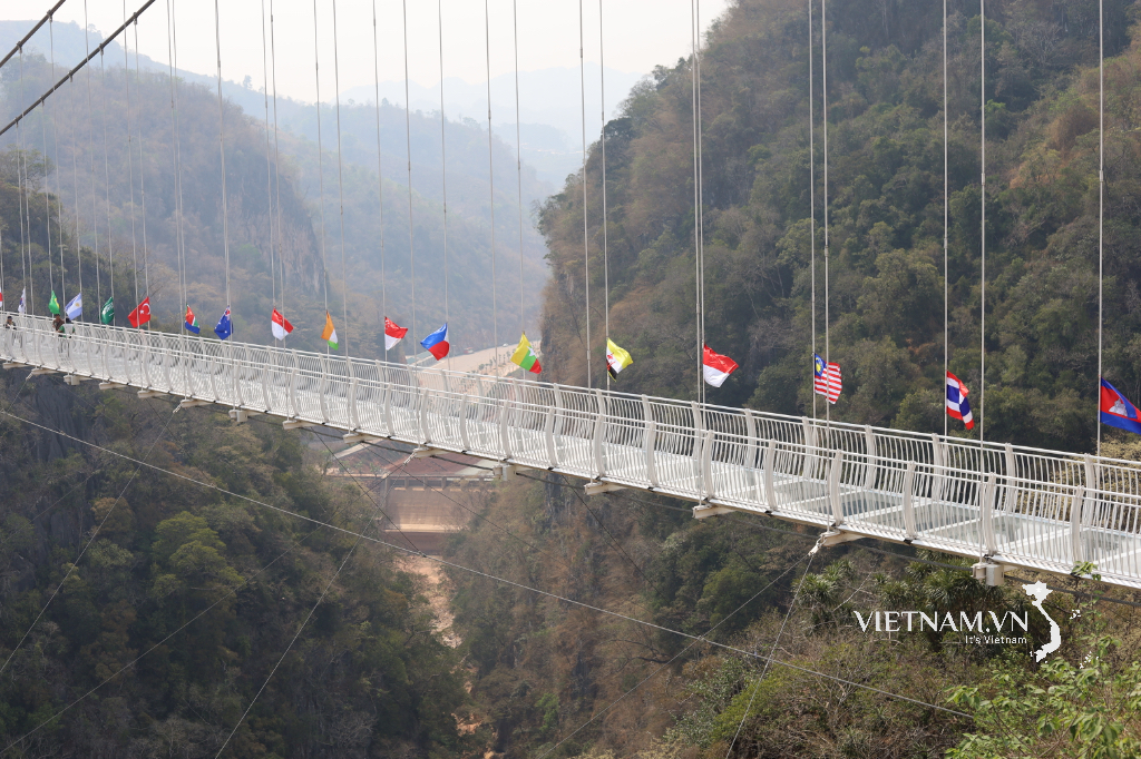
Hien Luong Bridge
Meanwhile, Hien Luong Bridge is the centerpiece of the Hien Luong - Ben Hai National Special Historical Relic Site. The bridge is located right on the 17th parallel, spanning the Ben Hai River, passing through Hien Luong village, Vinh Thanh commune, Vinh Linh district on the north bank and Xuan Hoa village, Trung Hai commune, Gio Linh district on the south bank ( Quang Tri province ). Looking at a map of Vietnam, the Ben Hai River resembles a thin silk ribbon, originating from the summit of Dong Chan mountain in the Truong Son mountain range before meandering along the 17th parallel and reaching the open sea at Cua Tung. Ben Hai also serves as the natural boundary between Vinh Linh and Gio Linh districts of Quang Tri province, with Minh Luong village (old name) on the north bank and Xuan Hoa village on the south bank.
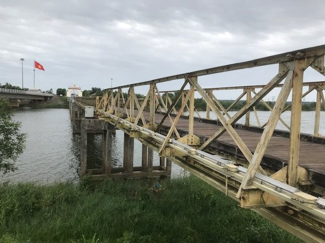
According to the book "Dai Nam Nhat Thong Chi," during the reign of Emperor Minh Mang, to avoid violating the taboo of using the emperor's name, Minh Luong was renamed Hien Luong. At this time, trade and travel were still only carried out by ferry. It wasn't until 1928, in an effort to connect the two banks, that the Vinh Linh prefecture mobilized thousands of local laborers from the North to build a bridge. After a short time, Hien Luong was officially formed, 2 meters wide, built with iron piles, and intended exclusively for pedestrians. Later, the French continued to upgrade the bridge to allow small vehicles to pass. By 1950, to serve the growing transportation and military needs, the French decided to build a reinforced concrete bridge, officially making Hien Luong an important part of the North-South highway. At that time, the bridge was 162 meters long, 3.6 meters wide, and had a load capacity of 10 tons. The bridge lasted for two years before being destroyed by guerrillas using explosives to prevent French attacks. In May 1952, Hien Luong Bridge was rebuilt with 7 spans, 178m long, reinforced concrete pillars, steel beams, and a pine wood deck, 4m wide. The bridge had 1.2m high railings on both sides. The maximum load capacity was up to 18 tons. This was also the original bridge, which existed for 15 years as the demarcation line during the war against the US.
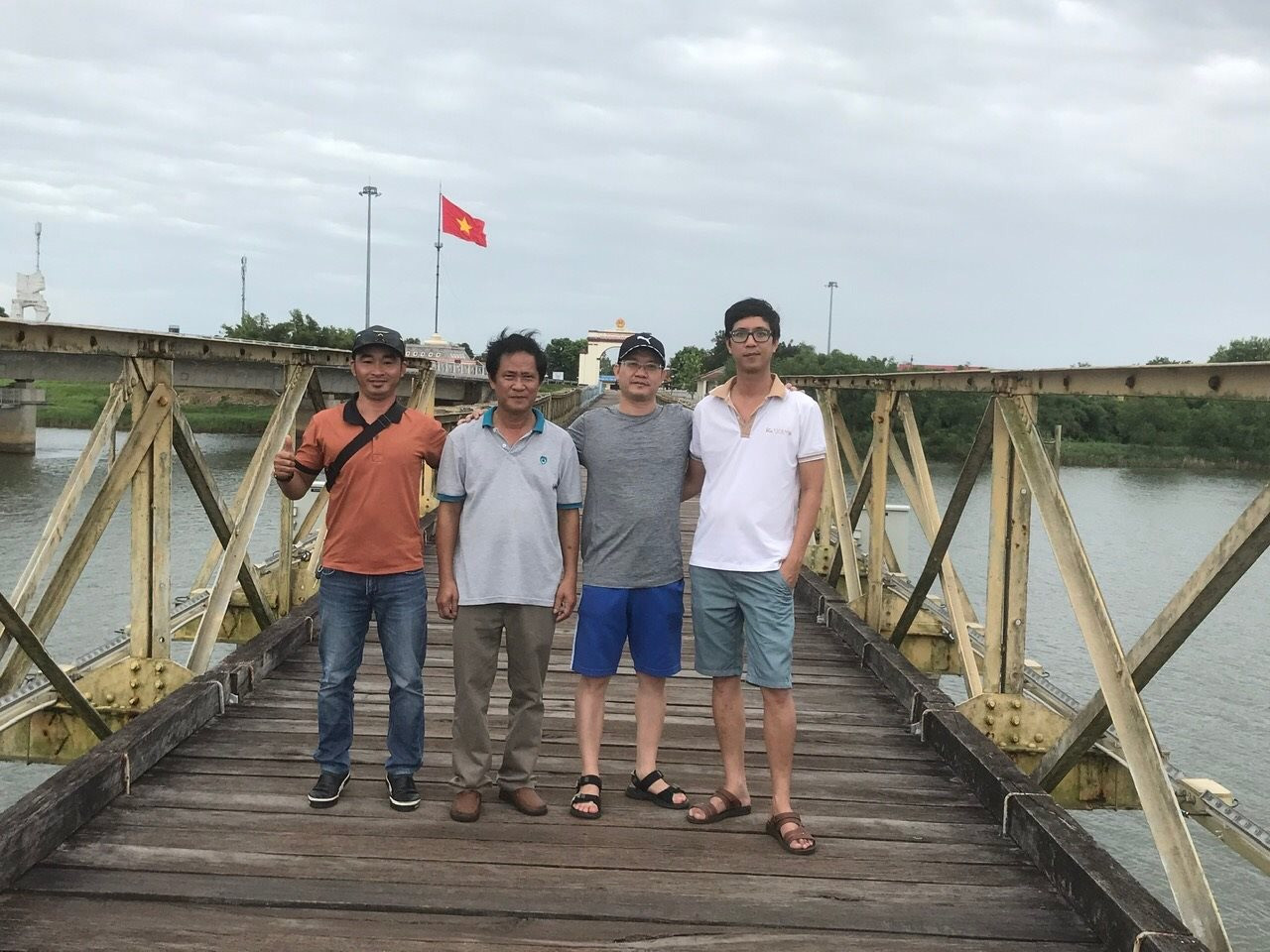
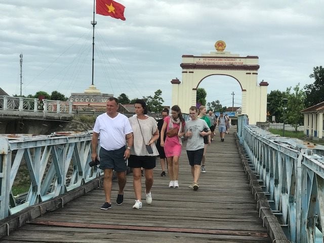
Today, when crossing this historic bridge, almost everyone slows down to touch upon "history"; the bridge is a witness to a time when the North and South were divided, and it reunited the land nearly 50 years ago. A member of the Binh Thuan delegation, standing on the Hien Luong bridge at the time, shared: "Having traveled back and forth between the North and South several times, I feel proud to stop and visit the Hien Luong - Ben Hai National Special Historical Site in Quang Tri province. This is the first time I've seen a historical site in such detail that I only knew about it from books." Not only young people from Binh Thuan, but also female students from Thua Thien Hue province, visiting for the first time during the summer, chatted interestingly about this historic bridge as they walked. That day, there was also a large group of Western tourists, both men and women, who walked slowly across the bridge, stopping to take commemorative photos, pointing down at the Ben Hai River as a testament to the war that had long since ended. As for me, I've only ever driven across the Hien Luong Bridge a couple of times before. Once, while visiting my hometown, I encountered the persistent drizzle typical of Central Vietnam, forcing me to turn back with regret. This summer, however, the weather was sunny and the breeze from the Ben Hai River was refreshing. My friends and I from the Binh Thuan group had ample time to explore and photograph the special national historical site of Hien Luong-Ben Hai. I walked slowly across the historic bridge, located right in my hometown (Trung Hai commune, Gio Linh district, Quang Tri province), filled with the pride of a son far from home revisiting this special historical site of my homeland, a testament to the heroic years of the resistance war against the US until the reunification of the country.
I suddenly remembered my fellow villagers from Bach Loc, Trung Hai, Gio Linh, when they talked about the years they followed the K7 and K8 units to the North to escape bombing and study during the war against America. They said goodbye to their villages along the river, but it was almost 10 years later, after the liberation of the South, that they were able to return to their hometowns, reunite with their families, and start businesses. Some people were displaced to the South, busy with making a living, and only had the opportunity to visit their hometowns and admire the Hien Luong Bridge over the romantic Ben Hai River after more than half their lives... Today, the Hien Luong - Ben Hai National Special Historical Site is a popular choice for tourists visiting Quang Tri. In Binh Thuan, cultural and historical sites need to be linked together to create tours that attract tourists; similar to the DMZ tour, a unique product of Quang Tri.
Source


![[Photo] Prime Minister Pham Minh Chinh presides over a meeting of the Steering Committee for the construction of the nuclear power plant.](https://vphoto.vietnam.vn/thumb/1200x675/vietnam/resource/IMAGE/2026/02/13/1770947038316_dsc-1534-jpg.webp)


Comment (0)