.jpeg)
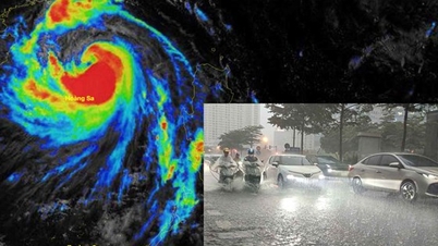
To proactively prevent and minimize damage caused by storm Matmo (storm No. 9), the Chairman of Hai Phong City People's Committee requested departments, branches and localities to absolutely not be subjective, closely monitor storm forecasts, and fully prepare necessary conditions to respond promptly. Be especially vigilant against thunderstorms, tornadoes, and lightning that may occur before the storm directly affects.
Urgently review and deploy storm prevention plans approved in Plan No. 01/PA-UBND and Plan No. 213/KH-UBND dated August 25, 2025, ensuring they are appropriate to the level of natural disaster risk.
Strengthen propaganda so that people can grasp the storm situation, proactively prevent and ensure safety for people and property.
The City Border Guard is tasked with checking, counting and promptly notifying vessels operating at sea to plan safe anchoring and maintain communication to effectively respond to all situations.
The Department of Agriculture and Environment is responsible for inspecting and directing the work of ensuring the safety of the dyke system, irrigation, dams, especially in locations affected by the recent storm No. 10. The Director of the Department of Agriculture and Environment, Deputy Head of the City Civil Defense Command, directs the development and promulgation of scenarios for the City Civil Defense Command to specifically respond to the storm.
Storm Matmo affects the Quang Ninh - Hai Phong area from the afternoon of October 5
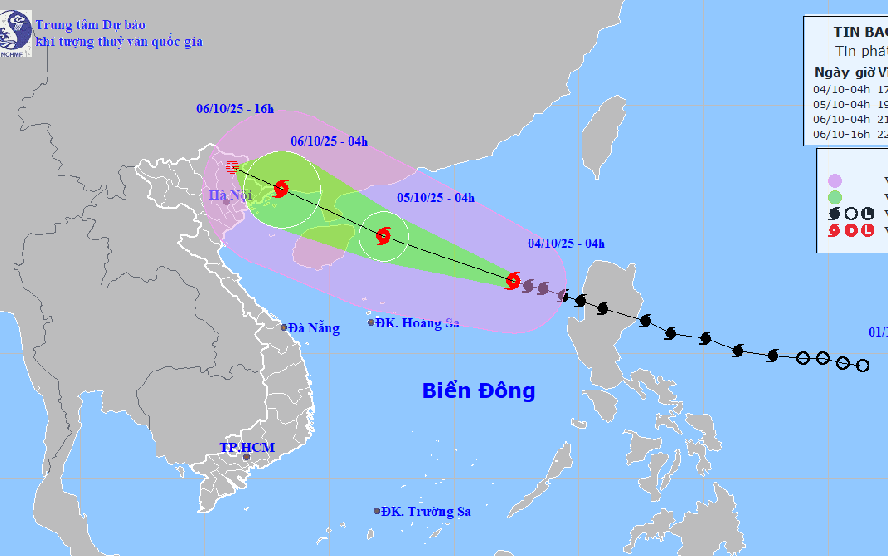
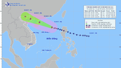
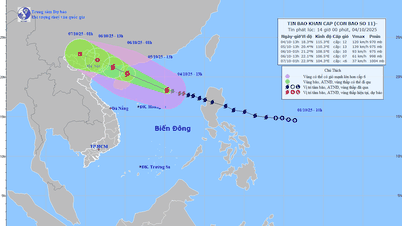
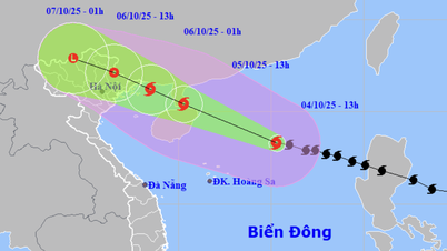
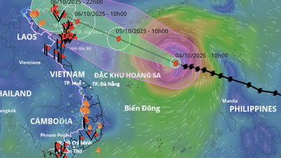
According to the National Center for Hydro-Meteorological Forecasting, at 4:00 a.m. on October 4, the center of storm Matmo (storm No. 11) was located at about 17.9 degrees North latitude; 117.4 degrees East longitude, in the eastern sea of the North East Sea, about 570km East Northeast of Hoang Sa special zone.
The strongest wind near the storm center is level 11 (103 - 117 km/h), gusting to level 14. The storm moves in the West Northwest direction at a speed of about 25 km/h.
It is forecasted that in the next 24 - 60 hours, storm Matmo will move in the West Northwest direction, at a speed of 20 - 25 km/h and may strengthen.
At 4:00 a.m. on October 5, storm Matmo was located at approximately 19.7 degrees North latitude; 112.2 degrees East longitude; in the North East Sea, approximately 130km east of Leizhou Peninsula (China). The strongest wind near the storm center was level 13, gusting to level 16.
Due to the influence of the storm, the North East Sea area has strong winds of level 8 - 10, the area near the storm's eye has winds of level 11 - 13, gusts of level 16, waves 4.0 - 6.0m high, the area near the storm's eye has waves of 6.0 - 8.0m, the sea is very rough (extremely destructive, extremely strong waves. Sinking large ships).
From the afternoon of October 5, the sea area east of the Northern Gulf of Tonkin (including Bach Long Vi special zone) has winds gradually increasing to level 6 - 7, then increasing to level 8 - 9.
From the evening of October 5, the Northern Gulf of Tonkin area (including Bach Long Vi, Van Don, Co To, Cat Hai and Hon Dau islands) will have stronger winds of level 8 - 9, waves 2.0 - 4.0m high, near the storm center will be level 10 - 11, gusts of level 14, waves 3.0 - 5.0m high, and very rough seas (very rough seas, very dangerous for ships).
Coastal areas and islands in Quang Ninh - Hai Phong provinces have storm surges of 0.4 - 0.6 m. Beware of flooding in low-lying coastal areas and river mouths due to surges and big waves from the afternoon and evening of October 5.
Source: https://baohaiphong.vn/hai-phong-phai-dac-biet-canh-giac-voi-dong-loc-set-co-the-xay-ra-truoc-khi-bao-anh-huong-truc-tiep-522539.html


![[Photo] General Secretary To Lam attends the 8th Congress of the Central Public Security Party Committee](https://vphoto.vietnam.vn/thumb/1200x675/vietnam/resource/IMAGE/2025/10/4/79fadf490f674dc483794f2d955f6045)


![[Photo] Bustling Mid-Autumn Festival at the Museum of Ethnology](https://vphoto.vietnam.vn/thumb/1200x675/vietnam/resource/IMAGE/2025/10/4/da8d5927734d4ca58e3eced14bc435a3)

![[Photo] Solemn opening of the 8th Congress of the Central Public Security Party Committee, term 2025-2030](https://vphoto.vietnam.vn/thumb/1200x675/vietnam/resource/IMAGE/2025/10/4/f3b00fb779f44979809441a4dac5c7df)











![[VIDEO] Summary of Petrovietnam's 50th Anniversary Ceremony](https://vphoto.vietnam.vn/thumb/402x226/vietnam/resource/IMAGE/2025/10/4/abe133bdb8114793a16d4fe3e5bd0f12)
![[VIDEO] GENERAL SECRETARY TO LAM AWARDS PETROVIETNAM 8 GOLDEN WORDS: "PIONEER - EXCELLENT - SUSTAINABLE - GLOBAL"](https://vphoto.vietnam.vn/thumb/402x226/vietnam/resource/IMAGE/2025/7/23/c2fdb48863e846cfa9fb8e6ea9cf44e7)







Comment (0)