Causes of consecutive hail
According to the National Center for Hydro-Meteorological Forecasting, hail is a phenomenon with stone particles of different sizes falling from strong convective thunderstorm clouds, growing very high, often occurring in strong thunderstorms, at the transition from winter to summer and often accompanied by heavy rain showers lasting from a few minutes to a few dozen minutes.
In fact, in the past two days (March 27 and 28), in Yen Bai , Ha Giang, Lao Cai, Cao Bang and Nghe An, there have been thunderstorms and hailstorms causing damage to crops, livestock and houses.
Currently, the North and North Central regions are in the transitional season, so thunderstorms are likely to be accompanied by extreme weather phenomena such as tornadoes, lightning or hail.
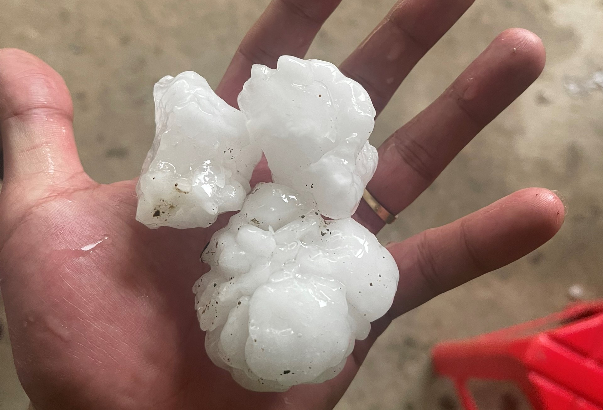
Stones with diameters from 1 to 2 cm were rained down in Mai Son commune, Tuong Duong district, Nghe An . Photo: LM
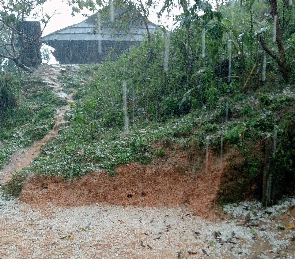
On the evening of March 28, speaking with Dan Viet reporter, Mr. Lu Van May - Deputy Secretary of Tuong Duong District Party Committee, Nghe An province confirmed the above information. Fortunately, the large hailstorm did not cause any human damage, however, some people's roofs were penetrated, and plants and crops were crushed. LM
The conflict between two air masses combined with the westerly wind zone at an altitude of about 5,000m created a strong updraft, causing convective clouds in the North to develop strongly and as a result, hail appeared in the North.
The cause of this hailstorm is due to the impact of the front part of the cold air moving towards our country. Although the intensity and speed of the cold air masses are different, they still compete with the hot and humid air mass that exists in the North.
Rain warnings are expected to continue in the North today due to the convergence of humid clouds developing from an altitude of 1,500m to 5,000m. Rain will be concentrated in the Northwest to the plains including the capital Hanoi , with the possibility of heavy rain accompanied by strong whirlwinds and even hail.
Hail is formed in thunderstorm clouds with strong convection. The ice particles here will be continuously supplemented with water and gradually grow larger until convection can no longer push them up, then they will fall and form hail. According to statistics, the size of hail particles can be from 0.5 cm to tens of cm, equivalent to a bean, and gradually grow larger until they reach a ball.
The larger the size of the rock particles, the more dangerous they are and can puncture roofs and damage large areas of crops.
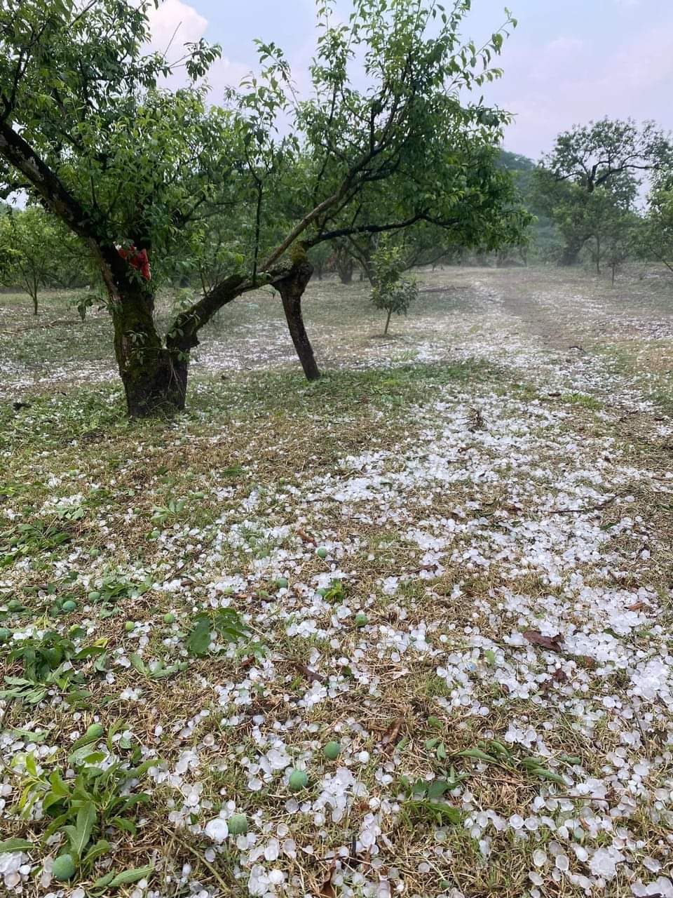
Hail caused many plum fields of people in Moc Chau district, Son La province to fall. Photo: IT
Forecast for today, the probability of these phenomena is still high. Especially in the plains, there will be a risk of thunderstorms and in the mountainous areas, there is a warning of both thunderstorms and hail, with the level of danger depending on the size of the falling hail.
Thunderstorm and hail warnings were also issued by the Hydrometeorological Center today and this evening (March 29) in some provinces and cities in the Central and Central Highlands regions. Although these phenomena may occur in a small area, they can be very destructive, so people need to pay attention and quickly find solid shelter when they see a strong thunderstorm approaching.
According to the National Center for Hydro-Meteorological Forecasting, currently (March 29), in the Northern, Northern and North Central regions, there have been scattered showers and thunderstorms, locally heavy to very heavy rain with rainfall from 7:00 p.m. on March 28 to 3:00 a.m. on March 29, some places have over 40mm such as: Yen Binh (Yen Bai) 61mm, Bach Ngoc (Ha Giang) 50.4mm, Huu Lung (Lang Son) 48.9mm, Phuc Yen (Tuyen Quang) 48.8mm, Hoa Thuong (Thai Nguyen) 41mm, Hong Son (Nghe An) 100.8mm,...
On March 29, in the Northern and North Central regions, there will be scattered showers and thunderstorms, locally heavy rain with rainfall of 10-30mm, some places over 50mm. In the late afternoon and evening of March 29, in the Central Central and Central Highlands regions, there will be scattered showers and thunderstorms, locally heavy rain with rainfall of 15-30mm, some places over 50mm. During thunderstorms, there is a possibility of tornadoes, lightning, hail and strong gusts of wind. Local heavy rain is likely to cause flash floods on small rivers and streams, landslides on steep slopes and flooding in low-lying areas.
Hail suddenly appeared in Mu Cang Chai district, Yen Bai province. Clip: Hoang Huu
Is consecutive hail an unusual phenomenon?
According to the National Center for Hydro-Meteorological Forecasting, during the transitional season, thunderstorms and tornadoes will occur more frequently, concentrated from March to May, with the peak in April. This is not an unusual phenomenon, but occurs every year, at the time of the changing seasons.
Experts say that in the coming time, not only the North but also almost the whole country will have a phase change in weather. In the Northern and Central provinces, the weather will change from cold to warmer, while in the Southern provinces, it will change from dry to humid. Therefore, in the coming time, we will see the probability of thunderstorms, lightning, hail, strong winds will be more and will be concentrated in the coming April to May.
With dangerous weather phenomena that may occur in the coming time, we continue to improve prevention work and raise awareness of hydrometeorology so that we can take proactive measures to prevent them. People should pay attention, first of all, to follow the warning and forecast bulletins from weather forecasting agencies from central to local levels to grasp the weather situation.
Next, there are preventive and living measures. After hearing the information warning of dangerous weather phenomena above, we should avoid living, working and working outdoors to avoid the effects of extreme weather phenomena, especially lightning and hail. Continue to update weather and hydrometeorological information to improve knowledge and experience to have proactive measures to prevent against the obvious changes in current weather and natural disasters.
Source










Comment (0)