
In this collection of ancient texts, the name Quang Nam appears as a multifaceted "intellectual label," sometimes referring to a port city, sometimes to a province-town, and at other times as the honorific title "Quang Nam Kingdom."
Maritime position
The name Quang Nam is recorded in a series of ancient Chinese texts. The book "Dictionary of Ancient Place Names of the South China Sea" lists at least 30 ancient texts with "document anchors" that record information about Quang Nam, such as: Viet Kieu Thu - A book recording the geography, customs, and history of ancient Vietnam (volumes 1, 7, 12114), Quang Du Do - A large geographical map often including maps of China and neighboring countries (volumes 1, 2), Hoang Du Khao - A book researching the geography of the contemporary dynasty (volume 21), Thu Vu Luc - A book recording information about areas outside China (geography, foreign customs) (volumes 5, 6), An Nam Do Chi - A book recording and mapping information about An Nam (Vietnam), Dong Tay Duong Khao - A book researching the countries of Indochina and the West (i.e., Southeast Asia, South Asia, and the Middle East) (volumes 1, 5), An Nam Ky Du - A book recording a journey to An Nam (Vietnam), Hai Quan Chi - A book recording information about ports. Seas, seaports and the control of customs duties on maritime trade (volumes 24, 30)...
On the maritime level, Truong Tiep's book "Eastern and Western Ocean Studies" (Volume 9, "Chu Su Khao") shows that Quang Nam is primarily an important landmark – a "compass" for maritime routes. This document presents methods for using a "compass," "time," "depth," and how to identify mountains, islands, and estuaries to "travel on the water" from Fujian to the countries of the South China Sea.
In that descriptive passage, the author clearly indicates the sea route passing through the border of Annam and the coastal ports of Central Vietnam. From the "Giao Chi sea" (the sea of present-day Northern Vietnam), "with a water depth of 70 fathoms," the route moved south in the direction of Khon Mui (southwest: 202.5° - 232.5°) to " Thanh Hoa port," "Thuan Hoa port," and then past the geographical landmarks of Chiem But La (Cu Lao Cham). Accordingly, Quang Nam appears as a trading space, a place for "anchoring ships, avoiding danger, obtaining water, and exchanging goods."
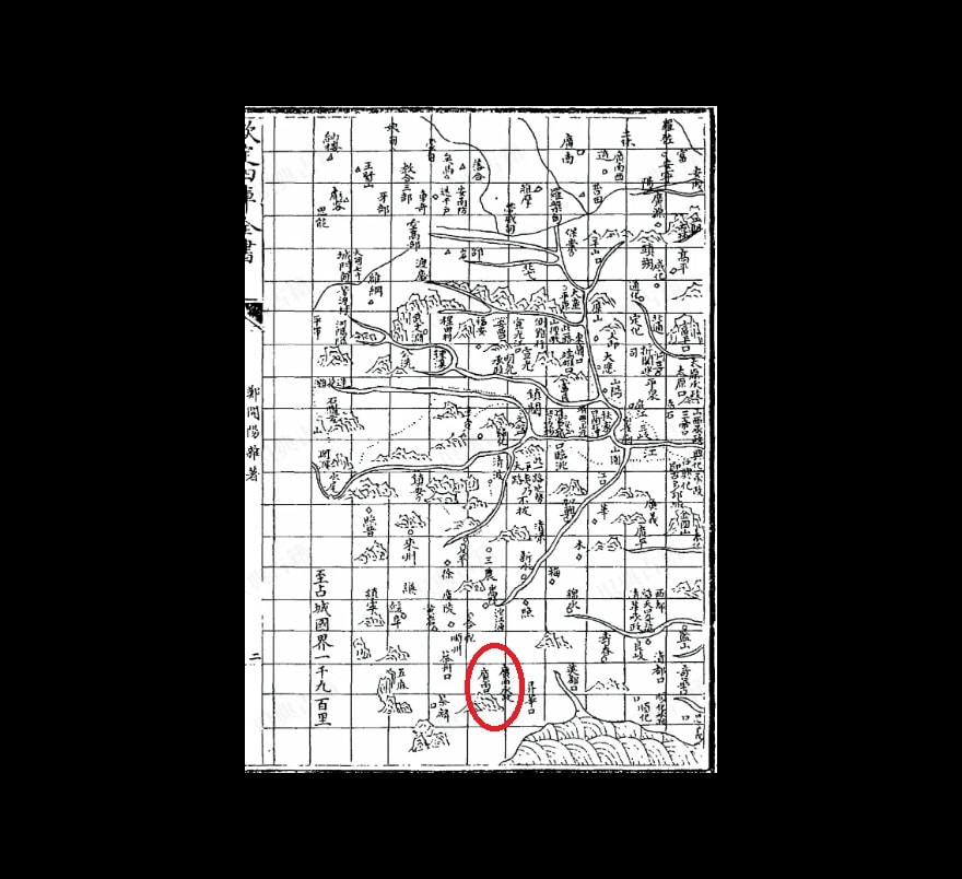
In the "Southern Ocean Chronicle" section of the book "Hai Quoc Luc" - a book recording information about countries in the sea region, Quang Nam Bay refers to the arc-shaped bay in central Vietnam (i.e., present-day Da Nang Bay?), and Quang Nam Port refers to the ancient city of Hoi An.
Defensive role
In terms of defensive knowledge, Quang Nam was placed within the internal political structure of An Nam. This is clearly demonstrated in the book An Nam Do Thuyet - a book containing maps and explanations of An Nam (Vietnam), compiled by Trinh Nhuoc Tang, from the perspective of maritime and border defense.
Modern research on Trinh Nhuoc Tang reveals that he wrote about neighboring countries (Japan, Korea, Ryukyu, Annam) with the purpose of "using geographical knowledge as a defensive tool," meaning that place names were mentioned as strategically sensitive points rather than purely discussing customs and products. In this perspective, Quang Nam was the "southern frontier" of Annam, situated on the transitional axis from Thuan Hoa into the former Champa territory, a "borderland within the country" belonging to Annam.
In the table of contents and the "preface" of the book "Viet Kieu Thu," author Ly Van Phuong advocated for a comprehensive record of An Nam, from its mountains and rivers, districts and counties, customs, and political systems to imperial decrees, memorials, and diplomatic documents. Through this, the author constructed a "national dossier" of Dai Viet in the style of ancient texts.
Notably, in the texts specializing in "official documents," debates concerning the South (including the Thuan Hoa - Quang Nam axis) often revolve around appointing officials, dividing land, and establishing regulations—that is, transforming border regions into "land with official records." Thus, Quang Nam here is not merely a "destination" as in the sea voyage, but also a part of the internal governance process: expanding territory, establishing administrative centers, creating districts, and collecting taxes. All aimed at ensuring the continuity of Dai Viet's territory.
Administrative place names
The book Hoang Du Khao, and especially the expanded version Quang Hoang Du Khao, clearly shows how the Ming Dynasty organized its geographical space using maps and annotations, from the "unified map" to the "two capitals and thirteen provinces," followed by the "nine border maps," and then the "four barbarian maps." In this layout, An Nam (and southern regions like Quang Nam) were often located in the "four barbarian" or near-four barbarian regions, noted by China for "precautionary measures," rather than described in detail as inland regions of China.
In this book, Quang Nam is recorded as a coastal strip outside the map of China, a place the Ming dynasty "knew about" but could not "control". The name Quang Nam Kingdom was used by foreigners to refer to Quang Nam, lasting from the 16th century to the end of the 18th century.
The name Quang Nam is not just a designation, but a reflection of the geographical reality of the region throughout different periods. During maritime trade, Quang Nam served as a seaport. When the border was unstable, Quang Nam was a crucial line of defense. When maps were drawn during the Ming dynasty, Quang Nam was considered a territory on par with China. This multifaceted nature demonstrates the importance of Quang Nam and reminds us that the history of place names is always intertwined with the history of how that land is perceived.
Source: https://baodanang.vn/quang-nam-luu-trong-sach-co-3338764.html


![[Photo] General Secretary and President To Lam and the President of the Philippines hold talks.](https://vphoto.vietnam.vn/thumb/1200x675/vietnam/resource/IMAGE/2026/06/01/1780283481955_vna-potal-tong-bi-thu-chu-tich-nuoc-to-lam-va-tong-thong-philippines-hoi-dam-8797519-1429-jpg.webp)


Comment (0)