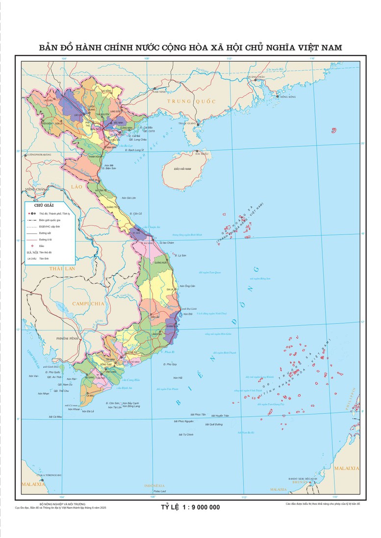
The Department of Surveying, Mapping and Geographic Information of Vietnam ( Ministry of Agriculture and Environment ) has completed the construction of an online administrative map updating 34 provincial-level administrative units.
Accordingly, the map accurately and visually reflects the new administrative system of 28 provinces and 6 centrally-run cities, and is a useful tool for looking up, studying, researching, managing and operating - especially in the context of digital transformation and organizational adjustment.
Map of 34 provincial administrative units of Vietnam in 2025. (Photo source: Department of Surveying, Mapping and Geographic Information of Vietnam).
Director of the Center for Geospatial Data Infrastructure (Department of Surveying, Mapping and Geographic Information of Vietnam) - Mr. Tran Duy Hanh, said that from the beginning of 2025 until now, implementing Conclusion No. 127-KL/TW dated February 28, 2025 of the Politburo and the Secretariat on the arrangement of administrative units according to two-level government - the Department has actively performed the task of coordinating the preparation of map documents to serve important meetings of the Politburo, the Central Executive Committee of the Party, the National Assembly, the Government, and the Ministry of Home Affairs .
The map-making process focuses on updating changes in administrative boundaries, standardizing symbols, and encoding spatial data according to national standards. All of this ensures the accuracy, consistency, and legal value of each map sheet.
When the National Assembly 's Resolution on the arrangement of provincial-level administrative units in 2025 takes effect, the Department will complete the construction and provide the 1:1,000,000 scale Vietnam Administrative Map online via the network environment and digital maps in (PDF) format to promptly serve the direction and administration of the Prime Minister, the state management of ministries, branches, and localities and meet the requirements of organizations and individuals.
In the near future, the 1:9,000,000 scale administrative map of Vietnam will be provided free of charge to ministries, branches, localities and people online via the network environment.
Ministries, branches, localities, organizations and individuals can access the website of the Geospatial Data Infrastructure Center to look up necessary information.
Previously, on the morning of June 12, with 461/465 delegates participating in the vote in favor (accounting for 96.44% of the total number of National Assembly delegates), the National Assembly voted to pass the Resolution on the arrangement of provincial-level administrative units in 2025.
Accordingly, the country has 34 provincial-level administrative units, including 28 provinces and 6 cities. The resolution takes effect from the date of its approval by the National Assembly.
According to: vtv.vn
Source: https://baothaibinh.com.vn/tin-tuc/9/225925/se-cung-cap-mien-phi-ban-do-hanh-chi-tiet-34-tinh-thanh-moi-tren-moi-truong-mang


Comment (0)