
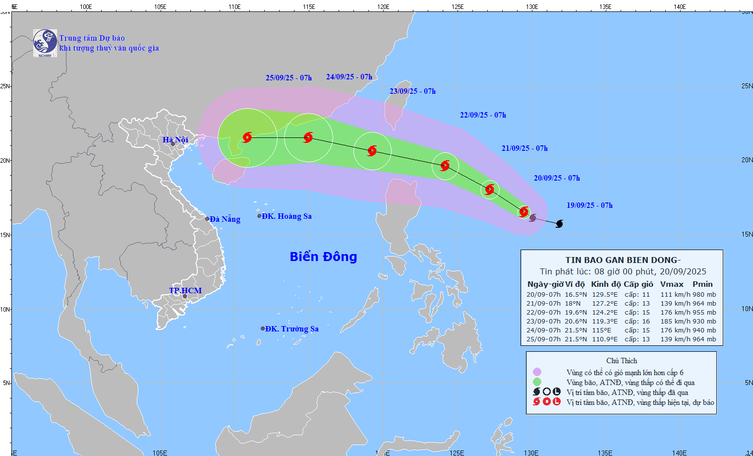
At 7:00 a.m. on September 21, the storm was about 530 km east of Luzon Island (Philippines) with strong winds of level 13, gusts of level 16; moving in the West Northwest direction at a speed of about 10-15 km/h and likely to strengthen further.
At 7:00 a.m. on September 22, the storm was about 240 km northeast of Luzon Island (Philippines) with strong winds of level 15, gusts of level 17; moving west-northwest at a speed of about 15 km/h and continuing to strengthen.
At 7:00 a.m. on September 23, the storm was in the Northeast sea, the North East Sea area with strong winds of level 15-16, gusting over level 17; moving in the West Northwest direction at a speed of about 20-25 km/h, continuing to strengthen and entering the East Sea.
From the next 72 to 120 hours, the storm will move mainly in the West Northwest direction, about 20 km per hour, gradually weakening in intensity.
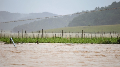
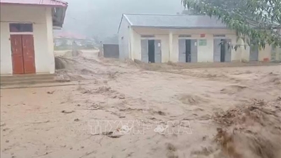
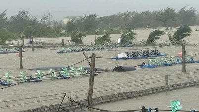
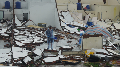
Due to the influence of the storm, on the afternoon of September 22, the eastern sea area of the North East Sea had strong winds of level 6-7, then increased to level 8-9, gusting to level 11; from the night of September 22, it increased to level 10-13, near the eye of the storm level 14-16, gusting to level 17, waves 4-8m high, near the eye of the storm over 10m; the sea was very rough.
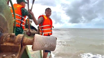
Vessels operating in the above mentioned dangerous areas are susceptible to the impact of storms, whirlwinds, strong winds and large waves.
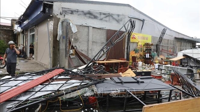
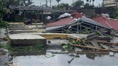
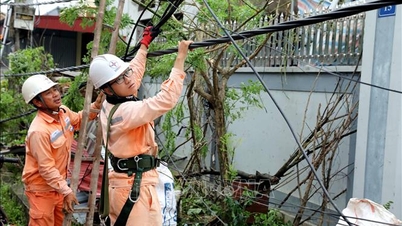
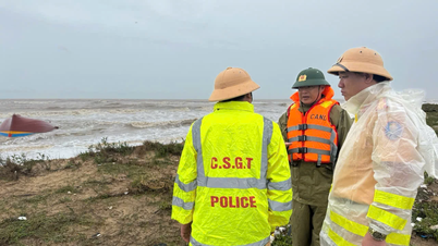
To proactively respond to storm RAGASA, the National Steering Committee for Civil Defense requested provinces and cities from Quang Ninh to Lam Dong to closely monitor warning bulletins, forecasts and developments of the storm; notify captains and owners of vehicles and vessels operating at sea to proactively prevent and have appropriate production plans, ensuring safety of people and property; maintain communication to promptly handle bad situations that may occur.
Localities are ready with forces and means to deploy rescue work when there is a situation, and at the same time organize serious on-duty shifts and regularly report to the National Civil Defense Steering Committee ( Ministry of Agriculture and Environment ).
Along with that, currently in the eastern sea area of the North East Sea, the central East Sea area, the southern Gulf of Tonkin, the sea area from South Quang Tri to Quang Ngai , there are scattered showers and thunderstorms.
Forecast, on the day and night of September 20, in the eastern sea area of the North East Sea, the central East Sea area, there will be showers and thunderstorms; in the southern Gulf of Tonkin, the sea area from South Quang Tri to Quang Ngai, there will be scattered showers and thunderstorms, during thunderstorms there is a possibility of tornadoes, strong gusts of wind level 6-7 and waves over 2m high.
All vessels operating in the above areas are at risk of being affected by tornadoes and strong gusts of wind.
Source: https://baotintuc.vn/xa-hoi/sieu-bao-ragasa-huong-ve-bien-dong-20250920084653479.htm
![[Photo] General Secretary To Lam chairs the meeting of the Central Steering Committee on preventing and combating corruption, waste and negativity](https://vphoto.vietnam.vn/thumb/1200x675/vietnam/resource/IMAGE/2025/9/29/fb2a8712315d4213a16322588c57b975)
![[Photo] Many streets in Hanoi were flooded due to the effects of storm Bualoi](https://vphoto.vietnam.vn/thumb/1200x675/vietnam/resource/IMAGE/2025/9/29/18b658aa0fa2495c927ade4bbe0096df)
![[Photo] National Assembly Chairman Tran Thanh Man chairs the 8th Conference of full-time National Assembly deputies](https://vphoto.vietnam.vn/thumb/1200x675/vietnam/resource/IMAGE/2025/9/29/2c21459bc38d44ffaacd679ab9a0477c)
![[Photo] General Secretary To Lam attends the ceremony to celebrate the 80th anniversary of the post and telecommunications sector and the 66th anniversary of the science and technology sector.](https://vphoto.vietnam.vn/thumb/1200x675/vietnam/resource/IMAGE/2025/9/29/8e86b39b8fe44121a2b14a031f4cef46)

![[Photo] General Secretary To Lam receives US Ambassador to Vietnam Marc Knapper](https://vphoto.vietnam.vn/thumb/1200x675/vietnam/resource/IMAGE/2025/9/29/c8fd0761aa184da7814aee57d87c49b3)


Comment (0)