
To prevent and adapt to natural disasters and storms and floods, it is important for localities to restore forest ecosystems; promptly divide zones and provide detailed warnings of points and locations at risk of landslides.
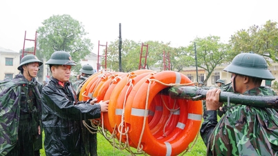
Typhoon Yagi (storm No. 3) and its circulation have recently devastated many provinces and cities in the North. Mountains and hillsides were swept away by raging floods in the blink of an eye; residential areas were submerged in water, villages were flattened, causing terrible human and economic losses.
Rebuilding life after storms and floods is a key and urgent task that has been and is being thoroughly implemented by the Party, State, Government and localities to soon stabilize people's lives and take care of the victims' health.
However, to ensure long-term safety and effective adaptation to natural disasters and floods, many opinions say that local authorities and people need to join hands to "patch" forests and reduce greenhouse gas emissions; especially, it is necessary to soon divide zones and provide detailed warnings of points and locations at risk of landslides.
After reconstruction, the forest needs to be "patched"
Dr. Mai Kim Lien, Deputy Director of the Department of Climate Change ( Ministry of Natural Resources and Environment ) said that in recent years, Vietnam has recorded 20 out of 21 types of natural disasters, causing many consequences and heavy losses in human life and property, especially for highly vulnerable population groups.
Just counting storm No. 3 and its circulation, the provinces and cities in the North have suffered initial estimated economic damage of over 40,000 billion VND; more than 350 people died or went missing; over 1,900 people were injured...
According to the Director of the National Center for Hydro-Meteorological Forecasting, Mai Van Khiem, Storm No. 3 is the strongest storm in the past 30 years in the East Sea. This storm and its circulation caused heavy rain, causing landslides, flash floods, and flash floods in many localities, causing very heavy damage to people and property. Some areas have experienced serious flash floods and landslides, such as in the provinces of Cao Bang, Hoa Binh, Lao Cai, Yen Bai, Quang Ninh, etc.
In particular, in Lang Nu village, Phuc Khanh commune, Bao Yen district, Lao Cai province, landslides caused particularly serious human losses. The main reason was that the northern mountainous region had had a lot of rain in the past 3 months.
Meanwhile, according to Associate Professor - Doctor Le Van Hung, Institute for Applied Research on Environmental Treatment, in addition to natural disasters, uncontrolled human activities have also contributed to increasing the extremity of climate change; including greenhouse gas emissions, increasing global temperatures. And when temperatures increase, it will "create conditions" for forest fires to occur more easily, thereby reducing/losing the water retention capacity of forests.
Sharing with the press recently, Mr. Trinh Le Nguyen - Director of the Center for People and Nature also gave sad information when emphasizing that Vietnam has had to say goodbye to many wild natural areas considered "paradise on earth." This change is a valuable lesson about human responsibility. According to Mr. Nguyen, forests being cut down for farming land along with unsustainable resource exploitation activities have seriously reduced biodiversity, the ecosystem is unbalanced, leading to a decline in the quality of the human environment.
Speaking more about the importance of natural forests in retaining rainwater and reducing floods, an environmental expert said that natural forest trees have roots tens of meters deep, intertwined with each other, playing an important role in maintaining the connection between soil and rock, between the surface layer and the deep layer, forming a stable and solid block. However, when the forest is stripped bare, that connection is lost. When heavy rains last for a long time, the soil in the mountains is saturated with water, the connection becomes weak, the soil and rock become soft and mushy, combined with the loss of the foot of the hills, ... will lead to landslides.
Therefore, in addition to rebuilding people's lives after storms and floods, localities also need to pay attention to restoring forest ecosystems. This is considered an urgent task in the decade when all humanity is working together to avoid an ecological crisis.
")
“Humans cannot wear torn clothes, and neither can forests” – that is also the message from many experts working in nature conservation because restored forests will help protect water resources and reduce the risk of landslides…
Early identification of landslide risk areas
Affirming that restoring the forest ecosystem is very important, the representative of the General Department of Hydrometeorology (Ministry of Natural Resources and Environment) also noted that in order to effectively respond to natural disasters, the ministry will continue to organize investigations and surveys of locations where landslides have occurred and are occurring; and delineate in detail areas at risk of landslides to provide early warning.
The Ministry of Natural Resources and Environment will also review and adjust the inter-reservoir processes of reservoirs on the basis of updating, calculating, and fully and comprehensively considering unusual and emergency situations and climate change scenarios; when conditions are met, the Operational Process will be adjusted in a real-time direction.
In addition, the ministry will study and propose a plan to use a part of the flood prevention capacity above the normal water level of large and important reservoirs to improve the ability to cut and reduce floods downstream when emergencies occur; disseminate propaganda and instruct people to recognize risks and signs of possible landslides, flash floods, riverbank erosion, and response skills.
The Ministry of Natural Resources and Environment also requested the Government to direct the Ministry of Industry and Trade, the Ministry of Agriculture and Rural Development, and localities to urge competent agencies and reservoir owners to strictly and fully implement the regulations of the Inter-reservoir Operation Procedures on river basins; and implement the reservoir monitoring and information regime according to the provisions of the law on water resources.
On the local side, the People's Committees of provinces and centrally-run cities need to develop plans to implement the contents of the Project on Early Warning of Landslides and Flash Floods in the Mountainous and Midland Areas of Vietnam according to Decision No. 1262/QD-TTg of the Prime Minister. In particular, focusing on investigating, evaluating, and surveying to supplement the database on natural disasters such as landslides and flash floods in the area; creating risk zoning maps, landslide and flash flood risk zoning maps at a scale of 1:10,000 and larger for locations and areas at high risk of landslides and flash floods in the locality.
")
According to Dr. Trinh Hai Son - Director of the Institute of Geological Sciences and Mineral Resources (Ministry of Natural Resources and Environment), in the coming time, it is necessary to focus on building the most detailed possible landslide and flash flood risk maps.
“If we cannot provide details down to the smallest detail, it cannot be called a warning, but only a forecast. Furthermore, we need to move towards real-time warning of landslides and mudflows for areas at high risk of landslides,” Mr. Son emphasized.
Vietnamplus.vn
Source: https://www.vietnamplus.vn/thich-ung-voi-thien-tai-can-va-rung-phan-vung-som-cac-diem-nguy-co-sat-lo-post977172.vnp


![[Photo] Prime Minister Pham Minh Chinh chairs the first meeting of the Central Steering Committee on housing policy and real estate market](https://vphoto.vietnam.vn/thumb/1200x675/vietnam/resource/IMAGE/2025/9/22/c0f42b88c6284975b4bcfcf5b17656e7)


Comment (0)