

Positive results
According to the City Department of Construction, by 2025 the entire city will achieve an urbanization rate of 47.6%; the percentage of urban population supplied with clean water will reach 95%; and the annual targets for urban solid waste collection and treatment will be met...

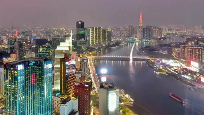
By 2030, Can Tho City's urban system is oriented towards meeting the criteria of a Type I urban area. In the photo: A view of Can Tho city.
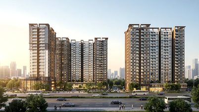
Can Tho City is also implementing many large-scale projects funded by the state budget and non-state budget capital; developing and expanding the urban area, focusing on infrastructure development and new residential areas, contributing to an increase in construction projects. The city is strengthening efforts to attract investment in urban development projects, effectively utilizing land allocated for urban development, and gradually addressing housing needs. To date, the city has implemented 12 projects, of which 3 have been completed or are nearing completion, and 9 are underway; during the 2021-2025 period, 3,802 social housing units have been completed.
The transportation, water supply, drainage, lighting, green spaces, solid waste collection and treatment systems, and public welfare facilities in urban areas have been invested in, renovated, and developed, creating a basic framework for urban development. The Lo Te - Rach Soi, Cao Lanh - Lo Te, Can Tho - Ca Mau , and My Thuan - Can Tho expressways have been put into use, overcoming limitations in the transportation network connecting these expressways. The Chau Doc - Can Tho - Soc Trang expressway, currently under construction and expected to be completed in 2026-2027, will further enhance the city's advantages in connecting with provinces in the Mekong Delta region. The city has been comprehensively covered by the master urban plan, with the establishment and approval of zoning plans, detailed plans, and urban architectural management regulations.
In the field of smart urban development, the city has completed key tasks such as piloting the Intelligent Operations Center (IOC) to serve the city's People's Committee in directing and managing over 10 areas; piloting the Smart Education Operations Center; deploying a smart tourism portal and mobile application to serve tourists. It has also built the Can Tho City Spatial Planning Platform (SPP) to provide and share common maps for the entire city. The Flood Risk Management Information System (FRMIS) for Can Tho City aims to enhance flood risk management capacity in the city center through the deployment of a flood risk management information system. The city is currently establishing procedures for deploying a Smart Traffic Operations Center; an environmental monitoring and observation system; and a smart agricultural production support system...
Development orientation until 2030
Can Tho City has announced the list of Type II and Type III urban areas and the list of wards achieving urban development levels for administrative units within the city of Can Tho, effective from January 1, 2026. Accordingly, the central area of Can Tho City (formerly Ninh Kieu, Binh Thuy, Cai Rang, O Mon, and Thot Not districts) is a Type II urban area. Phong Dien urban area (within Phong Dien commune), Co Do urban area (within Co Do commune), Thoi Lai urban area (within Thoi Lai commune), Thanh An urban area (within Thanh An commune), and Vinh Thanh urban area (within Vinh Thanh commune) are Type III urban areas. Vi Thanh urban area (within Vi Thanh and Vi Tan wards), Nga Bay urban area (within Dai Thanh and Nga Bay wards), and Long My urban area (within Long My, Long Binh, and Long Phu 1 wards) are Type II urban areas. The urban area of Soc Trang (within the boundaries of Soc Trang ward, Phu Loi ward, and My Xuyen ward) is a type II urban area. The urban areas in the remaining communes are type III urban areas.
Mr. Mai Van Tan, Director of the Department of Construction of Can Tho City, said: Can Tho City continues to inherit and promote the urban development achievements of the three former provinces and cities, and promptly adjust development orientations that are no longer suitable. After the merger, the city organized a review, adjustment, and approval of the revised Can Tho City Planning for the period 2021-2030, with a vision to 2050. Accordingly, the development orientation of Can Tho City's urban system is to build an urban system including a central urban area as the city's core and neighboring urban areas; developing into a center for commercial services, tourism, logistics, processing industry, high-tech applied agriculture, education and training, specialized healthcare, science, technology, culture, and sports for the entire region. Leveraging transportation routes connecting Can Tho - My Thuan - Trung Luong - Ho Chi Minh City, and Chau Doc - Can Tho - Soc Trang, linked with Tran De seaport, will focus on urban development, creating a ripple effect to other areas in the region. Developing Can Tho City as a growth pole, playing the role of a core urban center and driving force for the development of the entire Mekong Delta region.
By 2030, the urban system of Can Tho City is oriented to meet the criteria of a Type I urban area throughout the entire city. This includes nine central urban areas: Can Tho, O Mon, Thot Not, Soc Trang, Vi Thanh, Nga Bay, Nga Nam, Long My, and Vinh Chau; and new urban areas and areas planned for urban development. The identification of these new urban areas and areas planned for urban development will be carried out gradually and flexibly, in accordance with the city's socio-economic development situation.
Text and photos: ANH KHOA
Source: https://baocantho.com.vn/tp-can-tho-phan-dau-dat-tieu-chi-do-thi-loai-i-vao-nam-2030-a204736.html
![[Image] Close-up view of the interchange connecting the two expressways and Long Thanh Airport.](https://vphoto.vietnam.vn/thumb/1200x675/vietnam/resource/IMAGE/2026/05/25/1779703378210_ndo_br_z7863716673926-224453a31600126cce10622af6290afd-4549-jpg.webp)
![[Image] Hanoi's urban life under the challenge of a "scorching hot" environment](https://vphoto.vietnam.vn/thumb/1200x675/vietnam/resource/IMAGE/2026/05/25/1779706979265_nang-nong-t5-2026-minh-duy-7-4636-jpg.webp)


















































Comment (0)