
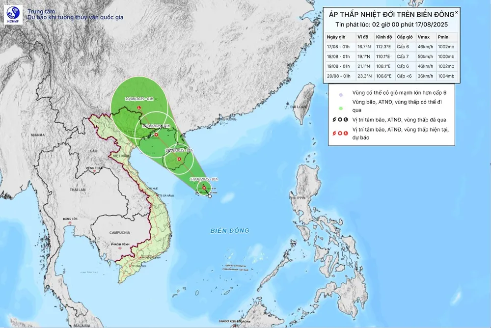
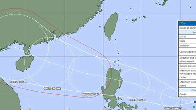
Early this morning, the center of the tropical depression was at about 16.7 degrees North latitude, 112.3 degrees East longitude, with a strong intensity of level 6 (39-49 km/h), gusting to level 8, moving northwest at a speed of about 10 km/h.
Forecast, on the morning of August 18, the center of the tropical depression is located on the mainland east of Hainan Island (China); strong intensity level 6-7, gust level 9. From the next 48 to 72 hours, the tropical depression will move northwest at a speed of 10-15km/hour, gradually weakening in intensity.
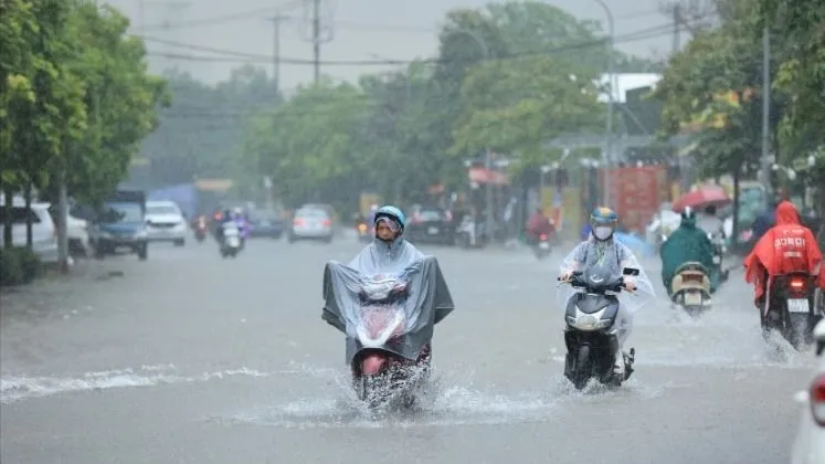
According to the National Center for Hydro-Meteorological Forecasting, last night and early this morning, the area from Thanh Hoa to Da Nang and the Central Highlands had rain, moderate rain, and some places had heavy rain to very heavy rain. The rainfall from 7:00 p.m. on August 16 to 3:00 a.m. on August 17 was over 70mm in some places, such as: Cu Lao Cham Station (Da Nang City) 130.6mm, Ky Thinh Station (Ha Tinh) 104.4mm, Hai An Station (Quang Tri) 91.0mm, Dai Lao Station (Lam Dong): 78.8mm
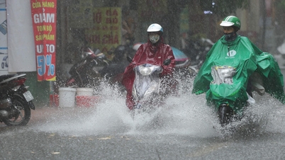
It is forecasted that from August 17 to the night of August 18, the Northeast, Thanh Hoa and Nghe An will have moderate rain, heavy rain and thunderstorms from 50-120mm, locally very heavy rain over 250mm. Particularly in the northern mountainous region, it will be 30-80mm, in some places over 150mm.
During the day and night of August 17, Ha Tinh and Quang Tri will have moderate to heavy rain from 40-90mm, locally very heavy rain over 200mm. In addition, the Northwest, Hue City, South Central Coast, Central Highlands and the South will have scattered showers and thunderstorms, locally heavy to very heavy rain from 10-30mm, locally over 80mm. There is a risk of rain intensity greater than 100mm/3 hours in some places, during thunderstorms there is a possibility of tornadoes, lightning, hail, and strong gusts of wind.
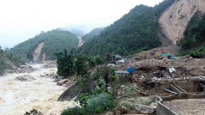
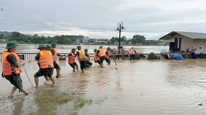
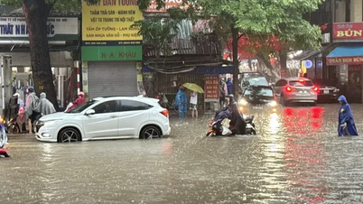
Heavy rain can cause flooding in low-lying areas, urban areas, industrial zones; flash floods on small rivers and streams; landslides on steep slopes...
Weather forecast for coastal areas shows that at Huyen Tran station, there is strong southwest wind of level 6, gusting to level 9-10; Phu Quy special zone has strong southwest wind of level 6, sometimes level 7, gusting to level 8; Con Dao special zone has strong gusting to level 7.
Forecast for the day and night of August 17, from Khanh Hoa to Ho Chi Minh City, the Central and Southern East Sea area (including Truong Sa special zone) will have southwest wind level 6, gusting to level 7-8, rough sea, waves 2.0-3.5m high.
The western sea area of the North East Sea (including Hoang Sa special zone) has strong winds of level 6-7, gusts of level 8-9, rough seas, waves 2.0-3.5m high.
In addition, on the day and night of August 17, in the Gulf of Tonkin, the sea area from South Quang Tri to Ca Mau, Ca Mau to An Giang, the Gulf of Thailand, the North, Central and South East Sea (including Hoang Sa and Truong Sa special zones) there will be showers and strong thunderstorms; during thunderstorms there is a possibility of tornadoes, strong gusts of wind and waves over 3.5m high.
Warning for the day and night of August 18, the Northern Gulf of Tonkin has strong winds of level 6, gusts of level 7-8, waves of 2.0-3.0m high, rough seas. The risk level of natural disasters due to strong winds in the sea area from Khanh Hoa to Ho Chi Minh City is level 2; the sea area west of the Northern East Sea (including the Hoang Sa special zone) is level 3. All ships operating in the above areas are at high risk of being affected by tornadoes, strong winds and big waves.
Source: https://www.sggp.org.vn/ap-thap-nhiet-doi-dang-hoat-dong-o-bien-dong-mua-lon-ca-3-mien-post808780.html

![[Photo] Keep your warehouse safe in all situations](https://vphoto.vietnam.vn/thumb/1200x675/vietnam/resource/IMAGE/2025/10/1/3eb4eceafe68497989865e7faa4e4d0e)

![[Photo] Hanoi morning of October 1: Prolonged flooding, people wade to work](https://vphoto.vietnam.vn/thumb/1200x675/vietnam/resource/IMAGE/2025/10/1/189be28938e3493fa26b2938efa2059e)

![[Photo] President of the Cuban National Assembly visits President Ho Chi Minh's Mausoleum](https://vphoto.vietnam.vn/thumb/1200x675/vietnam/resource/IMAGE/2025/10/1/39f1142310fc4dae9e3de4fcc9ac2ed0)


Comment (0)