 |
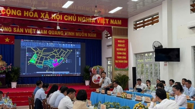
| Map editing and land data cleaning work at the Dong Nai City Land Registration Office. Photo: Hoang Loc |
The land parcel identifier, when integrated with national data on population, planning, construction, and taxation, will help to increase information transparency and facilitate administrative procedures.
Nearly 914,000 land plots now have electronic "identification cards".
In recent times, Dong Nai has been one of the leading bright spots nationwide in enriching and cleaning up land data, coupled with creating unique identification codes for each land parcel.
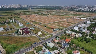
According to Mr. Trinh Quoc Dung, Deputy Director of the Dong Nai City Land Registration Office, there are currently over 2.7 million land parcels in the city, of which more than 2.6 million (equivalent to 96%) have had land data compiled. Regarding the creation of identification codes, the city has completed this for nearly 914,000 land parcels. Simultaneously, land parcel codes have been created for all land parcels in 95 wards and communes and have been successfully synchronized with the national land database. This is a crucial technical foundation for integration with the national digital address platform and other national databases in the next phase.
Government Decree No. 357/2025/ND-CP, dated December 31, 2025, on the construction and management of information systems and databases on housing and the real estate market, effective from March 1, 2026, stipulates that: Each real estate product has a unique identification code, a 12-character string encoded according to the geographical location in the WGS84 international geographic coordinate system of the land parcel. This code is directly linked to the national database, comprehensively storing data on: ownership rights, usage rights; planning, intended use and actual status; and transaction history.
According to regulations, the land parcel identification code is a unique sequence of characters nationwide, permanently assigned to each land parcel throughout its existence. The land parcel code contains legal information, current status, and history. Therefore, while land ownership may change, and the land parcel may be transferred, mortgaged, subdivided, or consolidated, the entire history of changes is stored and retrieved on a single data platform.
Mr. Nguyen Thai Hoa, a real estate broker in Tran Bien ward, believes that having an identification code for a land plot makes information lookup much more convenient, especially for those looking to buy land or a house. By scanning the electronic "identity card" of the land plot, buyers can access information about its location, area, legal status, and previous transactions, allowing them to make informed decisions without needing to use information lookup services.
According to the Ministry of Agriculture and Environment , creating unique identification codes for each land parcel offers many practical benefits. For management agencies, each land parcel has a unique code, facilitating updating, searching, and tracking changes, and building a unified and transparent land database; it also allows for close monitoring of land changes to make timely adjustments to planning. For land users, clearly verified information makes administrative procedures, transfers, or mortgages easier. Furthermore, notary offices can quickly verify the legal status of land parcels, reducing the risk of disputes; and tax authorities and banks can easily verify financial obligations and assets thanks to standardized data.
Foundation for modern land management
Currently, assigning unique identification codes to each land parcel is a legal requirement aimed at accelerating digital transformation in the land sector. On May 11th, Ms. Nguyen Thi Hoang, Member of the City Party Committee and Vice Chairman of the People's Committee of Dong Nai City, signed and issued Plan No. 23/KH-UBND, dated May 11, 2026, on the implementation of land surveying, cadastral record keeping, and land database construction in 2026. The plan sets the goal of completing the construction of a land database for land parcels that have not yet been included by the end of 2026. It aims to ensure that land data is updated and managed according to the principles of "accuracy - completeness - cleanliness - viability," connecting and sharing with national specialized databases to serve state management and streamline administrative procedures.
Vice Chairman of the City People's Committee Nguyen Thi Hoang assessed: The city's land database has been built relatively completely and is clearly demonstrating its effectiveness in state management. Thanks to this, in recent years, this system has supported the resolution of hundreds of thousands of administrative procedures related to land each year with an on-time rate consistently reaching 98-99%.
Thanks to increasingly standardized data, Dong Nai has effectively implemented a model for handling administrative procedures across geographical boundaries, allowing citizens to submit applications online or at any convenient reception point. In the future, the locality will continue to improve the land database, creating identification codes for each land parcel to enhance management efficiency, create a foundation for digital government, improve the quality of public services, and connect and share data with other sectors to better serve citizens and businesses.
According to Deputy Director of the Department of Agriculture and Environment, Dang Minh Duc, when land data is standardized, synchronized, and connected and shared with sectors such as taxation, notarization, banking, and other relevant state management agencies, people will be able to carry out land-related procedures more conveniently. This will also help shorten the time for verifying documents and reduce errors in the process of handling administrative procedures.
Hoang Loc
Source: https://baodongnai.com.vn/tin-moi/202605/ay-manh-lam-can-cuoc-dien-tu-cho-bat-dong-san-0900168/





































































































Comment (0)