

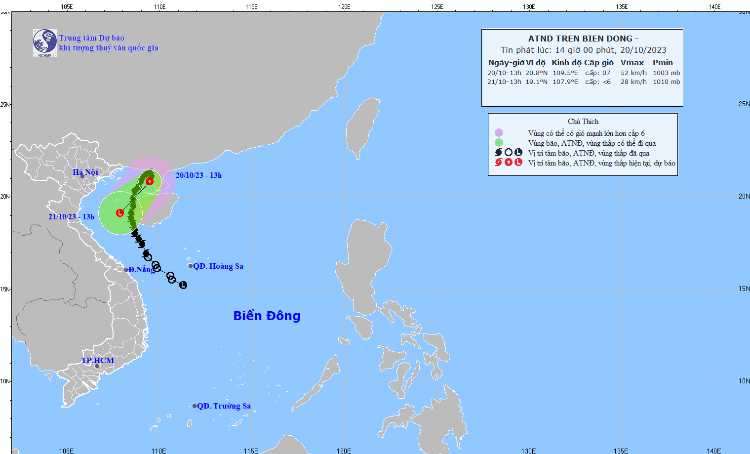
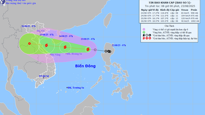
According to the National Center for Hydro-Meteorological Forecasting, at 1 p.m., the center of the tropical depression was located at about 20.8 degrees North latitude; 109.5 degrees East longitude, in the northeastern sea area of the Northern Gulf of Tonkin. The strongest wind near the center of the tropical depression was level 7 (50-61 km/h), gusting to level 9. The tropical depression moved in a south-southwest direction at a speed of about 10 km/h.
According to the meteorological agency's forecast, by 1:00 p.m. on October 21, the tropical depression in the southern part of the Gulf of Tonkin will move in a south-southwest direction at a speed of about 10 km/h and gradually weaken into a low-pressure area.
Due to the influence of low pressure combined with strengthening cold air, the Gulf of Tonkin area (including Co To and Bach Long Vi islands) has strong winds of level 6-7 and rough seas.
The Gulf of Tonkin (including Co To and Bach Long Vi islands) has waves 2-3m high. All boats, anchorages, aquaculture areas, and sea dykes in this area are affected by strong winds and big waves.
Source
![[Photo] General Secretary To Lam attends the 80th Anniversary of the Cultural Sector's Traditional Day](https://vphoto.vietnam.vn/thumb/1200x675/vietnam/resource/IMAGE/2025/8/23/7a88e6b58502490aa153adf8f0eec2b2)


Comment (0)