

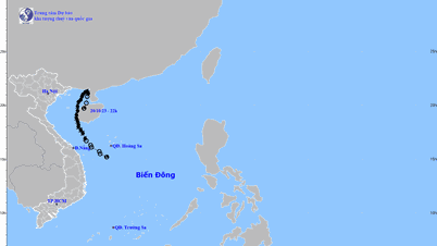
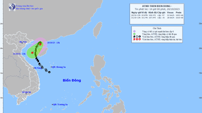
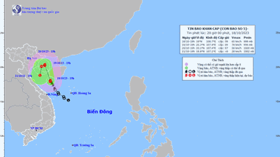
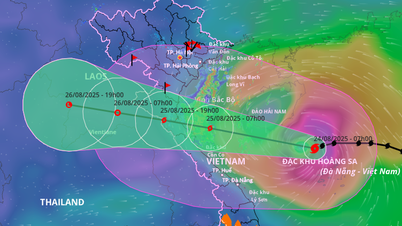
The National Center for Hydro-Meteorological Forecasting said that at 10:00 a.m. on October 19, the center of storm No. 5 was located at about 19.5 degrees North latitude; 108.6 degrees East longitude, in the sea area east of the Gulf of Tonkin. The strongest wind near the center of the storm was level 8 (62-74 km/h), gusting to level 10. The storm moved north at a speed of about 10 km/h.
Forecast by 10am on October 20, storm No. 5 in the Northern Gulf of Tonkin, moving north at 5-10 km/h, and is likely to strengthen. The strongest wind near the storm center is level 8-9, gusting to level 11.
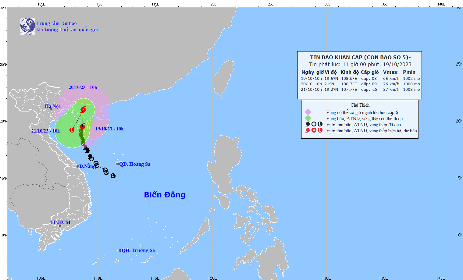
According to the forecast of the Hydrometeorological Agency, by 10:00 on October 21, this storm in the South-Southwest of the Gulf of Tonkin will travel about 10km per hour and gradually weaken into a tropical depression, then a low pressure area. The strongest wind near the center of the storm will decrease to below level 6.
Forecasting the impact of storm No. 5, the meteorological agency said that at sea, the Gulf of Tonkin area (including Co To, Bach Long Vi) will have strong winds of level 6-7, near the storm center will have strong winds of level 8-9, gusts of level 11, and very rough seas. On land, from early morning on October 20, coastal areas from Quang Ninh to Thai Binh will have winds gradually increasing to level 6, gusts of level 7-8.
The Gulf of Tonkin (including Co To and Bach Long Vi) has waves 2.0-4.0m high. All boats, anchorages, aquaculture areas, and sea dykes in this area are affected by strong winds and big waves.
Regarding heavy rain, from the night of October 19 to the morning of October 21, in coastal areas, the Southern Delta region, and the Northeast region of the North, there is a possibility of moderate rain, with heavy to very heavy rain in some places.
Source
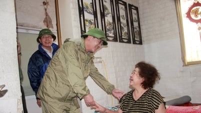
![[Photo] Party and State leaders meet with representatives of all walks of life](https://vphoto.vietnam.vn/thumb/1200x675/vietnam/resource/IMAGE/2025/8/24/66adc175d6ec402d90093f0a6764225b)
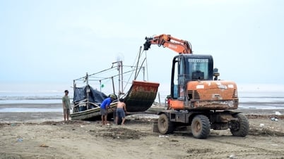
![[Photo] Phu Quoc: Propagating IUU prevention and control to the people](https://vphoto.vietnam.vn/thumb/1200x675/vietnam/resource/IMAGE/2025/8/24/f32e51cca8bf4ebc9899accf59353d90)


Comment (0)