
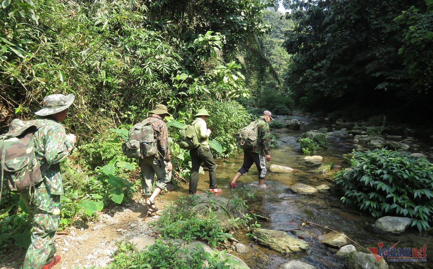
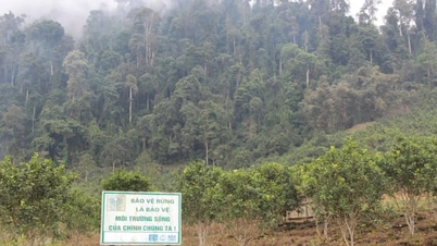
In an interview, Mr. Vo Minh Son, Director and Head of the Pu Huong Nature Reserve ( Nghe An province ), stated that the total forest area in the reserve is over 46,000 hectares, while only 55 staff members operate across five districts: Con Cuong, Quy Chau, Quy Hop, Tuong Duong, and Que Phong, which have rugged terrain.
“The area is vast and spread across many districts, with local people living within the protected forest area. Therefore, the risk of people encroaching on the forest is very high. To detect, prevent, and handle violations promptly, the unit has applied technologies to detect, prevent, and handle violations when people interfere with the forest,” Mr. Son informed.
The unit has implemented smart software as a tool for managing data, generating patrol reports, and monitoring biodiversity in national parks and nature reserves.
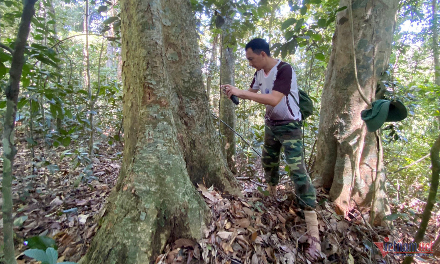
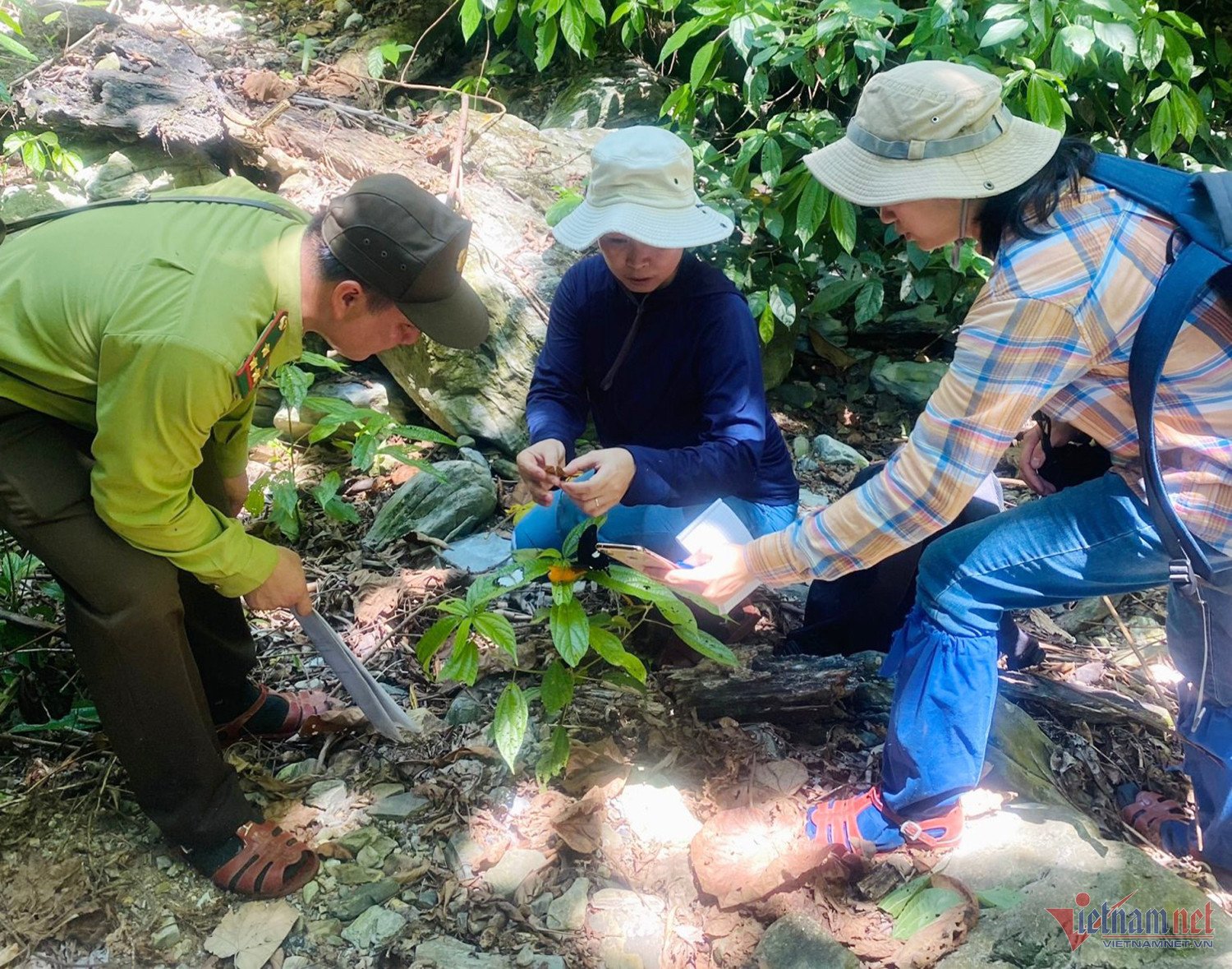
The application of smart technology during patrols allows security personnel to monitor the movement of officers within their managed forest areas. Along the patrol route, information from the field is transmitted to the management agency, such as: damage to forest resources, detection of footprints and animal tracks, etc., and photos are taken for assessment and sent to the server.
"This technology application helps officers minimize the need to present reports after returning from the forest. The server automatically generates the information that officers send via the software. In addition, the software helps forest rangers avoid confusing routes and travel schedules during patrols," Mr. Son shared.
Previously, before the implementation of smart software, patrol data collection was done using tools such as handheld GPS devices, notebooks, and cameras. Data was manually entered into computers, resulting in time-consuming patrol and monitoring processes and a high risk of errors during recording and data entry.
Since the advent of smartphones, collecting field information and data has become easier, faster, and more accurate, based on existing forest conditions.
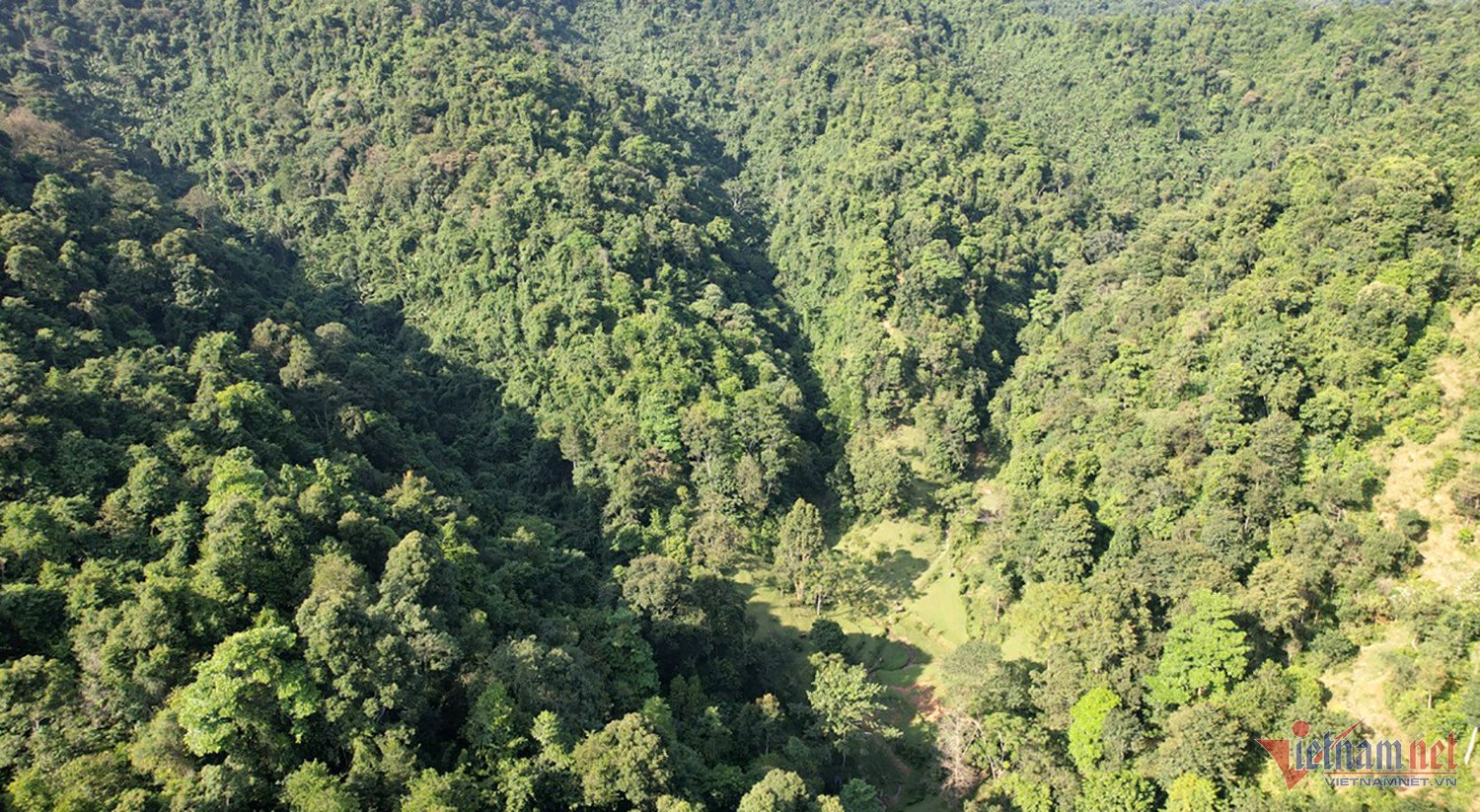
In addition, the nature reserve has purchased a license for the vetools software, which updates satellite imagery within the protected area twice a month. This satellite imagery allows forest protection officers to compare the current state of the forest from the previous month with aerial views.
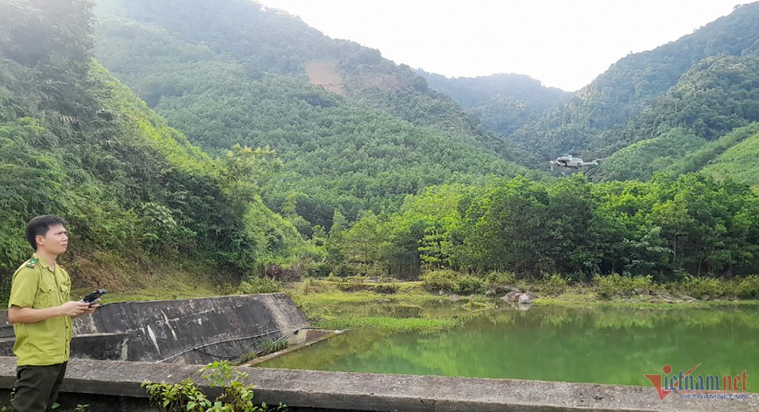
In recent years, the Pu Huong Nature Reserve has also been using drones with limited range control to monitor and inspect the forest's condition. This has helped staff reduce the effort and time spent on fieldwork.
Mr. Son added that satellite imagery revealed people illegally logging in protected forests to plant acacia trees. Specifically, in Chau Hong commune, the protected forest was cleared over an area of 1-2000 square meters. Immediately afterward, forces were deployed to the scene to handle the situation promptly.
Source


![[Photo] Prime Minister Pham Minh Chinh attends the Conference on the Implementation of Tasks for 2026 of the Industry and Trade Sector](/_next/image?url=https%3A%2F%2Fvphoto.vietnam.vn%2Fthumb%2F1200x675%2Fvietnam%2Fresource%2FIMAGE%2F2025%2F12%2F19%2F1766159500458_ndo_br_shared31-jpg.webp&w=3840&q=75)


Comment (0)