


The Champa territory that the Le dynasty conquered at that time can be understood to include the area from the Thu Bon River basin to the Deo Ca mountain range. However, the actual area where the Le dynasty established its administrative apparatus may only have extended to about the Cu Mong Pass; the land from the Cu Mong Pass south to the Deo Ca Pass was a buffer zone, which the Le dynasty did not yet manage.
Besides establishing administrative control by setting up administrative units and appointing officials to govern, the ancients also considered marking boundaries with stone steles. Regarding boundary steles from the Hong Duc era in Quang Nam province, two steles are recorded on maps.
The first stele is located on Thach Bi Mountain, north of Ca Pass. The map, called Giap Ngo Binh Nam Do , was created in the mid-17th century and depicts the location of the Hong Duc stele in the mountain range near the border between Phu Yen and Thai Khang prefectures.
Historical records, maps, and oral traditions all acknowledge this stone stele, and the name Thach Bi Mountain (Stone Stele Mountain) is a testament to it. Today, travelers on National Highway 1A, near the northern end of Ca Pass, can see a majestic rock formation rising from the mountain peak towards the sea. This rock formation and site have been recognized as a national scenic landmark.
Besides the boundary marker in southern Quang Nam province during the Hong Duc era, which is frequently mentioned in historical records, there is another monument also from the Hong Duc era, erected in western Quang Nam province, which is hardly ever mentioned except for a line of text on an ancient 17th-century map. This monument is depicted in the mountain range west of the My Son historical site, in what is now Da Nang city.
Apart from the information about the Hong Duc stele in western Da Nang in the Giap Ngo Binh Nam Do , we haven't heard of any other source of information and wondered if the author of Giap Ngo Binh Nam Do made a mistake when noting this stele?
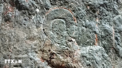
But at the end of January in the year of the Horse (1946), we had a conversation with Mr. Tra Quang Doan, a traditional medicine practitioner in Dai An village, formerly Dai Lan commune (now Thuong Duc commune), and he told us that in the mountain range west of Thuong Duc there is a Cham inscription stele and from the foot of the mountain there is a trail that the locals call the "Stone Stele Road".
An elderly person's memory of a Cham stele might be mistaken, but the place name "Stone Stele Road" suggests that there may have once been an ancient stele on the western peak of Thuong Duc. It could have been a Chinese stele erected during the Hong Duc era, as recorded in the Giap Ngo Binh Nam Do map; or it could have been an ancient Cham stele from the Champa kingdom.
And let me add that in the area of the former Dai Lanh commune, many relics of settlements and burial sites of the Sa Huynh culture, dating back 2,000 years, have been discovered. This area was also the dwelling place of the Champa people during the subsequent period; even today, there are still people of the Tra ethnic group, whose ancestors originated from the indigenous Champa people, as in the case of the traditional medicine practitioner who recounted the story about the ancient stele.
Unfortunately, our health condition prevented us from continuing our survey along the Stone Stele path to the mountaintop as instructed by the physician Mr. Tra; but we hope that young people passionate about exploration might discover the "Hong Duc Stele erected on this mountain" or a Champa stele. All of this would be beneficial for local history research and even for adventure tourism , similar to the case of the Stone Stele Mountain site north of Deo Ca Pass, which is now a popular tourist attraction.
Source: https://baodanang.vn/bia-da-doi-hong-duc-o-xu-quang-3329986.html
![[Photo] General Secretary and President To Lam presides over the meeting to approve the draft report on the results of the second inspection by the Politburo of the Standing Committee of the Hanoi City Party Committee.](https://vphoto.vietnam.vn/thumb/1200x675/vietnam/resource/IMAGE/2026/05/26/1779789811432_a2-bnd-4430-9620-jpg.webp)





















































































Comment (0)